Enjoying the Gems Under Your Nose

I have often said I am more interested in the places the Ozarks have to offer compared to the possible visits to iconic destinations in the rest of the country.  I know I would love and appreciate those spots, of course.  But the millions of photographs generated are probably enough without my lousy contributions.  I am more interested in showcasing the animals and habitats that can be found in the Show Me State, the places with names that so many who live here have never even heard.  I’ve come to realize lately that I am guilty of ignoring a few places less than an hour’s drive from my doorstep that have a lot to offer, passing them by on my three hour drives to more exotic Ozark locations.  These places include Castlewood, Washington and Babler State Parks, Emmenegger Nature Park, Bush Wildlife and a handful of other Conservation Areas.  The place I’ve gotten to know much better this spring is the location spotlighted in this post, St. Francois State Park.

St. Francois SP, located just north of Bonne Terre, MO, has a lot to offer the nature lover.  I have now hiked the three primary trails and they each offer unique features that should satisfy any true Ozarker.  Sarah and I enjoyed a nice hike on the Swimming Deer Trail a couple weeks ago and stumbled across the best bunch of Bluebells I have seen personally.  I did not bring the camera on that hike, but later that week we took a few days break to travel south and made sure we stopped back here again.  I was hoping the show would still be ongoing and I was not disapointed.  We were even fortunate to have a nice overcast sky and relatively little wind.  So the poor photography is my own blame.  Picking out compositions that worked was more trouble than I anticipated, of course.

IMG_3770

“Bluebells and Limestone″

Technical details: Canon EOS 5D Mark II camera, EF17-40mm f/4L USM @ 23mm, ISO 320,  f/13, 0.3 sec

This trail also contains the largest number of Ohio Buckeyes that I have seen at one location in Missouri.  These trees and their emerging, distinctive leaves were found everywhere.  Along with Pawpaws, these small trees fit in perfectly beneath the larger oaks and hickories that dominate the upper canopy.  Pictured below is one of the larger buckeyes I found on this day.
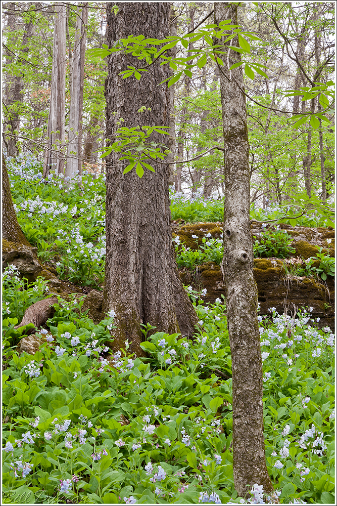
IMG_3795

“Bluebells and Buckeyes″

Technical details: Canon EOS 5D Mark II camera, EF17-40mm f/4L USM @ 70mm, ISO 320,  f/18, 0.5 sec

Along with this great display of wildflowers and trees, the Swimming Deer Trail offers nice views into the Big River valley from atop tall bluffs that are adorned with the characteristic Eastern Red Cedars who are so adept at holding on to cracks and crevices to get the best possible looks as the seasons fly by.

IMG_3779

“Bluebells and Woody Vine″

Technical details: Canon EOS 5D Mark II camera, EF17-40mm f/4L USM @ 24mm, ISO 400,  f/16, 0.4 sec

I apologize for so many vertical compositions.  I once read a photography e-article that suggested this tendency was more typical of the “stand up, aggressive, masculine” (male) photographer, whereas women photographers (and painters I assume), who are assuredly the “weaker sex” are more apt to produce horizontal landscapes, obviously the more passive and prostrate the compositional choice.  If there is any truth to this hogwash, I wonder what it says about the artist who prefers the square ratio?  😉

Anyway, back to the nature stuff, right?  Well, any nature photographer who still cares to keep his union badge has to shoot the cliched Bluebell macro shot, right?  Here it is.
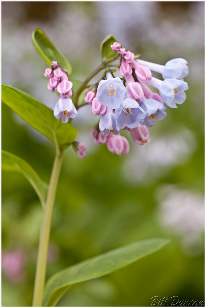
IMG_3815

“Nature Porn″

Technical details: Canon EOS 5D Mark II camera, EF100mm f/2.8L Macro IS USM, ISO 160,  f/8, 1/10 sec

Of course, anywhere in the Ozarks at this time of year is going to be heaven for any birder who is worth their salt.  St. Francois SP is definitely no exception.  During my several visits over the last month, I loved listening and watching the nesting wood warblers and other songbirds as they busily setup their territories, build nests and feed themselves.  I used to think the Romanticists’ metaphorical descriptions of spring as a bunch of overly sentimental hogwash.  Now I find myself just as captivated by this line of interpretation as I do the underpinning that natural history presents.  What heaven is spring!

A week or so following Sarah’s and my trip, Steve gave me a guided tour of the last trail I had yet explored at St. Francois SP: “Mooner’s Hollow”.  A beautiful sloped-shelf waterfall, rocky outcrops and wonderful examples of spring ephemeral wildflowers along the river bottom of Coonville Creek Wild Area were the expected highlights.  What we were not expecting was the fortunate stumbling upon of a Blue-grey Gnatcatcher’s nest!  The second smallest bird in the state, these guys build a nest that is similar in size and construction to that of the state’s smallest, the Ruby-throated Hummingbird.  In the picture below you can hopefully get a look at the construction materials of plant fibers, spider webs, fur and lichen, which is used so beautifully to camouflage the nest.

I watched the nest for a couple of hours.  In this little time I noticed the pair did not stay at the nest, which makes me believe there were not yet any eggs.  The pair stopped at the nest for no more than 60 seconds.  During this time one of the pair would enter the nest, add a bit of lichen or other material they had brought, do a little manipulation and then they would leave again.  This would be repeated every 15 – 20 minutes.  I hope to visit the nest soon to see if eggs, or perhaps even chicks might be found.

IMG_2992

“Not Just Gnatcatching”

Technical details: Canon EOS 7D camera, EF500mm f/4.5L USM lens, ISO 640,  f/6.3, 1/320 sec

This spring I have been fortunate to spend a fair amount of time in the rugged, karst topography that is so unique to the Ozark Highlands.  This continues to bring to mind what it must have been like to travel and exist in this country before ‘modern conveniences’ were introduced to muddle the experience.  A great series of roads can take you to within a ten mile hike or less to basically any spot on the map in Missouri.  For now, I leave with a great quote from that Confederate bushwhacking bastard, Sam Hildebrand.  This is in reference to a cave that is apparently located within or nearby St. Francois SP.  A reason for further exploring some day.

“We passed quietly through Butler County, along the western line of Madison, then through St. Francois and across Big River to those native hills and hunting grounds of my boyhood, known as the Pike Run hills.  The reader must bear in mind that these hills possess peculiar advantages over any other part of the country between St. Louis and the Arkansas line.  They look like the fragments of a broken up world piled together in dread confusion, and terminating finally in an abrupt bluff on the margin of Big River, where nature has left a cavern half way up the perpendicular rock, now known as “The Hildebrand Cave,” mouth to which cannot be seen either from the top or bottom.”
IMG_4082 2

“Fragments of a Broken Up World″
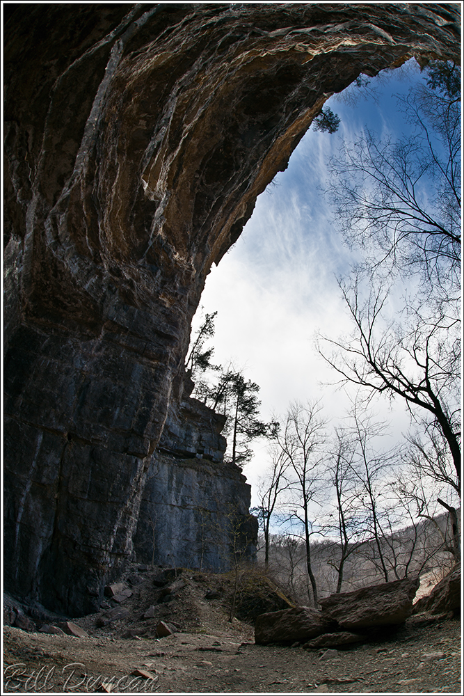
Technical details: Canon EOS 5D Mark II camera, EF17-40mm f/4L USM @ 24mm, ISO 100,  f/14, 1/8 sec

Bill & Steve’s Excellent Adventure, or On Quest to find an Overland Route to Jam Up Cave

I had read about and viewed photos of Jam Up Cave along the Jacks Fork River for a number of years.  Every source I could find made specific mention that the only way was by boat along the river.  The case being that I am still most comfortable and knowledgeable on my lug-soled boots, I figured it would be a while before I got a chance to see it.  Then, in one of the recent cover stories from the MDC’s Conservationist, Brett Dufur highlighted the Upper Jacks Fork and mentioned Jam Up Cave that lies at the confluence of Jam Up Creek and the Jacks Fork.  This prompted my friend Steve and his father to find an overland route via the Jacks Fork Natural Area.  Within a few days of their visit Steve graciously showed me the way.  I have marked what I believe was our general route to the cave from a small pullout.  County Rd OO 491 can be accessed off of OO north of Hwy 60 just east of the town of Mountain View.

Jam Up Cave Route

The hike was not too long, but it deserves highest marks in terms of the difficulty of the terrain.  We bushwhacked our way mostly along ridge tops but enjoyed the burn of moving up near 500 vertical feet.  I had my first look at the end of Jam Up Creek, a losing stream that vanishes underground among boulders and rubble of the karst topography that dominates this watershed.  We then entered the rear of the cavern where we were treated to views like these.  Can you find Steve in this one?

IMG_3419

“The Grand Perspective″

Technical details: Canon EOS 5D Mark II camera, Sigma 15mm f/2.8 EX DG, ISO 400,  f/8, manual blend of three exposures

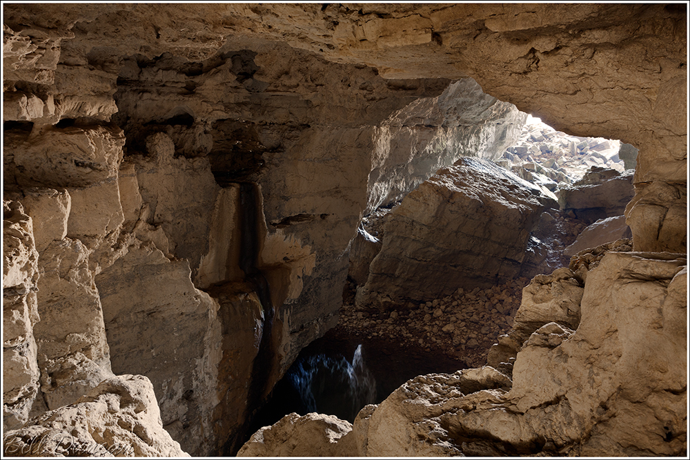
This next one is a bit deeper into the cave looking towards the front entrance across the forbidden pool.  The drop from this side to the pool would have been near 30-40 feet.  From both sides of the pool, impressive looks can be had of an underground waterfall.  Try as I might, I could not find an interesting way to make a photograph of it.  Did we find Smeagol?  We’ll never tell.

IMG_3449

“The Forbidden Pool″

Technical details: Canon EOS 5D Mark II camera, EF17-40mm f/4L USM @ 25mm, ISO 320,  f/11, manual blend of three exposures

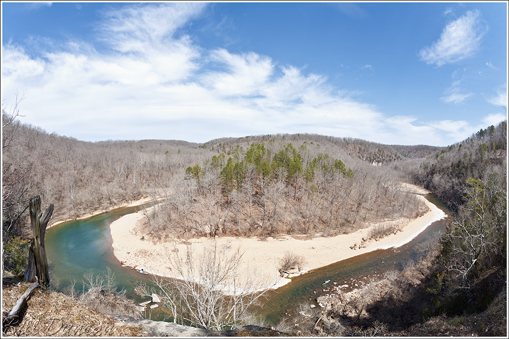
From here we made the climb out of the cave and up to the top of the bluff that offers great views of the Jacks Fork as it bends its way around the bluffs.  The ancient cedars attached to the edge of the bluffs were quite impressive and are not easily forgotten.

IMG_3363

“Jacks Fork Lookout″

Technical details: Canon EOS 5D Mark II camera, Sigma 15mm f/2.8 EX DG, ISO 100,  f/11, 1/100 sec

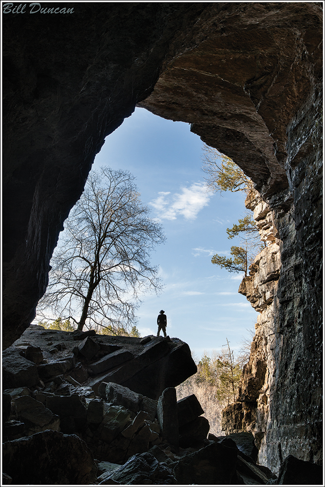
The “front door” of Jam Up Cave is this cavernous maw, the roof of which stands at over 100 feet high and nearly as wide.  This opening funnels into a much narrower tunnel that leads through a rubble field for ~500 feet to the other side of the forbidden pool that I discussed above.  This is a classic karst feature of the Missouri Ozarks and should rank up there with Grand Gulf, HaHa Tonka, the classic Ozark Springs and Devil’s Well.

IMG_3500

“Cavernous Maw″

Technical details: Canon EOS 5D Mark II camera, Sigma 15mm f/2.8 EX DG, ISO 100,  f/11, manual blend of three exposures

On the way out of the cavern we saw this impressive site and decided to give it a bit more sense of perspective by putting a certain pathetic creature into the scene.

IMG_3648

“Jam Up″

Technical details: Canon EOS 5D Mark II camera, EF24-105mm f/4L IS USM @ 47mm, ISO 160,  f/11, manual blend of three exposures

A Very Vernal Venture

Happy Sunday everyone.  Don’t get too excited, Monday is just around the corner… 😉

Compared to the past several years, spring was a bit tardy coming around.  However, on the trails of the northern Missouri Ozarks, she showed in full splendor this weekend.  I started off yesterday morning wanting to visit a few places in the Steelville/Salem area and first stopped at Red-Bluff recreation Area along the Huzzah Creek.  I hiked the trail and listened to the Parula, Yellow-throated Warblers and Black and White Warblers as they advertized their newly forming territories.  I checked out the bluff and looked in vain for the Davidson Natural Bridge nearby.  If anyone has any information to pass on concerning how to find this feature, I’d appreciate it.

From there I headed to Zahorsky Woods, an approximately 50 acre, high-quality wooded lot owned by TNC.  I was having some trouble finding the trailhead I was looking for when a friendly man named Bob stopped and helped me out.  He explained he was one of the owners of the neighboring Wildwood Spring Lodge, and invited me to park on his property and use the trailheads not only to Zahorsky Woods, but to the trail network that runs on his property.  He gave me a quick description and directions to some interesting features, including Steelville Natural Bridge that sets nearby the Meramec River.  Thanks Bob!  The views from the bluffs on both of these properties were very nice and the flood plain within Zohorsky was full of ephemeral wildflowers and other interesting things to see.

My next stop was Sutton Bluff, which rests along the Black River.  Very birdy and a nice hike.  The view from the top leaved a bit to be desired due to the fact that the very nice campgrounds filled most of the valley!  It should be quite a site from below during autumn, however.

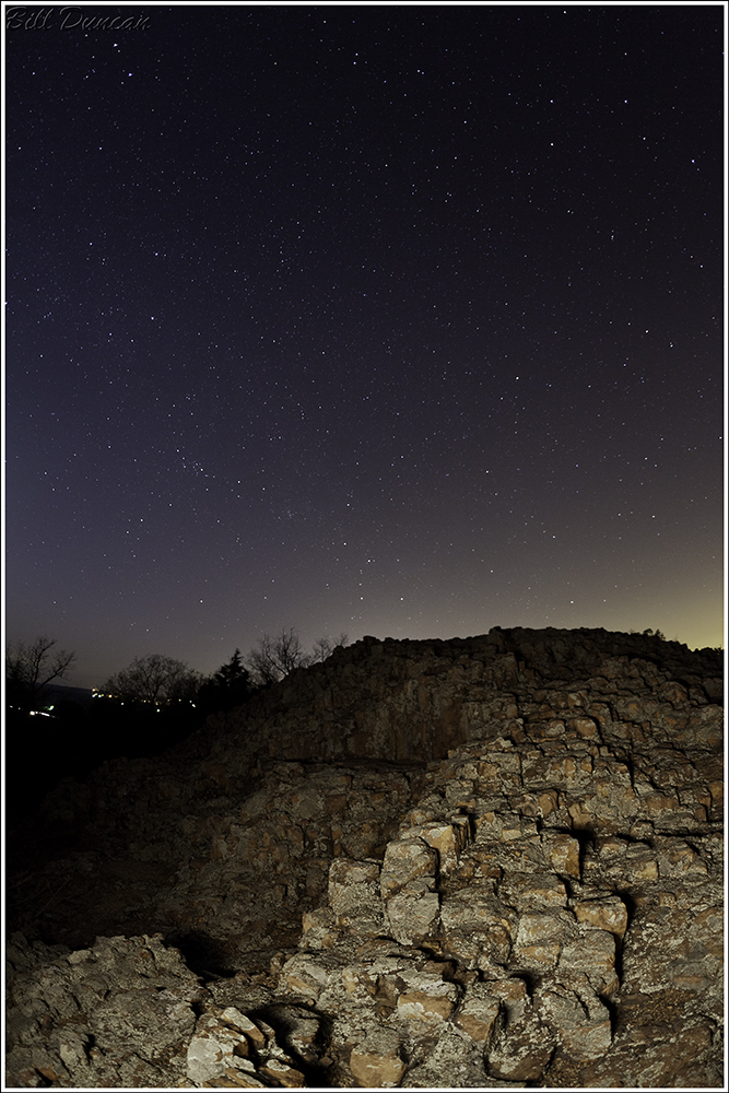
Photos from these location will follow in the near future.  My final stop was to Hughes Mountain near Ironton for a sunset and attempts at some “nightscapes”.  Steve joined me after his long shift at the hospital and kept me company on top of this windy Ozark peak.  The image below is probably my best from what I attempted last night.  Not terrible for my first serious attempt, but far from perfect.  Being reared and still residing in the big city, every time I can see a night’s sky like this is extremely special for me.  I can’t imagine what it would be like to see this on any clear night.  I can’t wait to try this some more!

You can find my, hopefully exhaustive, list of wildflowers in bloom and bird list below the picture.  I am still waiting to find a Brown Creeper in 2014.. 😦

Please enjoy your spring.  Like childhood, they do not last long enough.

IMG_3756

“Sky Envy″

Technical details: Canon EOS 5D Mark II camera, Sigma 15mm f/2.8 EX DG, ISO 640,  f/3.2, 30 sec


Wildflowers

White

·         Cutleaf Toothwort (on the backside of their season)

·         Harbinger of Spring (almost done)

·         Spring Beauty (in the spectacular peak of their season)

·         Pussytoes

·         Rue Anemone (in their peak.  Is there anything more precious than a bunch of these buds immediately before opening?  )

·         False Rue Anemone (near the peak)

·         Bloodroot (only a few remaining)

·         Dutchman’s Breeches (getting a nice start)

·         White Dogtooth Violet

·         Long-leaved Bluets

·         Leavenworthia

·         Saxifrage

·         Pale Violet

Yellow

·         Hoary Puccoon

·         Large Bellwort

·         Celandine Poppy

·         Yellow Violet

·         Buttercup (Ranunculus)

Red/Orange/Pink

·         Indian Paintbrush

Blue/Purple

·         Bluebells

·         Round-lobed Hepatica

·         Blue Phlox

·         Bird’s Foot Violet

·         Johnny Jump Up

·         Blue Violet


Birds

·         Canada Goose

·         Wood Duck

·         Mallard

·         Great-Blue Heron

·         Turkey Vulture

·         Red-tailed Hawk

·         Red-shouldered Hawk

·         Broad-winged Hawk

·         Cooper’s Hawk

·         Sharp-shinned Hawk

·         American Kestral

·         Barred Owl

·         Whip-poor-will

·         American Woodcock

·         Belted Kingfisher

·         Red-headed Woodpecker

·         Downey Woodpecker

·         Hairy Woodpecker

·         Pileated Woodpecker

·         Red-bellied Woodpecker

·         Northern Flicker

·         Eastern Pheobe

·         Great-crested Flycatcher

·         Eastern Kingbird

·         White-eyed Vireo

·         Yellow-throated Vireo

·         Red-eyed Vireo

·         Bell’s Vireo

·         Blue Jay

·         American Crow

·         Fish Crow

·         Tree Swallow

·         Bank Swallow

·         Carolina Chickadee

·         Tufted Titmouse

·         White-breasted Nuthatch

·         Carolina Wren

·         Ruby-crowned Kinglet

·         Golden-crowned Kinglet

·         Blue-grey Gnatcatcher

·         Eastern Bluebird

·         Mourning Dove

·         Hermit Thrush

·         American Robin

·         Northern Mockingbird

·         Brown Thrasher

·         Grey Catbird

·         European Starling

·         Northern Parula

·         Chestnut-sided Warbler

·         Yellow-rumped Warbler

·         Yellow-throated Warbler

·         Pine Warbler

·         Black and White Warbler

·         Louisiana Waterthrush

·         Ovenbird

·         Worm-eating Warbler

·         Kentucky Warbler

·         Eastern Towhee

·         Chipping Sparrow

·         Dark-eyed Junco

·         Song Sparrow

·         Swamp Sparrow

·         Field Sparrow

·         White-throated Sparrow

·         Northern Cardinal

·         Red-winged Blackbird

·         Common Grackle

The Halcyon Days

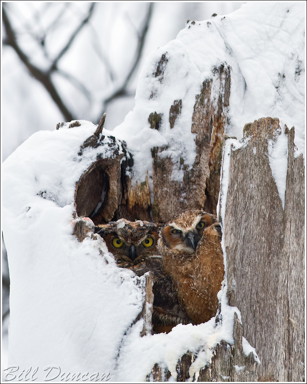
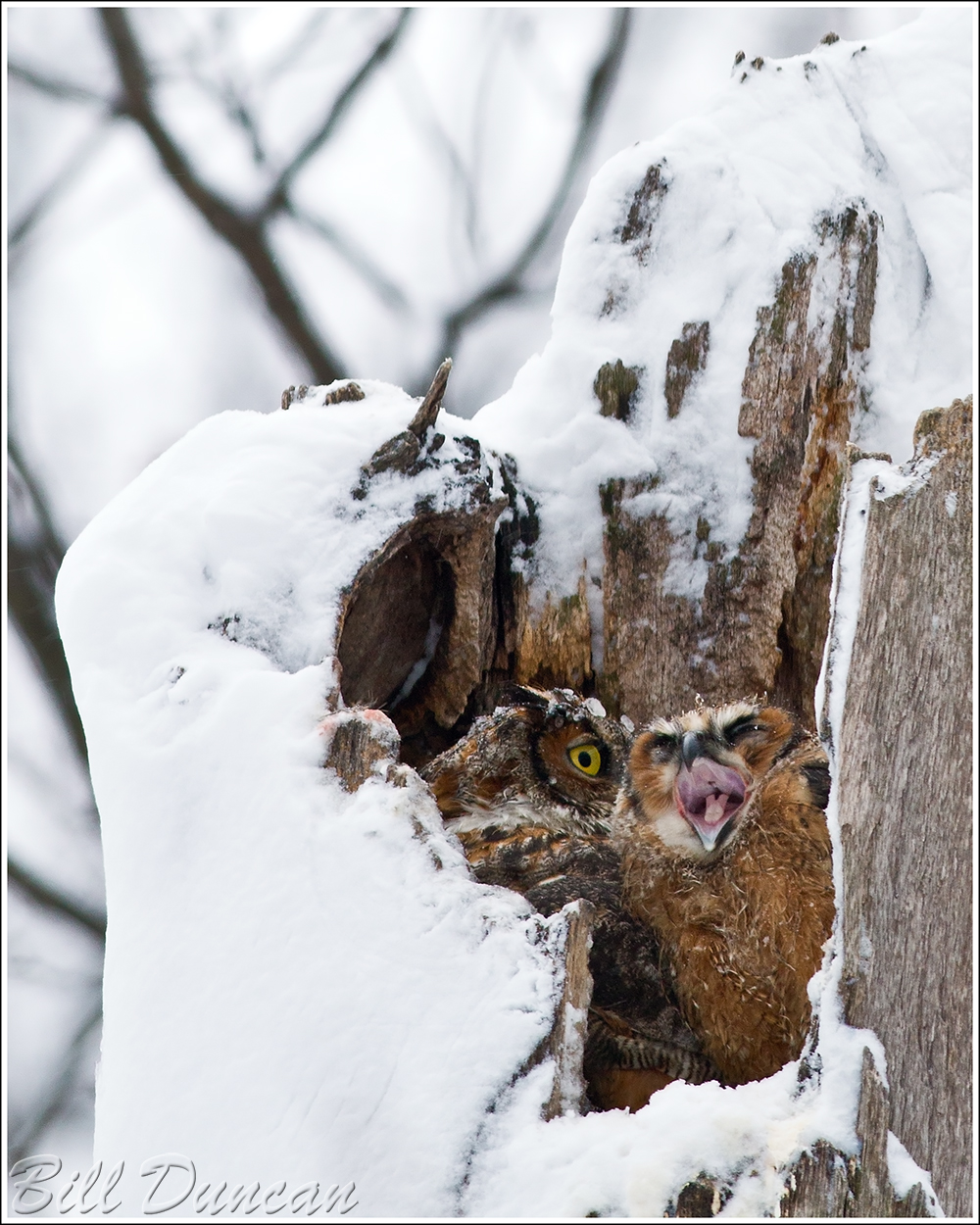
It’s surprising how often these guys take to yawning.  The poor things spend the first couple months or so stuck in the nest, so what else do they have to do?  I’m sure this time for them lasts forever, just like those endless days of summer youth do for us.  Do they reminisce as they move on through the years of those days spent packed in a tube with their siblings?

IMG_2130

“The Great Yawn”
Technical details: Canon EOS 7D camera, EF500mm f/4.5L USM lens, ISO 800,  f/5.6, 1/100 sec

First Bloodroot of the Year!

Putting close to 15 miles on the trails this glorious weekend, I was noticing just how delayed spring was this year compared with the past several.  Harbinger of Spring is about at its peak at the St. Louis latitude, and Spring Beauty and Cutleaf Toothwort are a few days to a week before their peak will be here.  But, it is coming.  I saw thousands of these plants pushing there way up through the leaf litter along with Dutchman’s Breeches (very cute little buds, I must say).  I finally tried the rhizome of the Toothwort today while on a hike at LaBarque Creek C.A. near Eureka.  A member of the mustard family, the Toothwort’s small, fleshy and crisp rhizome has a tooth-like appearance, hence its common name.  Another colloquial name associated with this plant is Pepper root, also in description of the rhizome.  I found the taste to have hints of horseradish and green onion, with a little peppery heat.  The perfect size and flavor makes me think it would be perfect in a variety of dishes, including stir-fry and salads.  But since it would require killing a lot of plants, I doubt I will make a habit of it.

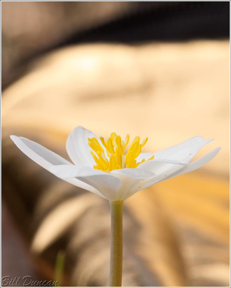
As I was coming to the last mile or so of my hike today, I thought I would once again strike out on my first Bloodroot of the season.  But, just in time, I saw a single, fully-opened bloom a couple of feet from the creek.  This was the only subject I photographed all weekend, but it was still a grand couple days for a walk.

IMG_3243

“First Bloodroot of the Year!″

Technical details: Canon EOS 5D Mark II camera, EF100mm f/2.8L Macro IS USM, ISO 200,  f/22, 1/15 sec

A Hike Down Rocky Creek

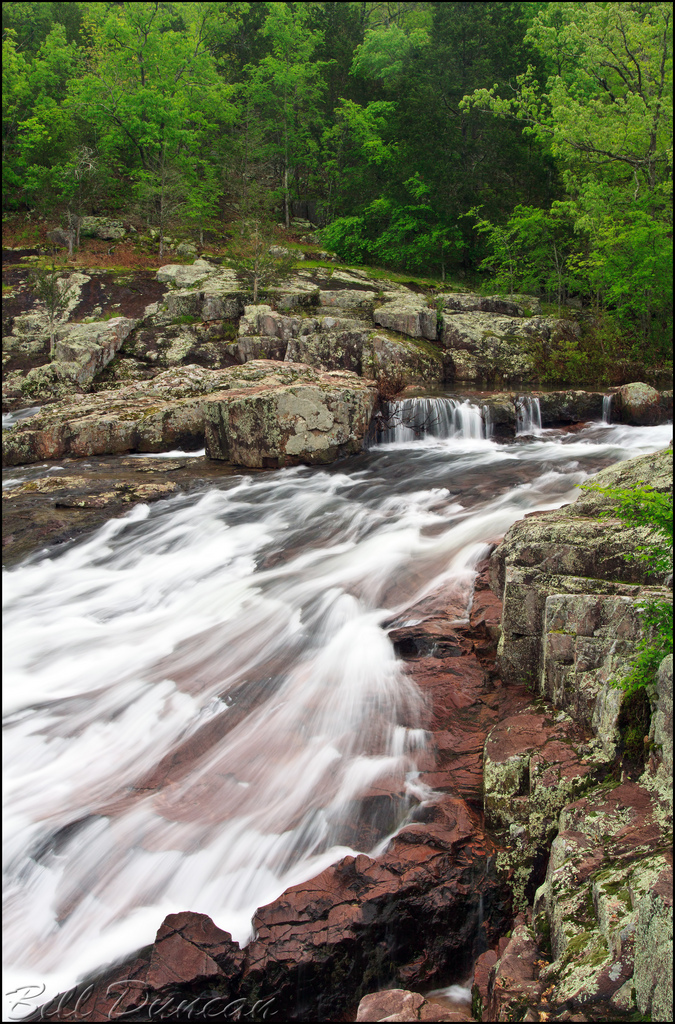
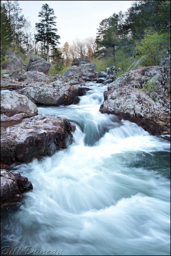
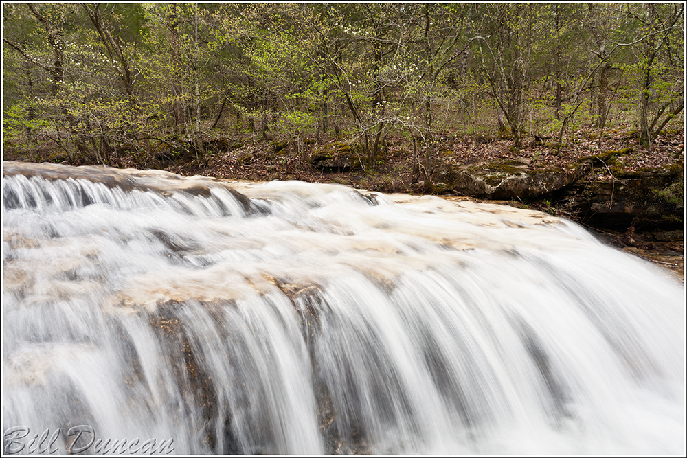
I have been wanting to make the hike down Rocky Creek to its confluence with the Current since I read about the idea in Louis C. White’s Ozark Hideways.  This past Saturday, Steve and I were both aching to get on the trails, to be with nature on a beautiful late winter’s day.  This hike was high on the ever-growing list of potential day-hikes, so we decided that this was the day for this one.  As was the plan, we started at the Rocky Falls N.A. parking lot.  We found that the water level in Rocky Creek was a bit higher than we expected.  While this is fantastic if your goal is to get some nice flowing water shots, it can make for some wetter than desired hiking and stream crossing.  Although this stream is not officially in the St. Francois Mountains, the exposed red rhyolite reminds me of the scenery there to the north-east.  We would see three of the best shut-in areas to be found in the Missouri Ozarks, with Rocky Creek Falls being first.  This image was taken on a previous visit.

Rocky Falls

“Rocky Creek Falls″

Technical details: Canon EOS 50D camera, EF17-40mm f/4L USM @ 23mm, ISO 100,  f/16, 1/4 sec

The first half mile or so of the hike is spent walking alongside the creek, past an impressive beaver-pond until this little side-spur hooks into the Ozark Trail.  A right turn leads to Stegall Mountain, one of the “higher” peaks in Missouri and Peck Ranch C.A.  We turned left to keep along with Rocky Creek and head ultimately to the Current River.  The OZT comes and goes from within sight of the stream.  When possible, Steve and I strayed from the trail and kept close to the stream.  About a half mile from the Hwy NN crossing, we came across the next series of major shut-ins, those at the base of Buzzard Mountain.  The photo below was made on a previous visit.

Buzzard Mountain Shut-ins

“Buzzard Mountain Shut-Ins″

Technical details: Canon EOS 50D camera, EF17-40mm f/4L USM @ 22mm, ISO 250,  f/14, 1/20 sec

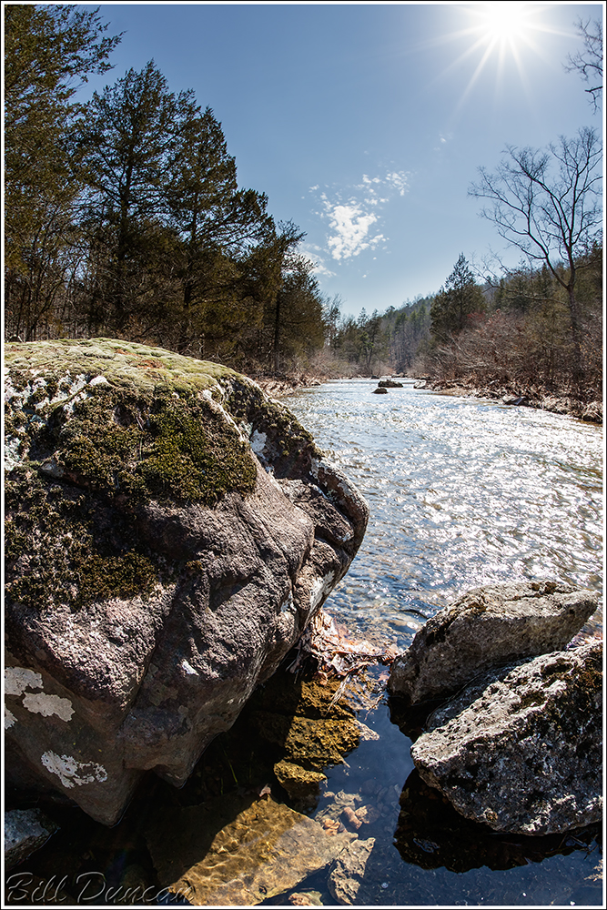
Continuing past these beautiful formations of rock vs. water we followed the stream.  It was difficult to make progress, as around every bend there were shelves of exposed, upraised porphyry.  These ~ 3.5 billion year old “benches” were perfect traps for lounging and loafing, snacking and passing the time philosophizing, all the while listening to the ever present sounds of the crystal-clear water fighting its endless battle downstream.  This image was made in between our breaks.

IMG_3052

“Another World″

Technical details: Canon EOS 5D Mark II camera, Sigma 15mm f/2.8 EX DG, ISO 100,  f/14, manual blend of two exposures

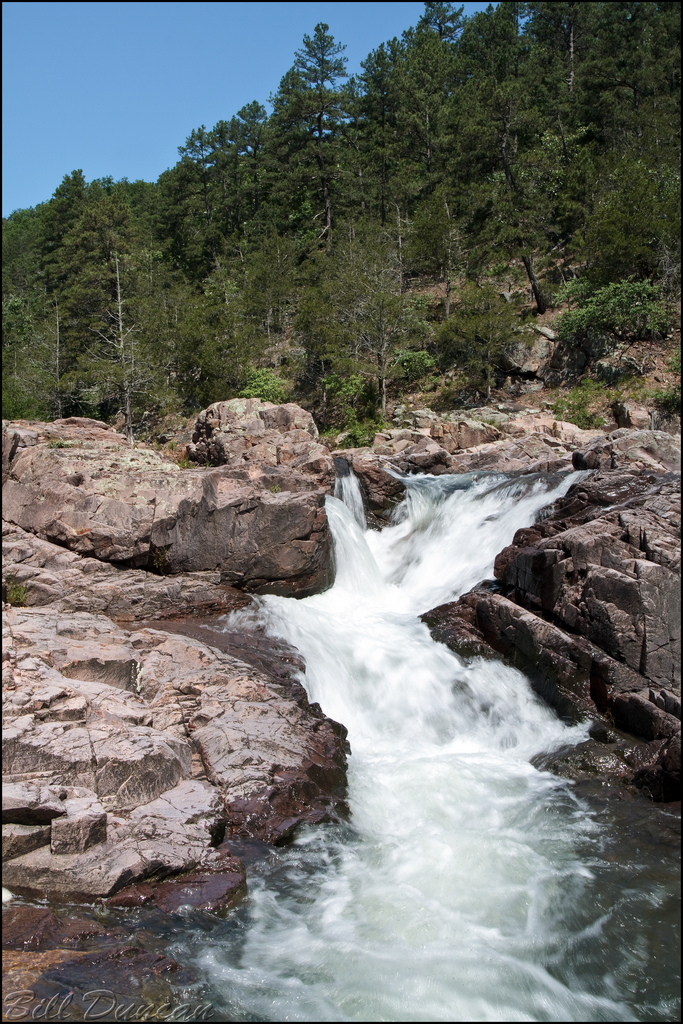
A mile or two past Buzzard Mountain we came across the third and last of the major shut-ins along Rocky Creek.  These shut-ins are at the base of Mill Mountain, and the Klepzig Mill can still be found here.  Somehow, after several visits I have still not photographed the mill structure.  Oh well, another excuse to return.  Below is a photo of the shut-ins made on a prior visit to the area.


“Mill Mountain Shut-Ins″

Technical details: Canon EOS 50D camera, EF17-40mm f/4L USM @ 24mm, ISO 250,  f/16, 1/25 sec

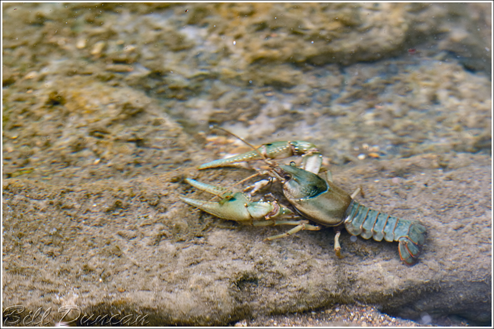
About here we left the OZT to continue east with the stream towards its rendezvous with the Current.  The vast majority of the course of the stream has a very shallow base; in most places it can be forded without wetting your knees.  Once in awhile, pools deep enough to swim in would come about.  These pools held some decent sized fish and looked quite inviting for a swim.  Near one of these we stopped for a bite, including some tuna sandwiches that Steve brought along.  At one point Steve missed his mouth and a chunk of tuna  landed in the water along a shallow shelf.  We watched to see if a fish would come along for a free bite.  No fish found this piece, but in a few minutes this guy, smelling the oils leaching from the fish presumably, came out of the depths to scavenge our waste.

IMG_3115

“Spothanded Crayfish″

Technical details: Canon EOS 5D Mark II camera, EF100mm f/2.8L Macro IS USM, ISO 400,  f/4, 1/60 sec

Did you know…? The Missouri Ozarks are home to 25 species of Crayfish, seven of which are found nowhere else.  The ancient geology of the Ozark region has created spatially isolated streams, supporting varied aquatic habitats based on bedrock and erosional composition.  This has enabled high speciation rates of crayfish and other aquatic and riparian animals.

The Spothanded Crayfish is known to have specific color and other morphological differences between populations in Missouri.  In the western populations, such as this one found in the Current River watershed, the species is greenish in color and contains the dark spots  on the base of the pincers, while populations in the eastern drainages of the Meramec and Black Rivers usually do not show the spots and have red or orange tinted pincers.

Read more about the Spothanded Crayfish or any other of Missouri’s Crayfish by checking out this wonderful guide: The Crayfishes of Missouri, by William Pflieger.

Another two or three miles of stream-side bushwhacking, trail and forest road hiking and we found ourselves at the confluence, the now flat and tranquil Rocky Creek dumping its waters into the Current River.  The hike back was quicker and partially under the cover of darkness.  A highlight of our return was very close looks of an American Woodcock that we heard wobbling  among the dry leaves near the trail.  A favorite of mine.

We finished the day by grabbing a couple of pies at Saso’s in nearby Ellington.  The pies were fine, but no homemade baklava was on hand… 😦

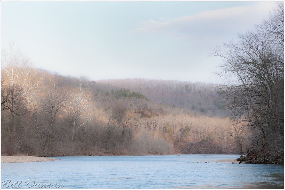
I’ll end with the late-afternoon view we had from the point of the confluence.  Rocky Creek is moving in from the right.  The sun was pushing its last of the day onto the hills and was partially obscured by rapidly-moving clouds.  This resulted in the dynamic light across the landscape on the opposite bank of the Current.  I decided to go with a bit of a pictorialist treatment, but I am not completely convinced it was the best direction to go.  I used the clarity slider in ACR RAW to give the image a softer, less defined appearance, hopefully bringing attention to the changing tones as well as to the calmness of the water, which is juxtaposed by the images made upstream that were placed earlier in this post.

Well, I hope this wasn’t boring, and perhaps makes you wish to witness some of these locations for yourself.  Until next time, make like a camper and go take a hike.

IMG_3139


“A Place in My Heart″

Technical details: Canon EOS 5D Mark II camera, EF24-105mm f/4L IS USM @ 96mm, ISO 125,  f/10, 1/13 sec

Shaw Nature Reserve – Photo of the Month

One of my first serious bird photos I made, showing a Red-bellied Woodpecker taking advantage of some Black Gum berries, was honored as March’s “Photo of the Month” by SNR.

4252123357_1593444ce0_o

“Red-bellied Woodpecker”

Technical details: Canon EOS 50D camera, EF70-200mm f/2.8L USM +1.4x @ 280mm, ISO 400,  f/6.7, 1/750 sec