"What a thousand acres of Silphiums looked like when they tickled the bellies of the buffalo is a question never again to be answered, and perhaps not even asked." -Aldo Leopold
After record breaking rainfalls in southeastern Missouri, Casey and I headed down to visit some favorite waters in the St. Francois Mountains a couple days later. We expected a little more flow but this area drains so quickly, if you aren’t there immediately after the rains stop you won’t get to see the shut-ins and waterfalls at their peek. We were also unfortunate to have a mostly cloud-free day. Not the skies you want for shooting waters like these. But, we made the most of it – focusing our efforts near sunrise and sunset.
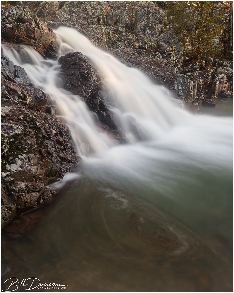
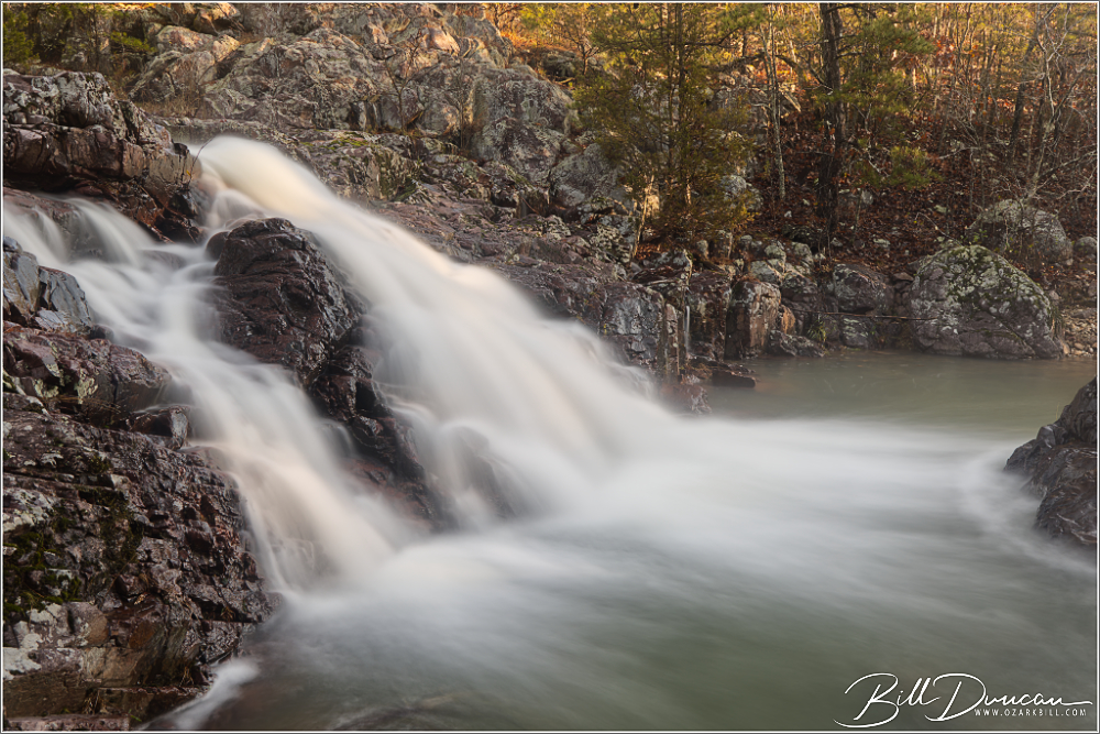
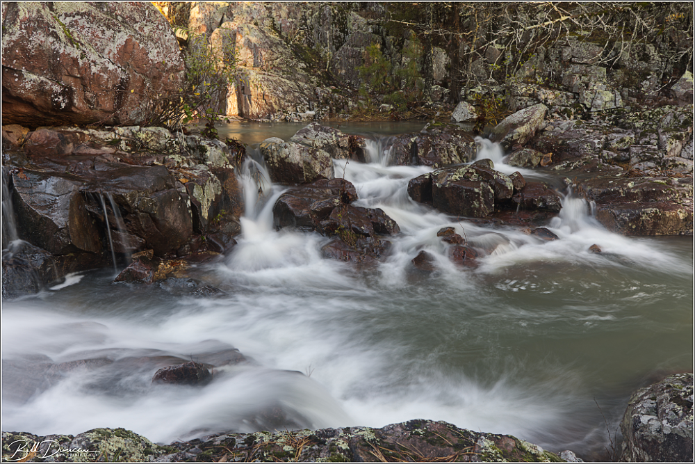
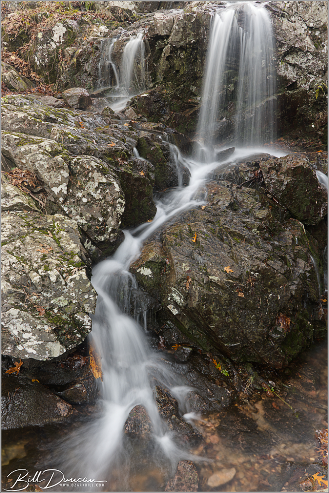
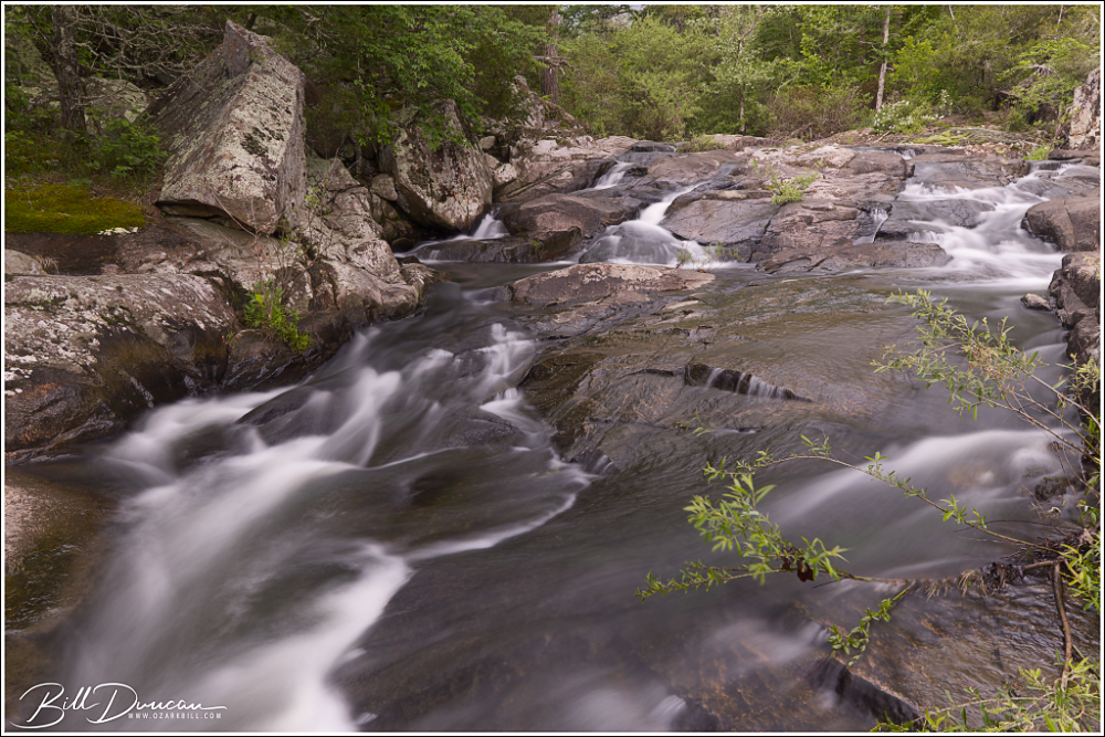
First up is a few from Leatherwood Creek Shut-ins.
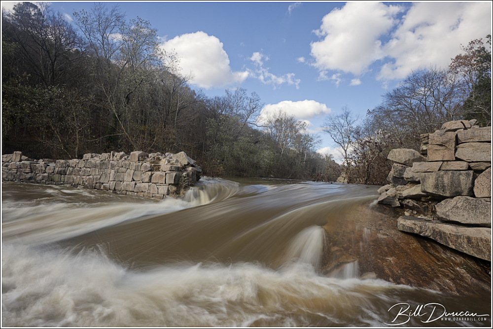
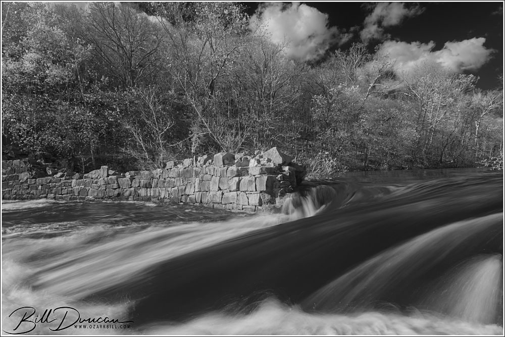
We then headed over to the St. Francois River to see how high the water was flowing at the Einstein Dam. This dam, built in 1879, was used to provide power to a mill and other facilities surrounding a nearby quartz mine. I have seen the water rolling higher over the dam, but we still had some impressive flow.
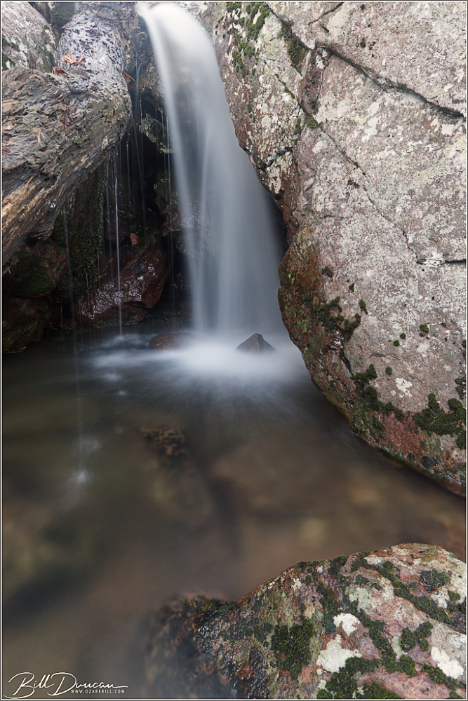
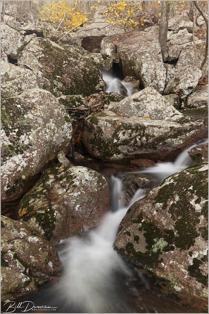
Our final stop of the day was the cascades of Black Mountain. With light running out, we climbed a little and made the following images.
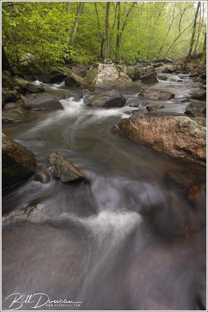
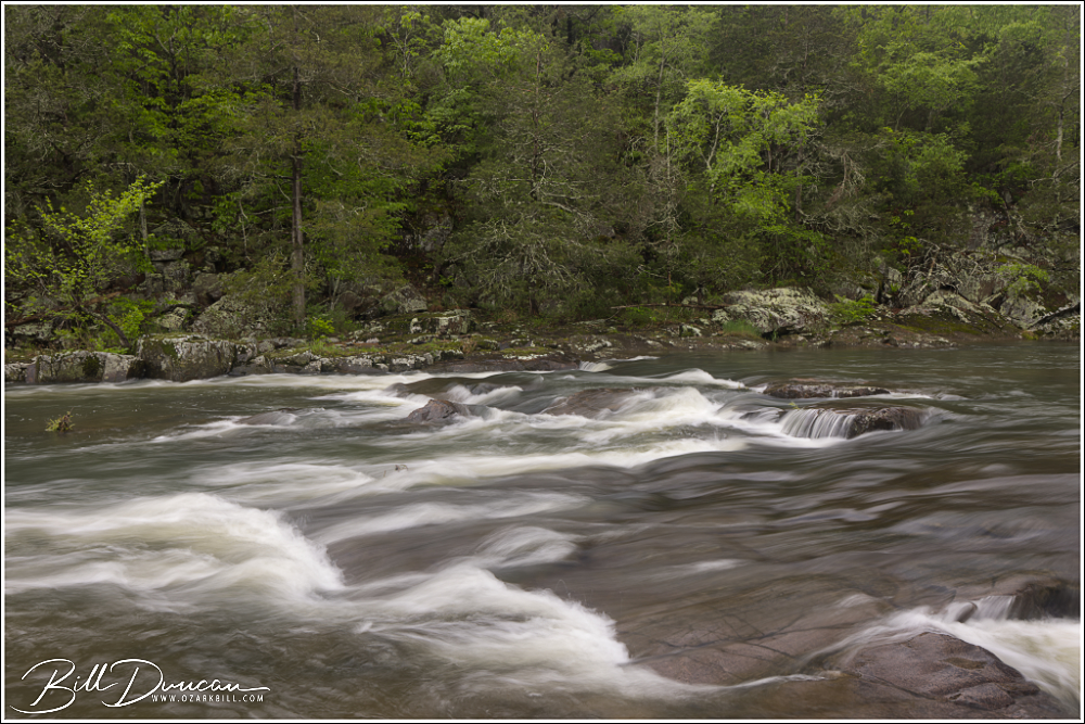
Anyone with a bit of knowledge about the St. Francois River of southeastern Missouri has probably heard of or has even visited the well-known stretch of the Tiemann Shut-ins that create the great series of class 1-3 rapids that experienced kayakers long to ride. The stretch of this river between Millstream Gardens and Silver Mines Recreational Area is one of the most scenic and biodiverse areas of the Show-Me State.
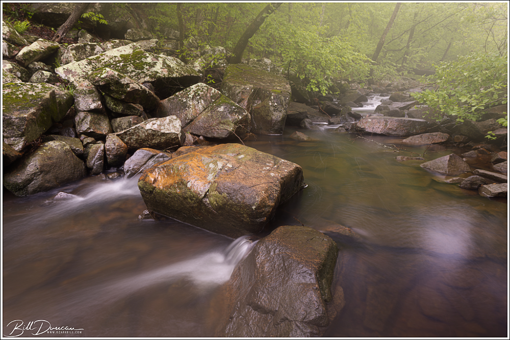
This spring I was turned on to three new-to-me shut-ins in the St. Francois watershed that I should have visited long ago. At first, it was surprising to me that these three geological features are not more well known. However, once I found out a little of the difficulty of getting to these locations, I am now not surprised at all.
Looking up Turkey Creek
The St. Francois Watershed The geological history of the St. Francois River watershed is a tale written in stone, shaped over millions of years by dynamic processes. At its core lies the ancient Ozark Plateau, characterized by its resilient dolomite and limestone bedrock, remnants of a bygone era when shallow seas covered the region. Erosion and uplift sculpted the landscape, carving out rugged hills, steep bluffs, and winding valleys that define the watershed’s topography today.
Upper Stouts Creek Shut-ins
Within the embrace of the St. Francois River watershed thrives a rich tapestry of ecological diversity, harboring a multitude of habitats that support an abundance of plant and animal life. The forested slopes of the Ozarks provide refuge for a myriad of tree species, from towering oaks and hickories to delicate dogwoods and redbuds. Beneath the canopy, a lush understory of ferns, wildflowers, and mosses carpet the forest floor, while clear, spring-fed streams meander through the landscape, sustaining populations of freshwater mussels, fish, and amphibians.
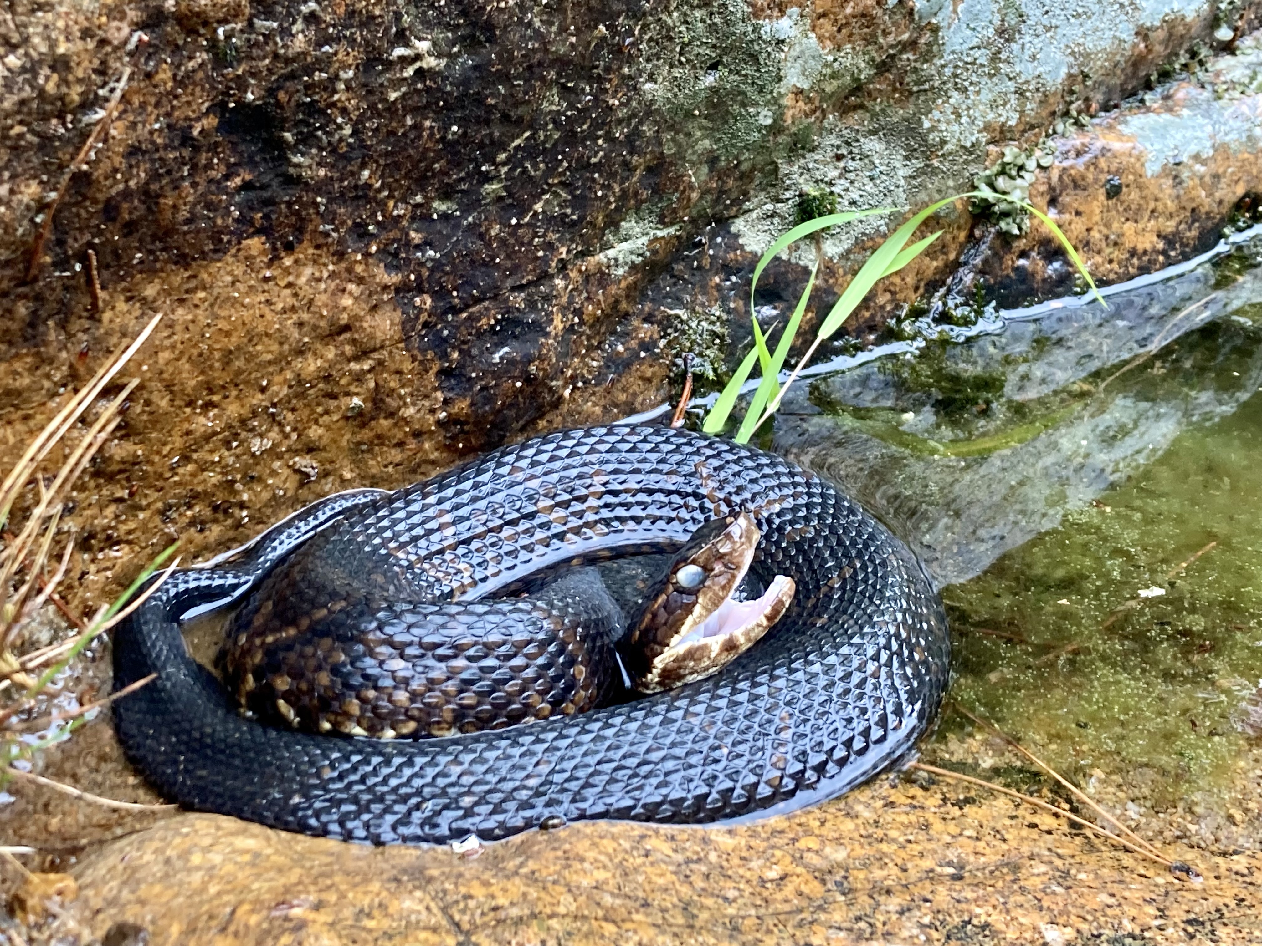
The traveler to the shut-ins of the St. Francois River watershed should always be on the lookout for cottonmouths.
The river itself serves as a lifeline for countless species, offering vital habitat and nourishment along its meandering course. From the elusive Ozark hellbender to the Bald Eagle, the St. Francois River watershed supports a diverse array of wildlife, including many species of conservation concern. Endemic flora and fauna, such as the Ozark chinquapin and the Hine’s emerald dragonfly, find sanctuary within the watershed, highlighting its importance as a stronghold for biodiversity.
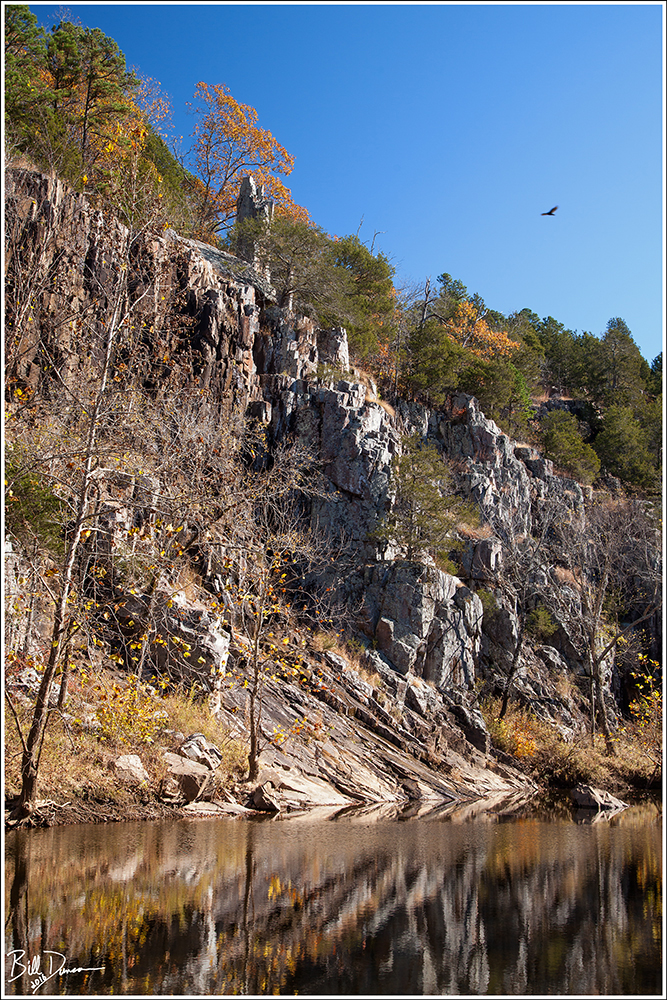
About Missouri’s Shut-ins Shut-ins are a testament to the enduring forces of nature. Formed over many thousands of years, these unique rock formations are the result of a complex interplay between water erosion and geological upheaval. The shut-ins, characterized by narrow channels and cascading waterfalls, are formed when swiftly flowing streams encounter resistant igneous bedrock, creating natural barriers that redirect the flow and sculpting the surrounding landscape into breathtaking formations.
Humidity in these creek beds is usually very high, creating fog and haze. Turkey Creek Shut-ins.
Beyond their stunning beauty, shut-ins are also home to a diverse array of flora and fauna. The cool, clear waters of the shut-ins provide a habitat for various aquatic species, including aquatic invertebrates, freshwater mussels and fish. Along the rocky banks, towering hardwood forests thrive, offering refuge to an abundance of wildlife, from songbirds to white-tailed deer. The unique microclimate created by the shut-ins supports a rich tapestry of plant life, including rare species adapted to the harsh conditions of the rocky terrain.
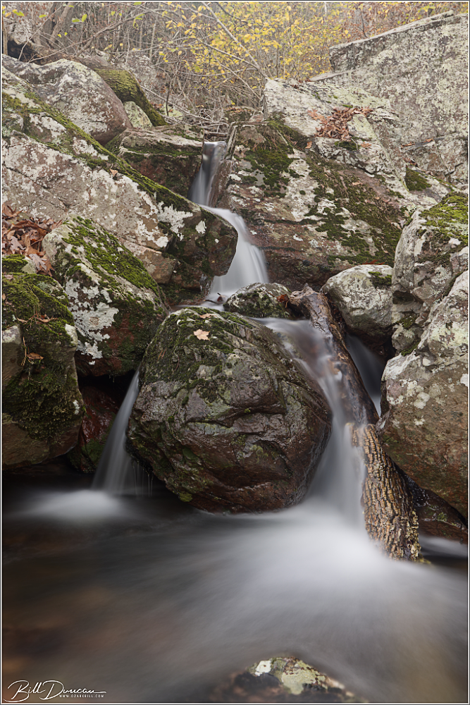
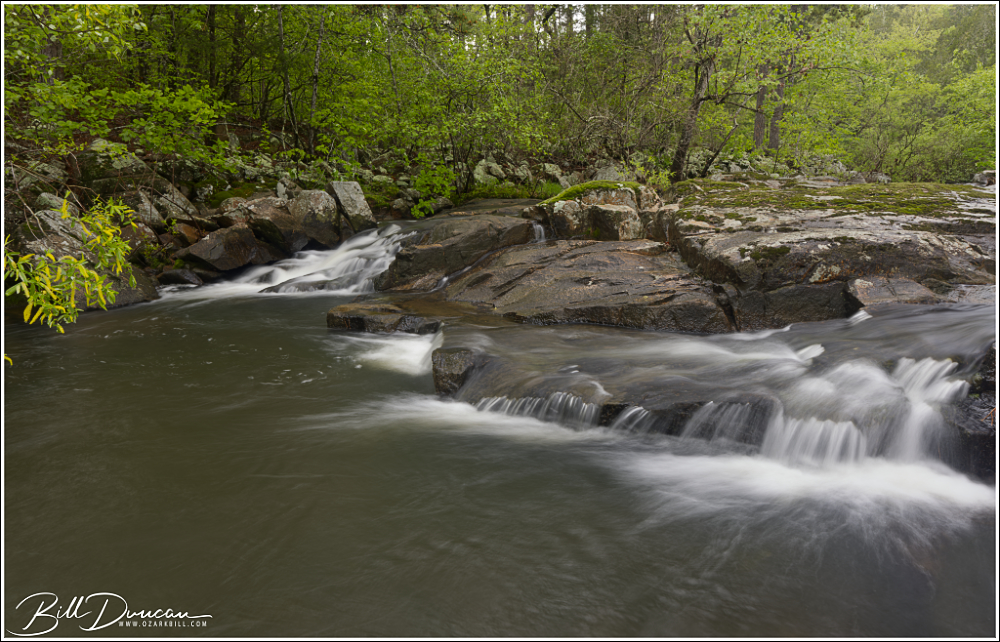
Upper Stouts Creek Shut-ins One of the main feeding branches of the St. Francois River, Stouts Creek contains a number of picturesque shut-ins. Casey and I had noted this particular one driving by for years but had never made the stop. We had to trespass a little to get our shots, but the folks who own this property are, theoretically at least, supposed to be inclined to forgive those who trespass. We spent just a few minutes here and were in and out without incident.
Upper Stouts Creek Shut-ins
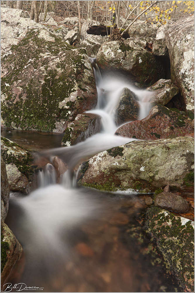
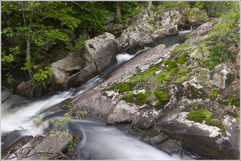
Turkey Creek Shut-ins Flowing from the north, Turkey Creek empties its contents into the east side of the St. Francois River, just upriver from the historic Silvermines Dam. Getting to the Turkey Creek Shut-ins requires either a treacherous hike along the creek from the confluence, or a slightly less arduous bushwhack up and over a highland to the sight of the more picturesque parts of the shut-ins. Taking the easier way means missing portions of the shut-ins but will also result in fewer potential run-ins with cottonmouth snakes and ankle-snapping rocks.
Turkey Creek Shut-ins
Swimming holes abound in shut-ins like these at Turkey Creek.
Turkey Creek Shut-ins
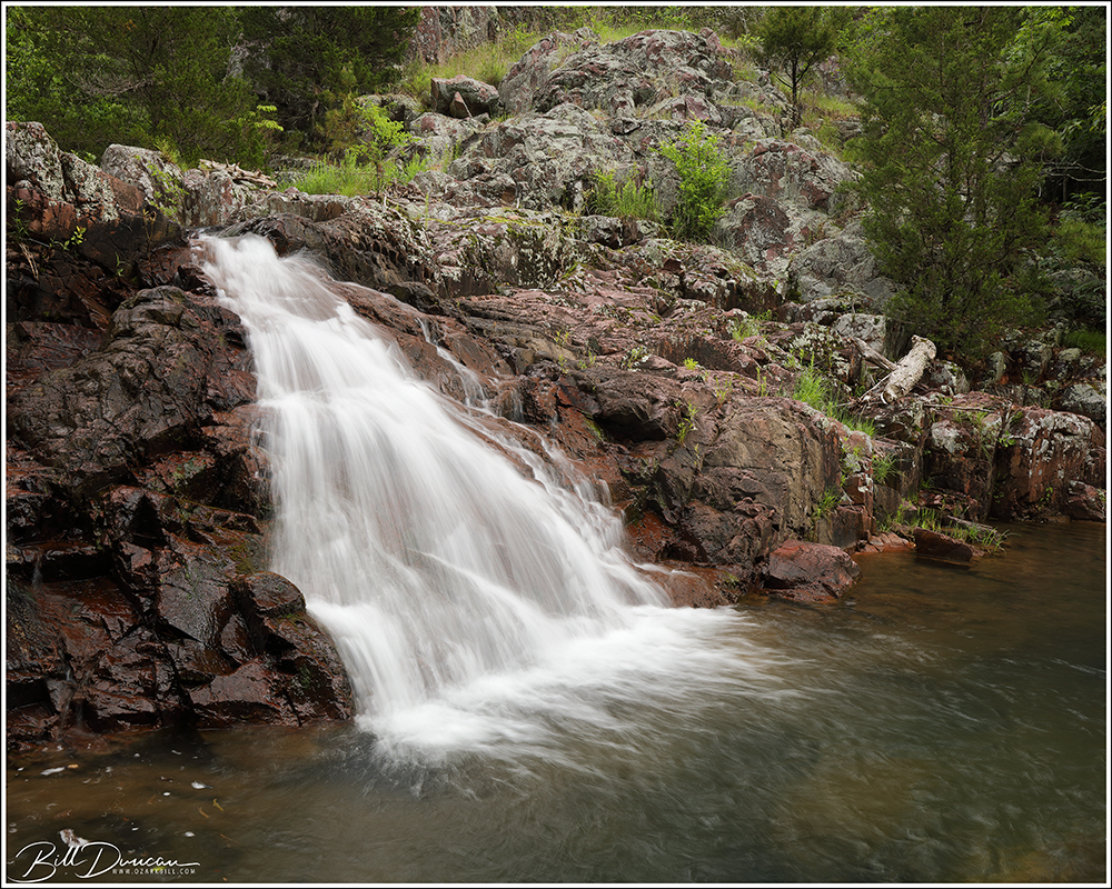
Mud Creek Shut-ins Mud Creek Shut-ins are definitely one of the most memorable shut-ins that I have had the pleasure to visit – not only because of their classic St. Francois Mountain beauty, but due to my story in reaching them. As is the case with Turkey Creek Shut-ins, these shut-ins can be reached by paddling the St. Francois River. However, I doubt my kayak skills would service safe passage across the class-3 rapids of this stretch of the river, especially while carrying expensive camera gear.
Moving upstream along Mud Creek from its confluence with the St. Francois, one first gets to view this very nice waterfall.
The next best option? Footing it across. I began this trek from the parking lot of the Silvermines Recreational Area. In times of high water, the low footbridge across the St. Francois River can be underwater, so I recommend parking on the north side of the river and paying the ridiculous $5.00 to park your car for a few hours.
The water finds multiple pathways against the rock as the creek races down the ravine.
From the parking area, I took the “trail” that runs upstream along the north side of the river until I got to the namesake mines. From here, it was steep climbing until I eventually ran into an old two-track that allowed for some switch-backing until I eventually rose from the river’s ravine into a more upland forest. Although the topology here was more manageable, fallen trees were everywhere, presumably from strong storms of recent years. The bushwhacking got frustrating, especially with the need to eat a spider or two every five to ten steps! Using my GPS, I kept the river to my right side and generally headed to the northeast to where Mud Creek meets the St. Francois. I should have headed much further to the north, but I kept finding myself heading back into the boulder-strewn ravine of the river. Eventually, I learned my lesson and rose to the highest elevation possible and made a direct line to where the GPS told me the confluence would be. Finally arriving, I realized I was then facing the hurdle of heading back down the ravine to the confluence. I could hear rushing water from the east and the north, shut-ins along the river and creek, respectively. I chose my point to descend into the ravine, not knowing if this would take me to sheer cliffs that would force me back up to try again. I eventually stumbled into the relatively small river bank that was thick with twenty foot tall alder and witch-hazel thickets.
Mud Creek Shut-ins
Clearing these thickets, with water halfway up my wellies (I got my first pair of Gumleaf boots recently, so I can no longer call these muck boots), I was finally able to see the confluence. Navigating around huge boulders, I began clambering up Mud Creek and almost immediately came upon the nicest waterfall of these shut-ins. About this time, the sky began to darken. Most of my trek to this point was in mostly sunny skies, making me wonder if the overcast skies forecasted for this afternoon where ever going to happen. Now I was hearing thunder and watching dark skies closing in quickly from the west.
Porphyry and swirls
I realized I probably had limited rain-free time with the shut-ins so I got to work, moving myself and my gear from one point of interest to the next upstream. This type of landscape photography is not for the faint of heart! Due to the sharp sides of the ravine, I was forced to cross the creek several times, negotiating deep pools, fast-moving water and slippery rocks. On several occasions, I used my tripod as an extra set of legs, helping me stabilize myself while crossing the creek.
Mudd Creek Shut-ins
Getting about a half mile upstream from the confluence, the shut-ins widened, opening up to large sections of exposed granite. It was around here that I decided the storm was not going to pass me by, but come right down on me. The thunder was getting closer and more frequent. I put my camera bodies and lenses into individual Ziplock bags and put the rain cover over my bag just when the sky opened up with torrential rains. It was then that I realized I was on the wrong side of the creek to get back to where I needed to be. I also sensed the waters in Mud Creek were starting to rise. The opposite side of the creek this far upstream looked like near-vertical cliffs, but I knew I probably did not have time to head back downstream to a point where I made the crossing earlier. I found the closet point to make a relatively safe crossing and found myself with just a few feet between the steep rise of the ravine and the creek that seemed to be increasing inch by inch. I found some handholds and started climbing. Spiders be damned!
St. Francois Mountain Beauty!
I climbed as carefully as possible, making progress while the rain came down in sheets and lighting danced across the sky directly above me. In five to ten minutes I made it up the approximately 400 feet of increased elevation and reached the top of the ravine. Not liking the idea of clambering down the opposite side of the ravine to get back to the mines, I decided a better route back would be to stay in the uplands and head north to Highway D to get back to my car. That was another two-mile bushwhack, back through the fallen trees, my wellies filling up with rain water, and limited visibility. I eventually made it to the road, finding my way safely back to my car. Not wanting to ruin my seat with my soaking wet cloths and not having a dry change of cloths, I striped to my boxer-briefs, put a towel down on my seat and drove the two-hours home. Thankfully I did nothing to raise the attention of any authorities on the way. 😉
I’d Like to thank Casey Galvin, Kathy Bildner and midwesthiker.com for the information that helped me reach these fantastic locations!
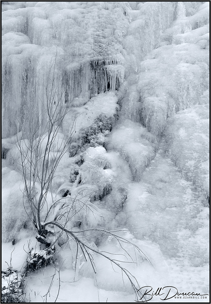
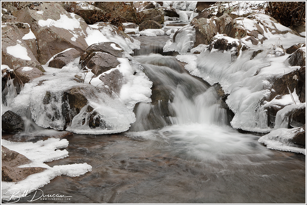
A bluff face covered in ice along the the Little St. Francis
A few images from our recent deep freeze. Casey and I visited the St. Francois Mountains and collected some images along the Little St. Francis River and Little Rock Creek.
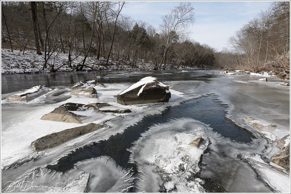
Nice shelf ice formed along the river. Hip boots and metal cleats, along with thinking about where you step, are all recommended.
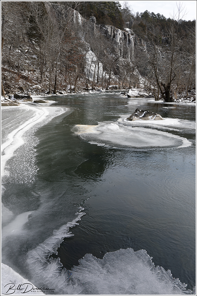
Looking down river
Looking upstream, the ice-shrouded bluffs (~125 feet tall) can be seen through the trees.
A close up look at the frosted bluff face of this rugged river bed.
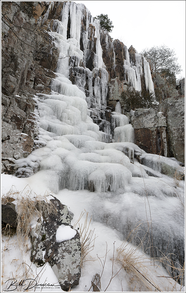
Finally, a small, ice-crowned shut-in along Little Rock Creek. More interesting shut-ins are found further upstream but those will have to wait for another day.
A sharp drop of approximately 8 feet (to pool’s surface) ends one of the nicest series of shut-ins – located on private land in Madison and Iron Counties (location 1).
This year I was fortunate to be introduced to two new-for-me shut-ins in the southern region of the St. Francois Mountains. Both of these locations are currently on private land and with assistance from a couple of friends, it was quite a thrill to be able to visit and photograph these stunning geologic features.
We would of have liked to have more flowing water on our couple of visits to these shut-ins (loc. 1), however, these creeks are both partially spring-fed so there is always at least some flow.
What surprised me most about both of these locations was that they were not covered in Beveridge’s “Geologic Wonders and Curiosities of Missouri”. I am not sure if this was because he did not know of them or because he chose not to feature them for some reason. I sure hope it was the later.
This phot was taken at the same location as the previous image, but in the autumn.
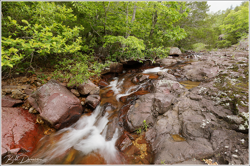
Definitely wild country. We pushed through witch hazel and other streamside brush, taking deliberate steps over slick-as-ice rocks to find the next small section of cascades.
The tile-red rhyolite porphyry that makes up the majority of this streambed matches well against the warm tones of autumn foliage.
My recent delves into geology and astronomy have really been eye-opening, tying together everything else I know of natural history into place. There is so much more for me to learn, with Geology I know almost nothing, but it has been such an aid for me in remembering that most of what everyone worries over is so insignificant compared to the real that is right under our noses.
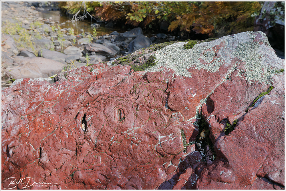
Lava-gas bubbles (lithophysae), thought to be formed by expanding gases prior to solidification into rock, can be seen on this rhyolite protrusion.
Talk about your tile-red rhyolite porphyry!
Don’t confuse this with lava flows from Kīlauea. This is ancient igneous rock that solidified approximately 1.5 billion years ago.
This creek bed at location 2 is located in Iron County. Here, the rock would be considered more of a purple porphyry and is nicely capped by royal fern (Osmunda regalis).
Found near the creek at location 2 was this splendid Lobelia cardinalis (cardinal flower) growing against a bed of Conoclinium coelestinum (blue mistflower). A nice October find.
This is all I have to share from these two locations for now. I am looking forward to visiting again with hopefully more water flow and at different season. Thanks for visiting.
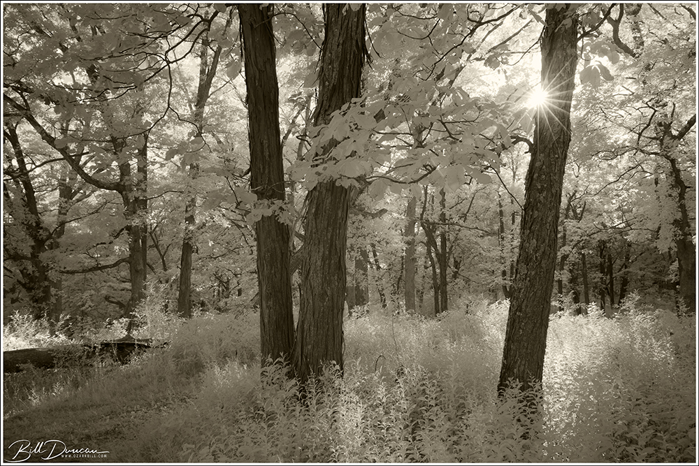
I have had some opportunity lately to try for infrared landscapes with my converted Canon 5D mkii. There is still so much I want to try with this, but between summer laziness and a lack of time and opportunity, I get by with what I can. The image above was taken in an Illinois woodland.
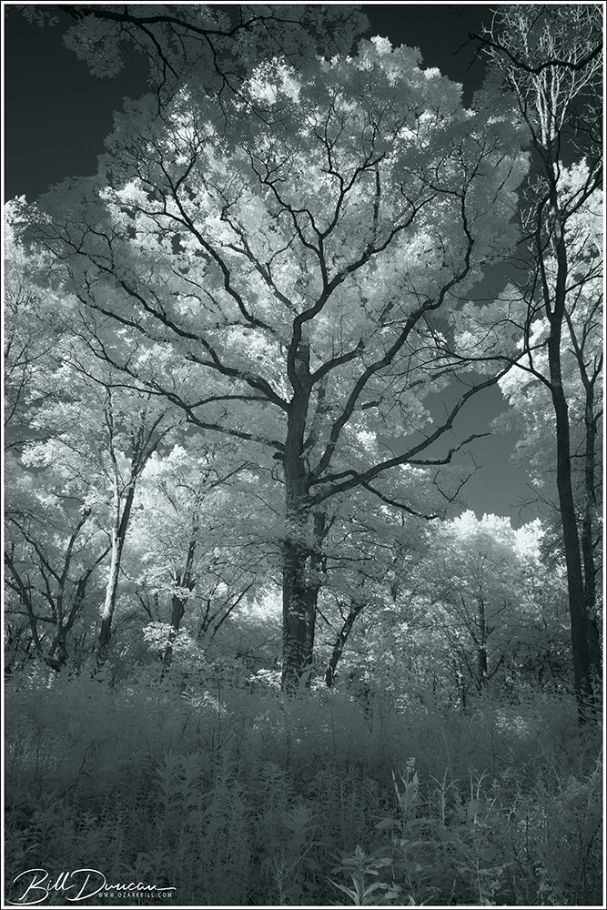
Infrared White Oak
I found this white oak in the same woodland and it screamed for the IR treatment. I’m still getting the hang of processing the images from the “supercolor IR conversion” of this camera. Although the basics are simple, I find the plethora of options one has in processing these files to be a bit intimidating. I’m trying to go a little more on the subtle side with these, but there’s a fine line between just enough and too much.
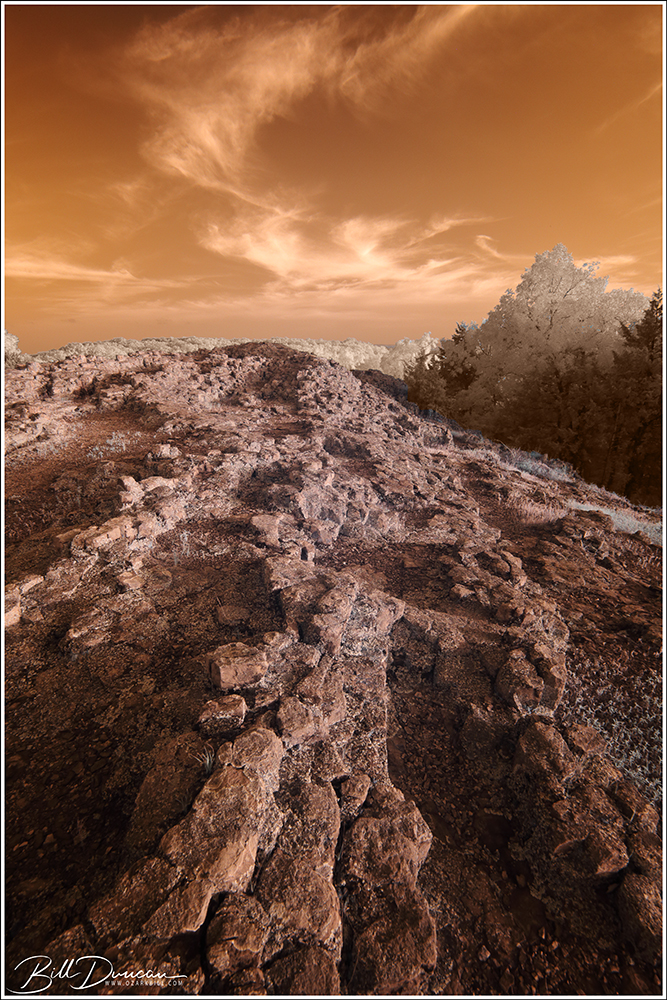
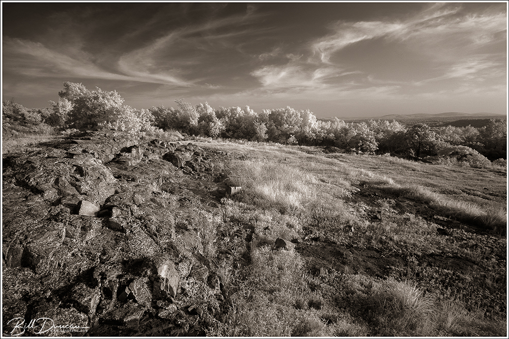
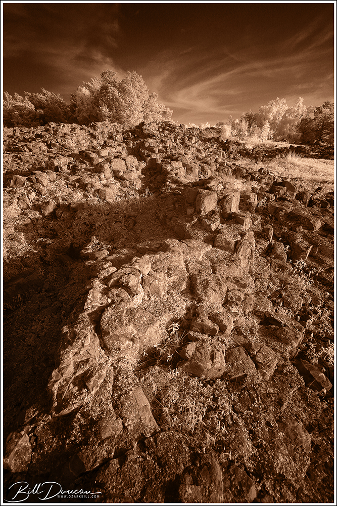
Hughes Mountain in IR
These final three images were taken at Hughes Mountain C.A. – a place that I find begs for the infrared photographic treatment. These were taken on one of the evenings of potential for extra color from the Sahara sandstorms. There was nothing extra for the sunset due to these storms other than increased haze, but the high clouds made for interesting skies in IR.
Hughes Mountain in IR
Finding green plants in the glade areas is important in getting the contrasts for an IR image. This hasn’t been a very wet summer but there was some green still left among the rocks. Optimally, it would be best to try in late spring to early summer to get this setting just right.
Hughes Mountain in IR
So these were some of my first serious attempts at IR landscapes with the newly converted camera. If you have any suggestions for improvement, particularly in the processing area, I would be grateful to listen.
Eastern Collared Lizard – female. 520 mm focal length equivalent, f/11, 1/160 sec. ISO-200
These photos were taken on a WGNSS Nature Photography Group field trip into the St. Francois Mountains in early June, 2019.
Eastern Collared Lizard – female. 520 mm focal length equivalent, f/8, 1/200 sec. ISO-160
Along with a couple of female eastern collared lizards, we found quite a few other herps of interest.
Eastern Collared Lizard – female. 406 mm focal length equivalent, f/6.3, 1/320 sec. ISO-200
These lizards are really great photographic subjects. They are relatively easy to photograph, allowing for watching while they bask in the sunlight of a clear day without much manipulation or interference necessary.
Little St. Francis River Pinnacles – Madison County, MO
“The Pinnacles are not easy to reach but a visit to the site is worth a considerable amount of time and effort. Differential weathering of vertically fractured pink porphyry created a sheer bluff cresting a hundred feet above the bed of the Little St. Francis River. Individual columns rising as monoliths above the bluff are responsible for the name, but the bluff per se is even more spectacular than the pinnacles. The site could be compared to the Palisades of the Hudson and merits photography but defies the lazy or poor planner.”
Thomas R. Beveridge Geologic Wonders and Curiosities of Missouri
Missouri’s Pallisades? – Little St. Francis River Pinnacles – Madison County, MO
Eight different pinnacles are listed in the Legacy that Dr. Beveridge left this state. This particular pinnacles, along with associated geological features, is located in the St. Francois Mountains, just a stone’s throw away from a number of other classic destinations of this area. Steve and I had been discussing our potential route for this excursion for quite some time. We had tried once for an overland route but could not find or did not wish to aproach the private property owners and so decided that a water route was the best option for us. This past November, with leaves being mostly fallen and temperatures being much warmer than average, was the perfect opportunity to try out our designed route.
This destination lies on a stretch of the Little St. Francis River (LSF) approximately 1.5 – 2.0 miles upstream from its confluence with the St. Francis River. We knew that water levels were on the low side but we were completely uncertain what this would mean for traveling upstream into the LSF. Would there be any navigable water at all? If not, would it be possible to navigate within its bed by foot? Facing the possibility of failure, we decided to give it a shot. We loaded the canoe onto the powerful, symmetrical all wheel drive Subaru Forester and hit the road.
Love. It’s what makes a boxer a boxer…
We dropped off Steve’s truck at our takeout – the Cedar Bottom Creek bridge and put into the St. Francis at Silver Mines Recreation Area. With the sun directly in our eyes (as almost always seems to be the case), it was a pleasant and short paddle downstream to its confluence with the LSF. See the following map for the highlighted route that we took that day.
Arriving at the confluence, our spirits were lifted. We were forced to push a little to get over a sandbar, but the route upstream was slow and just deep enough to allow for paddling most of the way. We portaged a few times, but we expected worse.
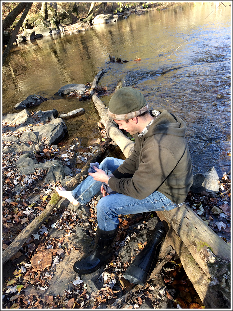
Steve emptying his boots
After taking in the initial views of the bluffs, we were naturally drawn to see the pinnacles themselves up close. A quick lung-burning climb and we were there.
Ozark Monolith – Little St. Francis River Pinnacles – Madison County, MO
Although not the tallest of these spires, this monolith was the more picturesque. I have other photography plans in mind for this guy if I can ever visit again. See below to see Steve in the frame for scale.
Monolithic – Little St. Francis River Pinnacles – Madison County, MO
The views from atop the bluff were quite nice. The primary hill that faces south was Tin Mill Mountain and Pine Mountain lies to the north. Here is an example of the rhyolite porphyry that composes the majority of this bluff.
Rhyolite Porphyry Bluff – Little St. Francis River Pinnacles – Madison County, MO
This place reminded us a lot of Lee’s Bluff, which was not surprising due to how close these locations are to one another. However, the pinnacles here brought a bit more visual interest. Here Steve poses with a small, but likely ancient cedar, clutched within a crack that is probably older than the human species.
Little St. Francis River Pinnacles – Madison County, MO
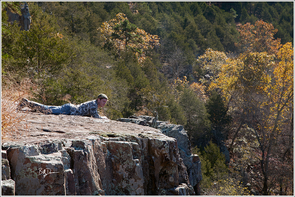
To conclude, here I captured Steve doing a belly crawl to the edge of the bluff. As I say so often, I long for another visit here. It seems the LSF has several other features to share. I hope we can one day float the entire ~15 miles with a couple or more feet of water. There are apparently a couple of stretches of shut-ins that shouldn’t be missed.
Little St. Francis River Pinnacles – Madison County, MO
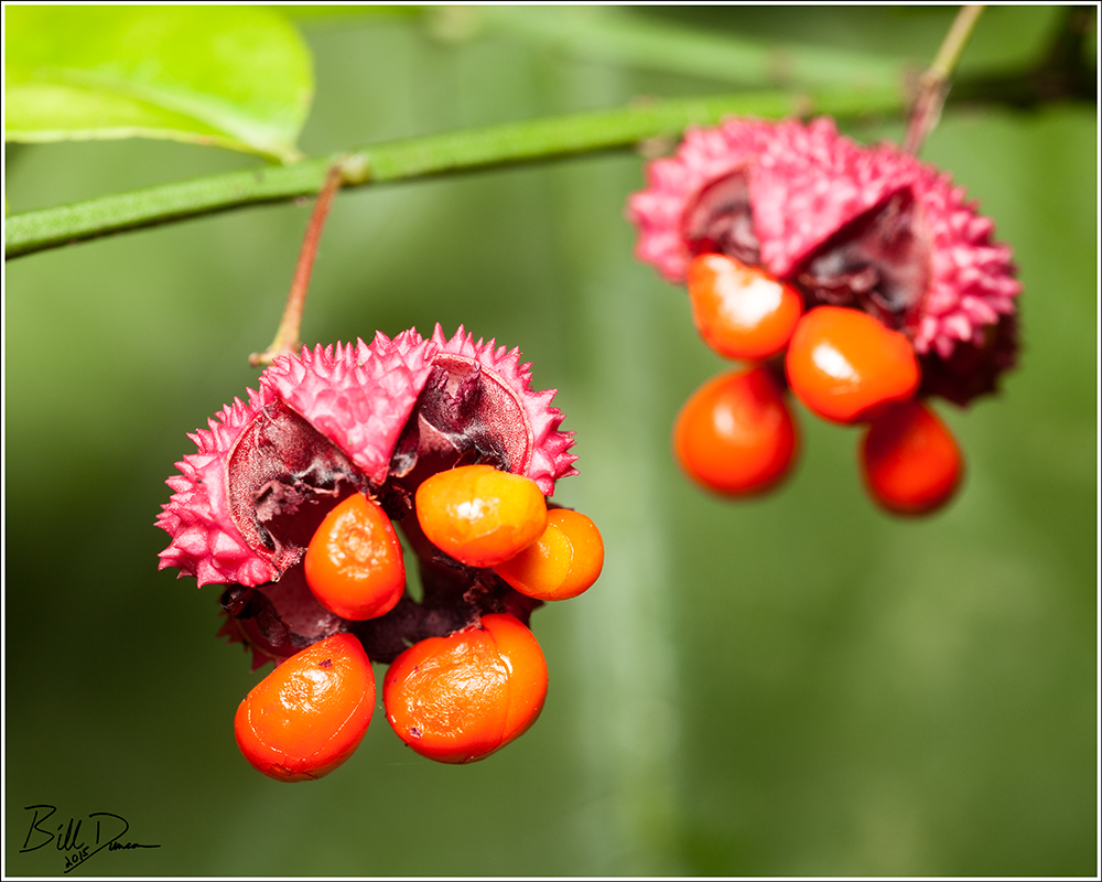
The Strawberry Bush is a rather new one for me. Steve and I found these plants, with freshly opened fruit capsules along the St. Francis River within Millstream Gardens CA this autumn. Rare due to loss of preferred habitat, this plant prefers moist, sandy soils along stream banks. Along with the St. Francois Mountain region, this plant also grows in extreme south-eastern Missouri.