"What a thousand acres of Silphiums looked like when they tickled the bellies of the buffalo is a question never again to be answered, and perhaps not even asked." -Aldo Leopold
Between driving and focusing on birds, I didn’t do a lot of landscape work during our trip out west in April. The few landscapes I did manage were all infrared. Here are some that I felt were worthy of sharing.
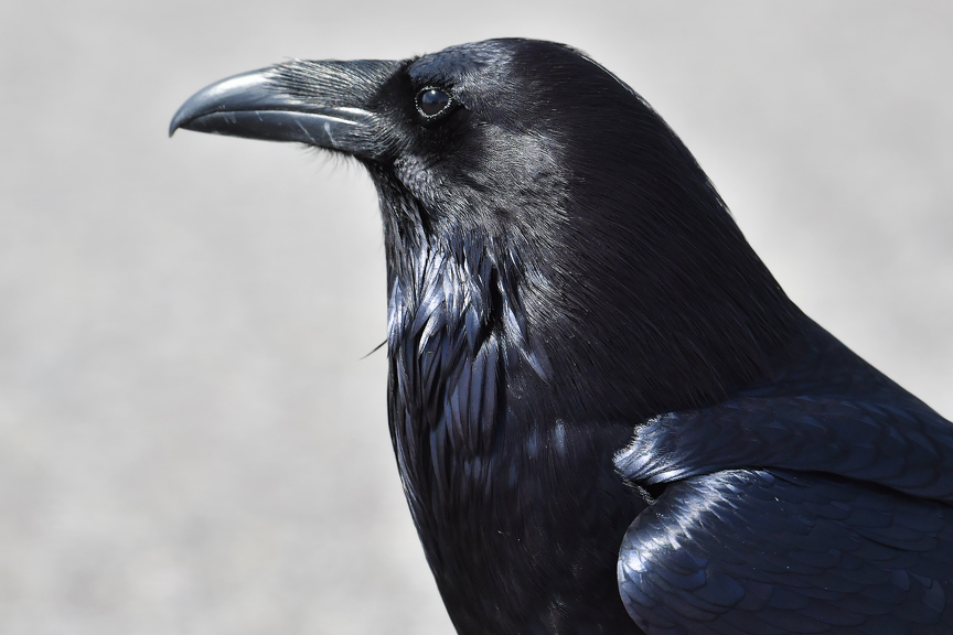
First up are a couple of false color IR images featuring one of the sidling Common Ravens at Grand Tetons.
Next up are a couple of panos during our drive through basin and range country.
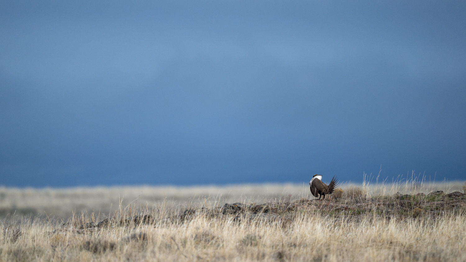
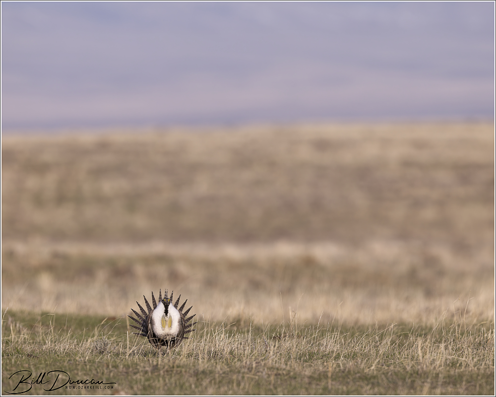
In mid-April 2025, David Seidensticker, Casey Galvin, Dan Kirk and I took a week-long trip to find and photograph the Greater Sage Grouse (GSGR). This bird had been on our lists to photograph for quite a few years and it took a number of years and quite a bit of research and help to find the opportunity we were looking for. Like most of the North American Grouse species, the GSGR is best photographed on their leks during the spring mating season. Finding public leks and watching these birds from considerable distances is relatively easy. However, we knew that most likely we would have to share these types of leks with potentially many others and would probably not be close enough to the birds to do the type of photography we were hoping for.
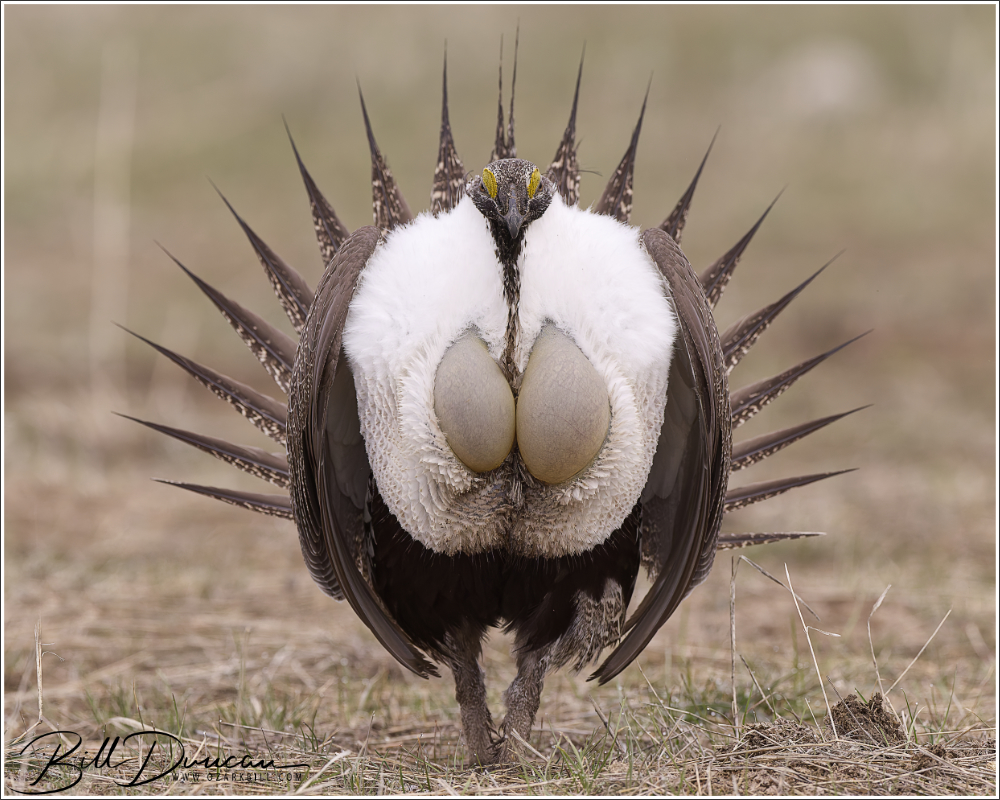
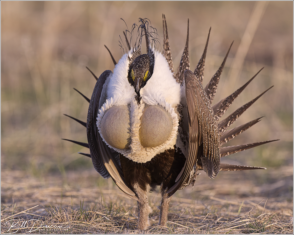
Greater Sage-Grouse mid display
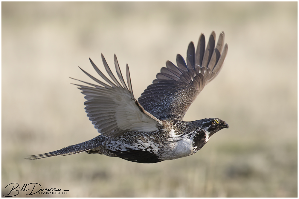
Enter a friend named Steve Jones. Steve has been monitoring and photographing GSGR leks in southern Idaho and volunteered to show us to a nice lek if we were willing to make the trip. We did and were rewarded with three beautiful mornings on a lek with up to 200 birds each day! Words can’t express the appreciation I have for Steve and we all offer our thanks for his help in this endeavor.
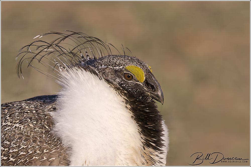
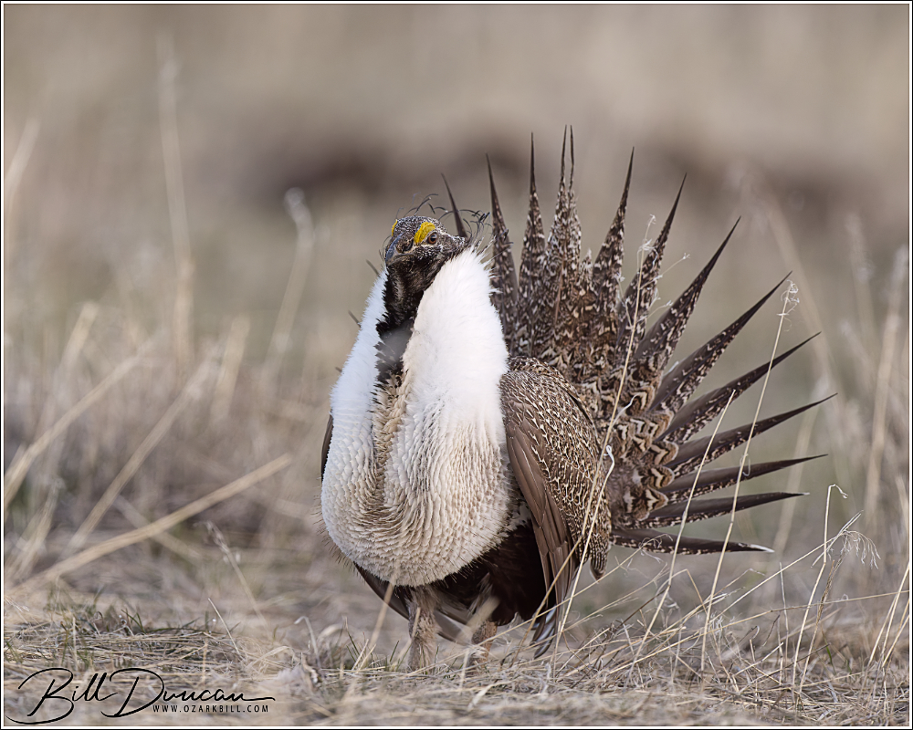
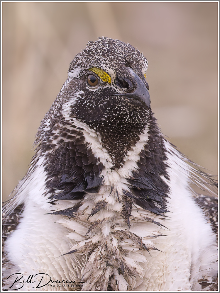
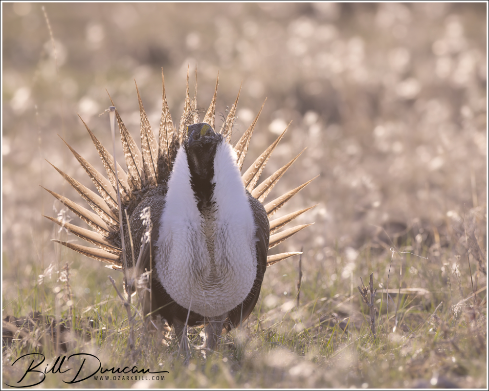
Portrait of a handsome male Greater Sage-Grouse
Spring weather at these western high elevation locations can be quite variable. We were quite fortunate on this trip that temperatures were moderate and we had almost no precipitation to speak of. During some springs snowpacks keep mountain roads closed until well into May or June.
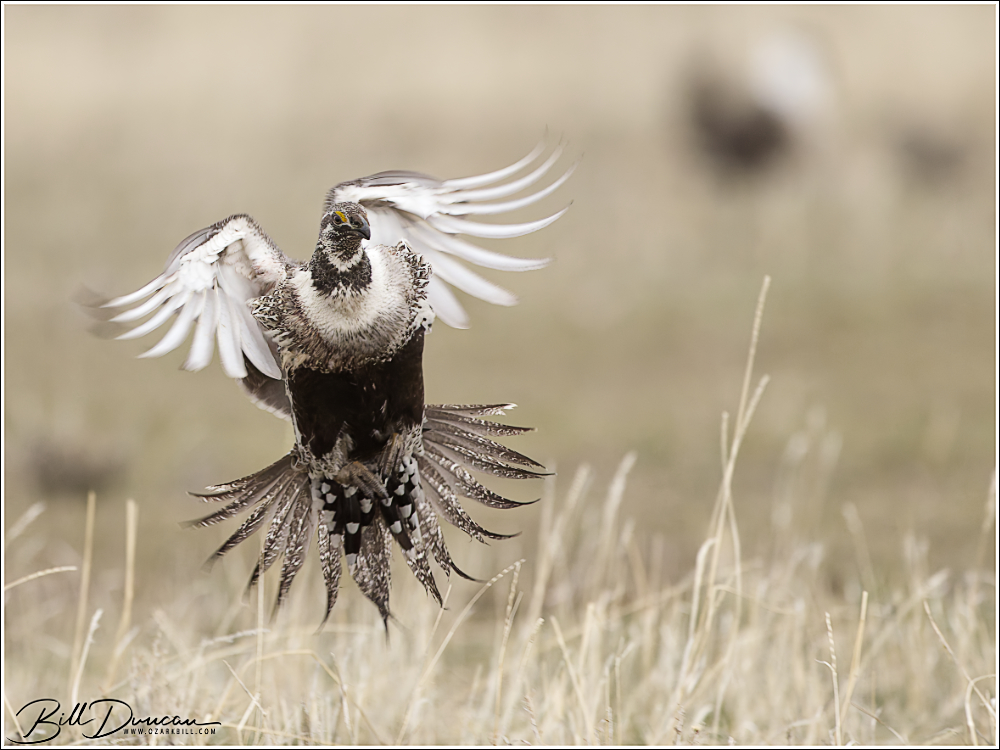
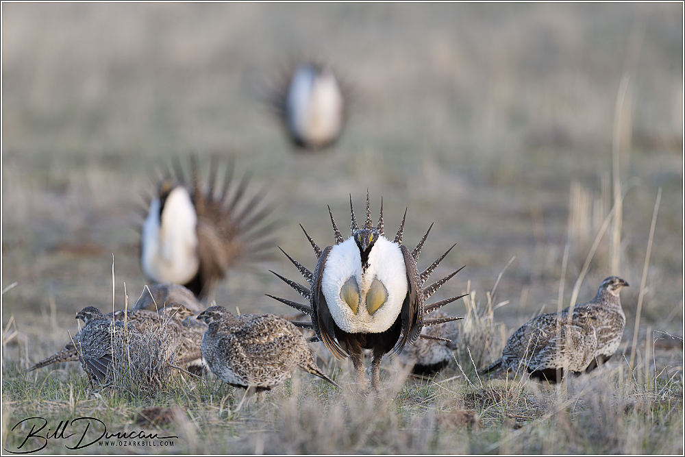
Male Greater Sage-Grouse moving about the lek
The mornings at the lek were unforgettable. But that was not the only highlight of the trip. The birds would typically disperse from the lek between 8:00 and 9:00 each morning, leaving the rest of the day for us to explore other opportunities, typically in search of other western bird species. The problem here is the vast expanse of the west. Points of interest in this area were drives typically 100 – 300 miles from our base and by the end of the trip, Dave had put approximately 3,500 miles on his brand-new Subaru. I’ll share photos and stories of these side trips later. First, let’s discuss this fantastic grouse and view some more photography.
The moment of the pop!
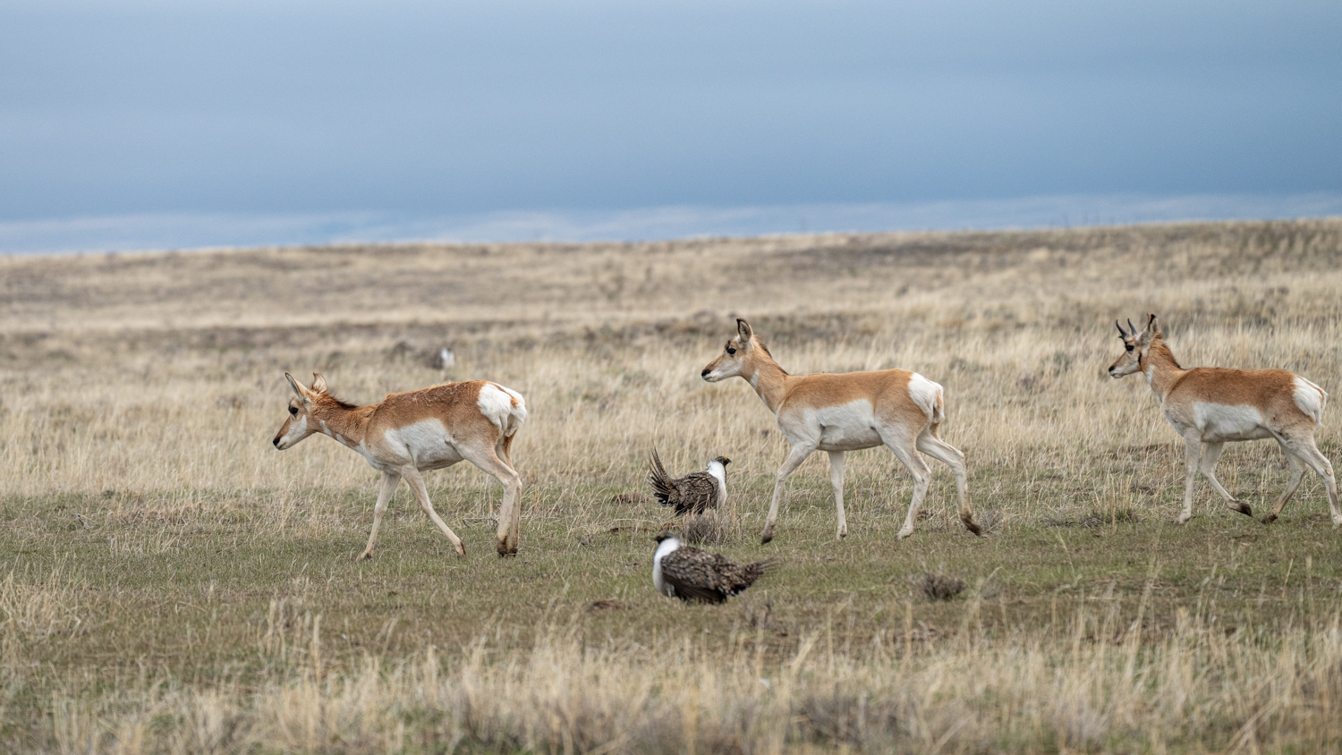
We were in for some nice surprises while waiting on the lek each morning. A few times a small number of pronghorn antelope would show up, even moving through the middle of the lek!
Antelope moving through Greater Sage-Grouse lek Photo by David Seidensticker
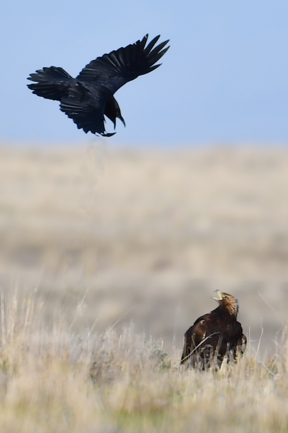
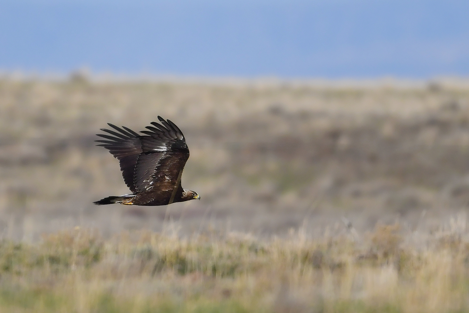
Golden Eagles, Long-billed Curlews and Rough-legged Hawks were also seen while we were sitting on the lek.
Photos of Golden Eagle by Casey Galvin
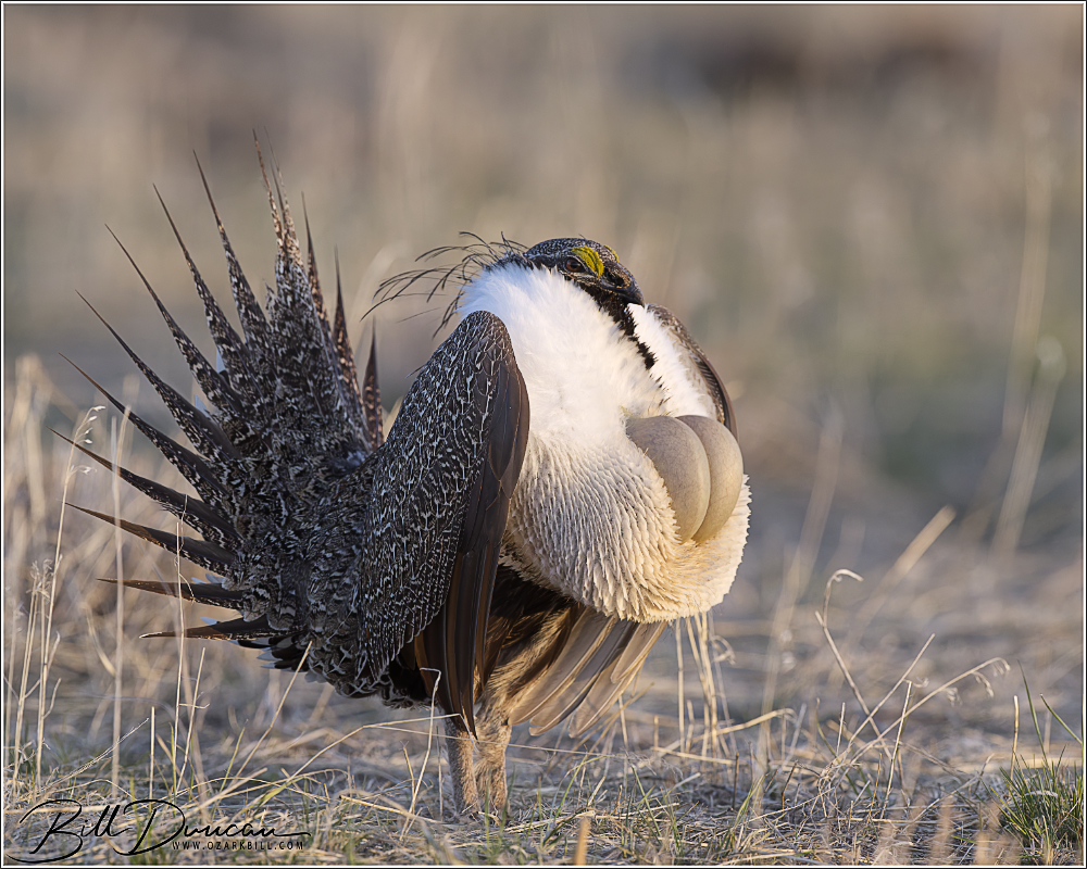
Strutting Greater Sage-Grouse
For lack of a better place to put this, I want to share some video I took at the lek. If you don’t care to read further, please do have a click on the video to hear what the lek sounded like and watch some of the courtship and mating behaviors of these birds. I highly recommend you watch this in full 4K resolution in YouTube!
The Natural History and Biology of the Greater Sage-Grouse
The Greater Sage-Grouse (Centrocercus urophasianus) is the largest grouse species in North America and an iconic inhabitant of the sagebrush steppe ecosystems of the western United States and parts of Canada. Renowned for its unique mating rituals and dependence on sagebrush habitat, the GSGR has become a focal point for conservation efforts due to habitat loss and declining populations.
Dirty male Greater Sage-Grouse
Habitat and Range
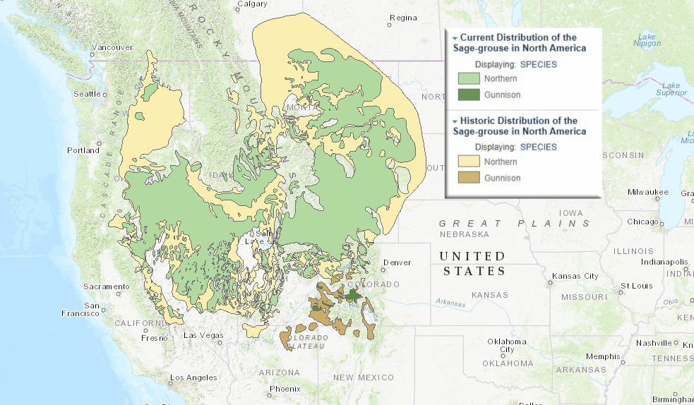
The GSGR is inextricably linked to the sagebrush biome. This bird relies on large, contiguous tracts of sagebrush for all stages of its life cycle. Sagebrush provides critical cover and a primary food source, especially in winter when the birds feed almost exclusively on sagebrush leaves. The range of the GSGR once extended across 13 U.S. states and three Canadian provinces, but it has since diminished significantly due to agricultural expansion, energy development, and other human activities that fragment their habitat.
Map showing current versus historical range of the GSGR.
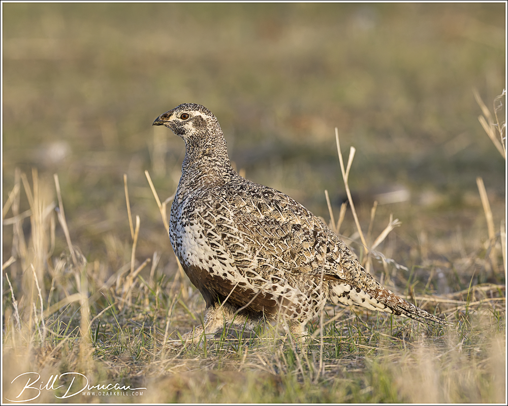
Female Greater-Sage Grouse
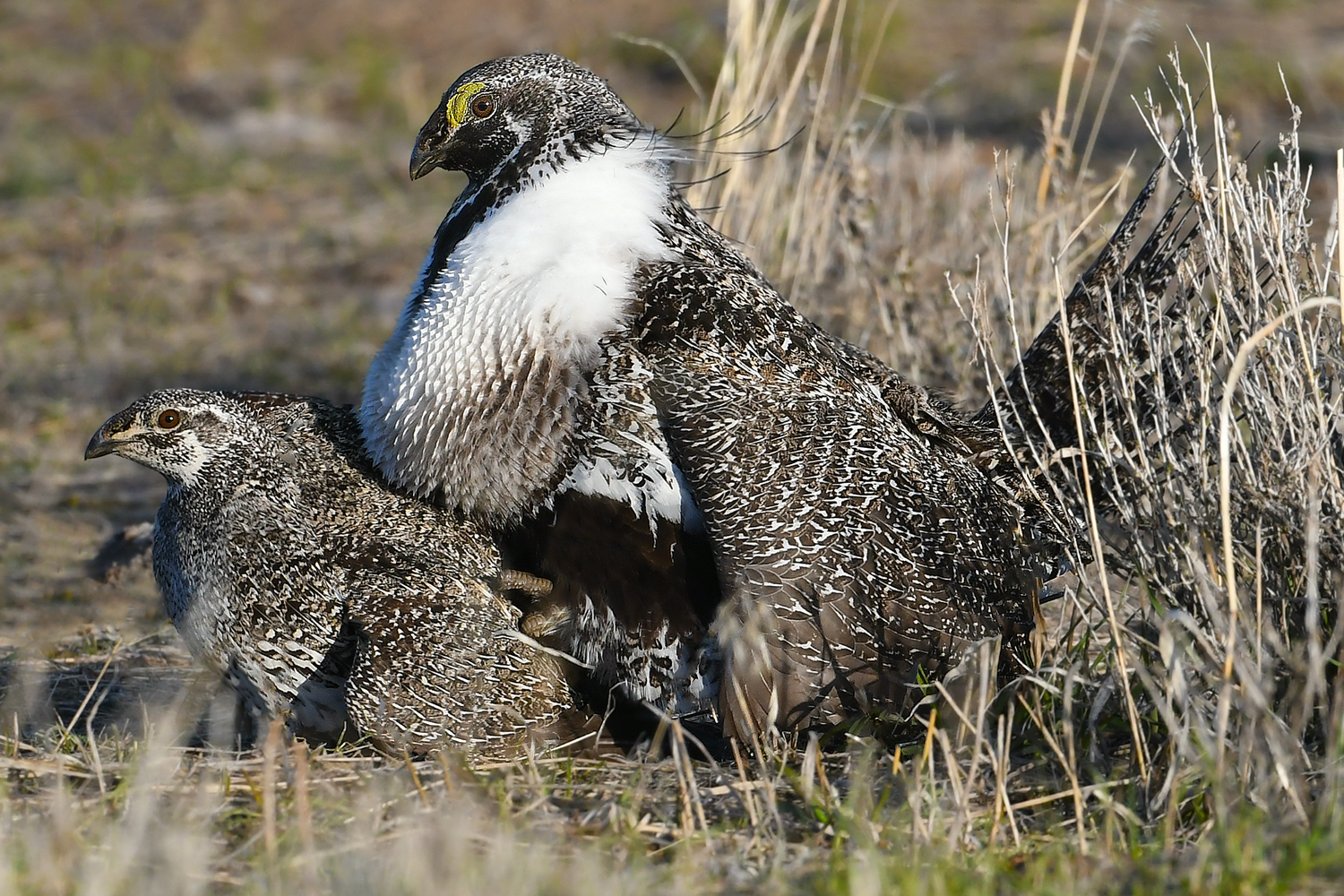
Biology and Diet Greater Sage-Grouse are ground-dwelling birds with a robust build and mottled brown, white, and black plumage that provides excellent camouflage in their arid environment. Males are significantly larger than females and are distinguished by their elaborate courtship plumage, including a white ruff around the neck and yellow air sacs on the chest.
Their diet varies seasonally. During spring and summer, they consume a mix of forbs (herbaceous flowering plants) and insects, which are particularly important for chicks. In fall and winter, their diet shifts almost entirely to sagebrush, highlighting the plant’s importance to their survival.
Greater-Sage Grouse displaying male
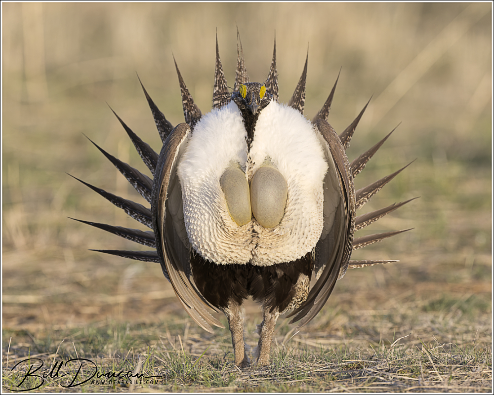
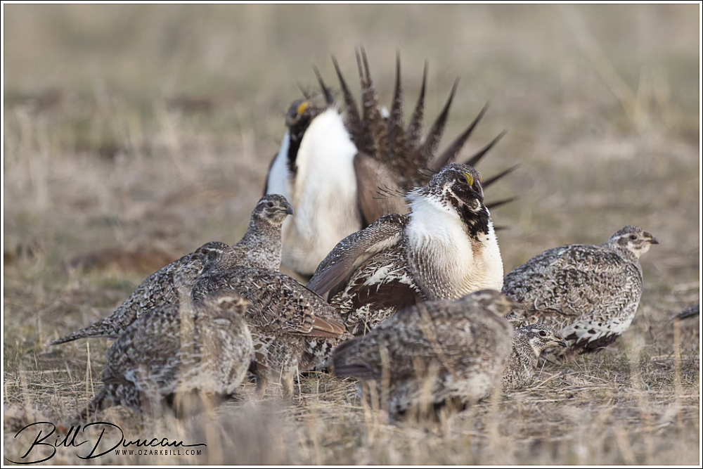
Mating Behavior and Leks One of the most remarkable aspects of the GSGR’s biology is its mating behavior, which takes place on “leks.” A lek is an open area where males gather each spring to perform elaborate courtship displays aimed at attracting females. These displays are both visual and auditory. Males puff up their chests, fan their tail feathers like a turkey, and inflate and deflate their air sacs, producing a distinctive series of popping and warbling sounds. As can be heard in the accompanying video, there are also whistling sounds produced. These sounds are created during their display as the males thrust their inflated vocal sacs, which are covered in short and bristly feathers, against their wing feathers.
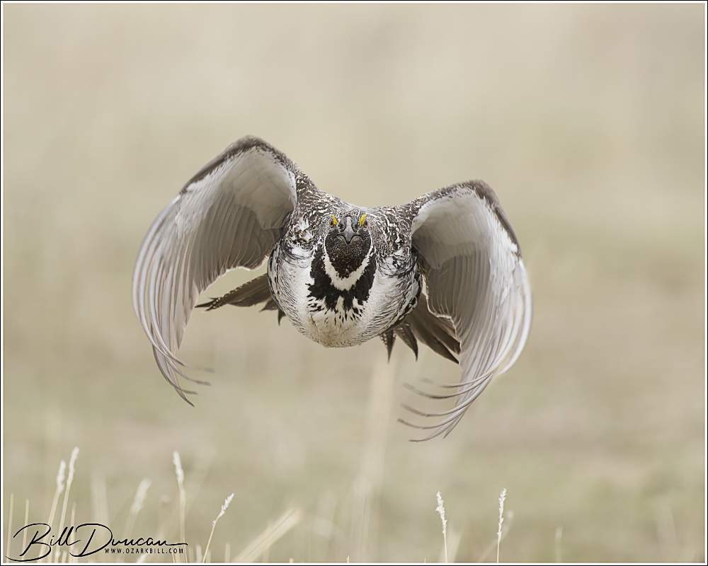
Male Greater Sage-Grouse with inflated vocal sacs
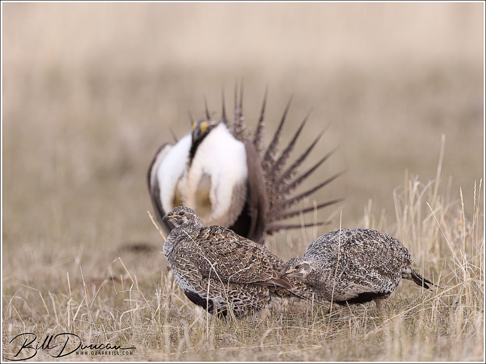
Mating success on the lek is highly skewed, with a few dominant males securing the majority of matings. Females visit the lek, observe the displays, and select mates based on display vigor, plumage quality, and lek-territory location. After mating, females leave the lek to nest and raise their young independently, typically within several kilometers of the lek site.
Females are always attracted to the coolest guys
Reproductive Biology After mating, female GSGR take full responsibility for reproduction. They build nests as shallow depressions in the ground, usually beneath the protective cover of sagebrush or tall grasses. A typical clutch consists of 6 to 10 eggs, which the female incubates for approximately 25 to 29 days. During this time, she remains well-camouflaged and vigilant to avoid predation.
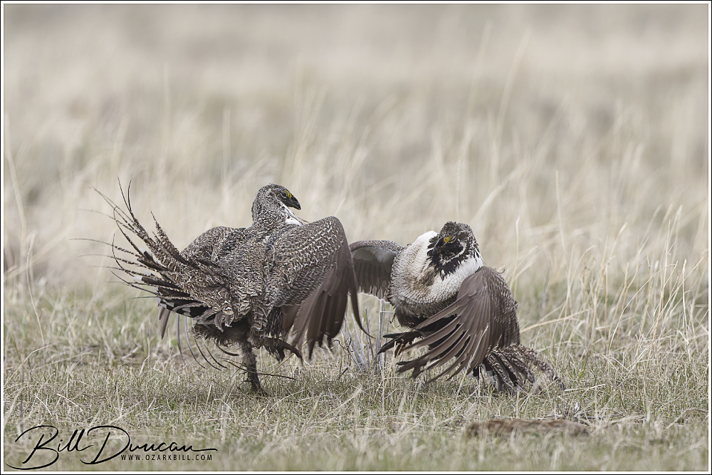
Male Greater Sage-Grouse do not seem to fight as often or as vigorously as other grassland Galliformes. When they do, it often is the equivalent of a slap fight.
Once hatched, chicks are precocial, meaning they can walk and feed themselves shortly after birth. However, they still depend heavily on the mother for warmth and protection during the early weeks. The diet of young chicks includes a variety of insects and forbs, which are high in protein and essential for growth. Brood-rearing habitats with a diverse and abundant understory are crucial for chick survival.
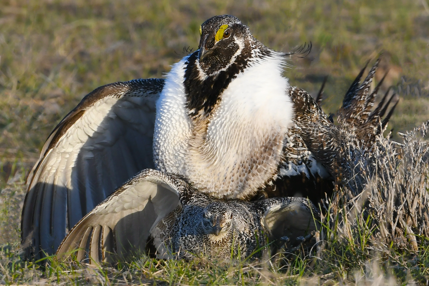
Mating Greater-Sage Grouse Photo by Casey Galvin
As with all of our ground-based Galliformes, survival rates for chicks are low, with the highest mortality occurring within the first few weeks due to predation, weather, and limited food resources. Females may re-nest if the first nest is lost early in the season, but reproductive success is highly influenced by environmental conditions and habitat quality.
Mating Greater-Sage Grouse Photo by Casey Galvin
Greater Sage-Grouse reach sexual maturity at about one year of age, though young males are usually less successful in mating compared to older, more dominant individuals. Females may live up to ten years and usually return to the same nesting areas each season if habitat conditions remain favorable.
Backlit strutting Greater Sage-Grouse
Conservation Status and Efforts Populations of the GSGR have been declining for decades, primarily due to habitat degradation. Fragmentation caused by roads, urbanization, agriculture, and energy infrastructure has greatly reduced suitable habitat. Invasive plant species, altered fire regimes, and climate change further exacerbate these issues.
Greater Sage-Grouse
Habitat loss and fragmentation seems to be the universal story for all of our grassland Galliformes. In recent years, Missouri has effectively lost the last remaining populations of Greater Prairie Chickens.
Greater Sage-Grouse on lek
The conservation status of the GSGR has been a matter of significant debate and legal review. As of 2025, the species is not listed under the Endangered Species Act, though it remains a candidate for federal protection and is designated as a species of conservation concern by many state and federal agencies. Several petitions have been filed to list the species, but formal listing decisions have been deferred in favor of state-led and collaborative conservation plans.
Far beyond the satellite males, this guy was at the outer reaches of the lek, “Dancing With Myself” Photo by David Seidensticker
Conservation efforts have focused on a range of strategies:
Habitat Conservation Plans: Many states and federal agencies have implemented habitat conservation and restoration plans that include limiting development in key sage-grouse areas.
The Sage Grouse Initiative: Launched by the USDA’s Natural Resources Conservation Service, this initiative partners with ranchers and private landowners to conserve sagebrush habitat while maintaining productive rangelands.
Protective Land Use Policies: Efforts have been made to limit energy development, road construction, and grazing in core sage-grouse habitats, especially during breeding and nesting seasons.
Research and Monitoring: Long-term monitoring of sage-grouse populations and habitat trends supports adaptive management and informs policy decisions.
Invasive Species and Fire Management: Programs to control invasive plants like cheatgrass and to manage fire regimes help maintain sagebrush integrity.
Male Greater Sage-Grouse
The GSGR is a keystone species of the sagebrush ecosystem and a symbol of the ecological richness of the American West. Its fascinating biology and dramatic mating rituals underscore the importance of conserving the natural habitats on which it depends. Efforts to protect and restore sagebrush landscapes are vital not only for the survival of this iconic bird but also for the broader health of the ecosystem it inhabits.
Greater Sage-Grouse
Side Quests
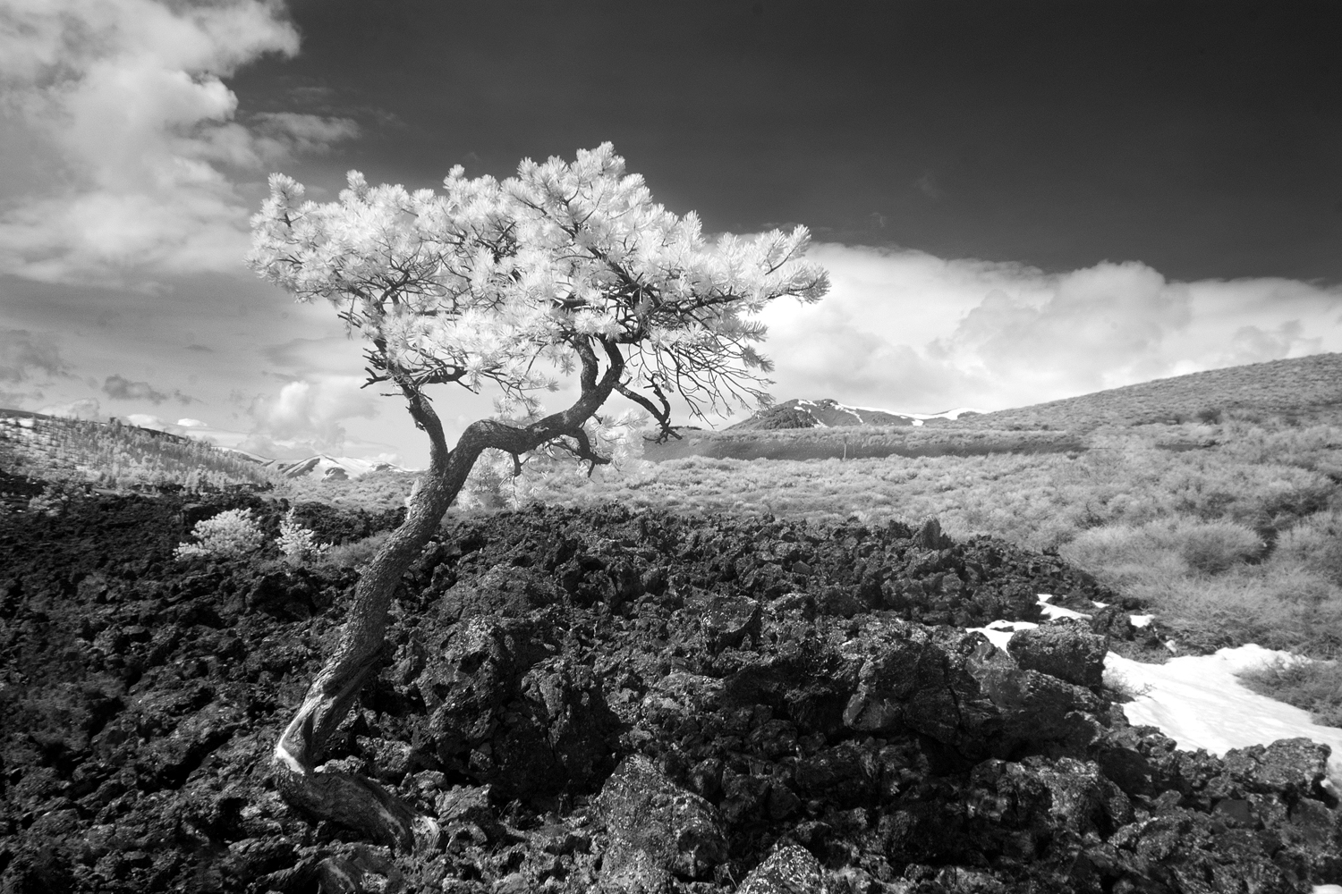
Infrared image taken at Craters of the Moon by Casey Galvin
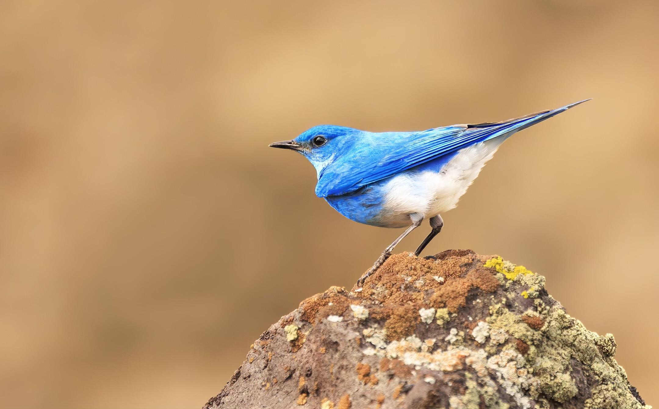
One of our post-lek side quests was to the Craters of the Moon National Monument and Preserve. Based on a tip from Steve, this would be a good location to look for Mountain Bluebird as well as some interesting geologic features and potential landscape opportunities. We did have very brief looks at Mountain Bluebirds but the winds were horrendous on the day of our visit with 40-50 mph sustained speeds. This made birding and photography exhausting and damn near perilous.
Mountain Bluebird Photo by Dan Kirk
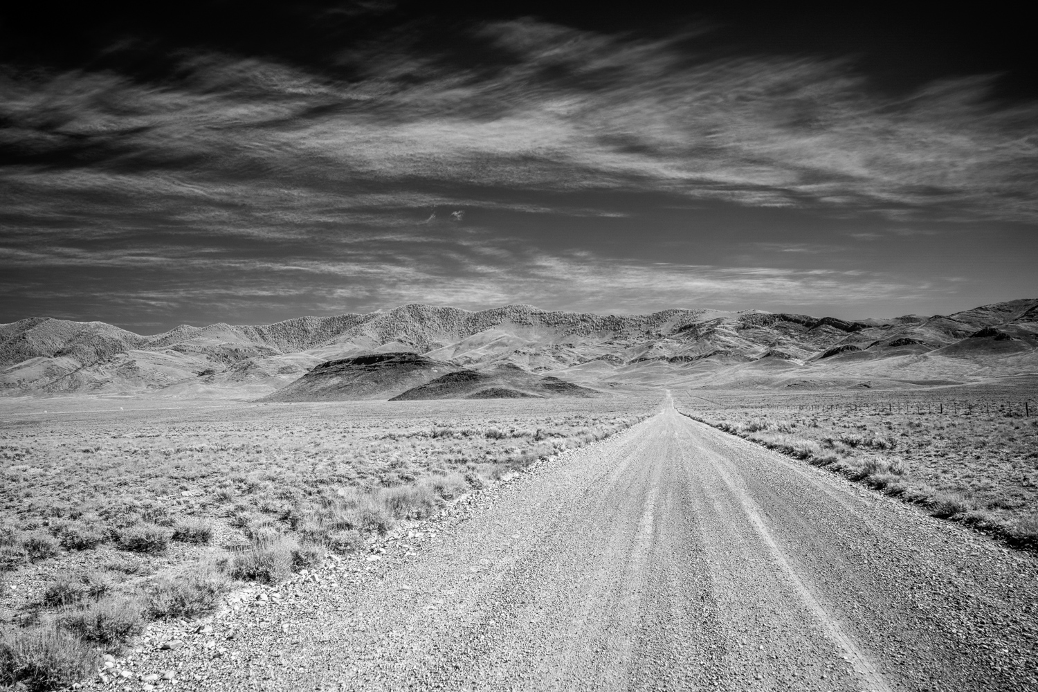
Infrared landscape of sagebrush and foothills Photo by David Seidensticker
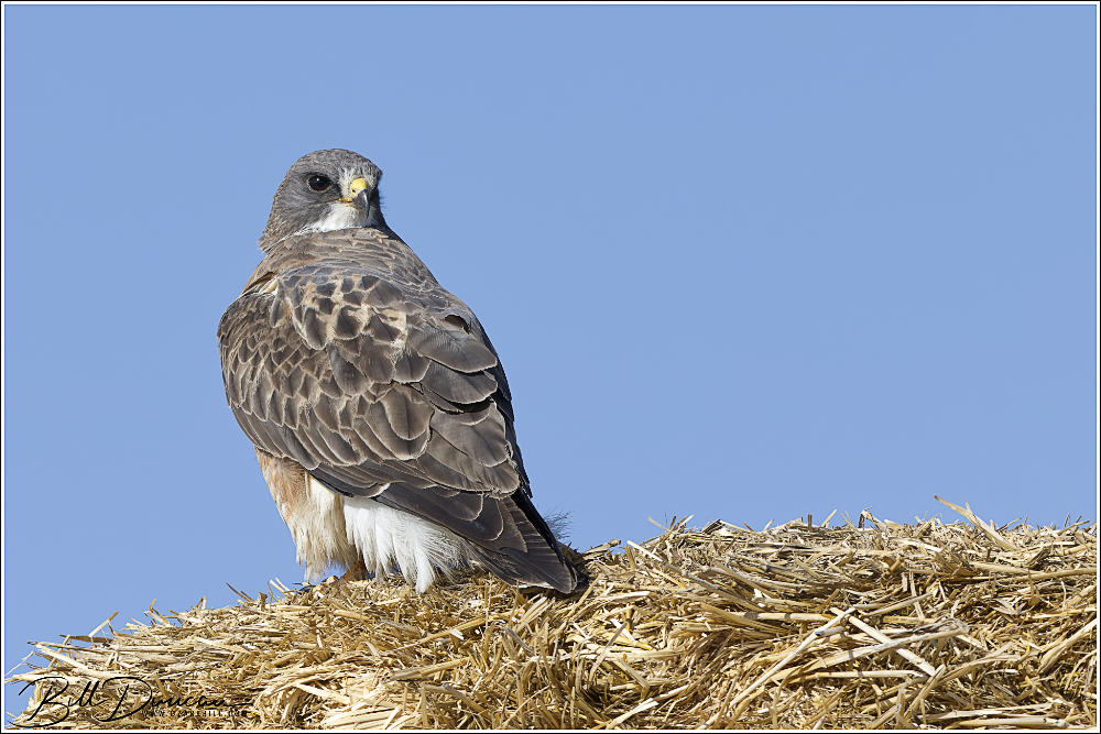
Swainson’s Hawks were commonly encountered during our travels west
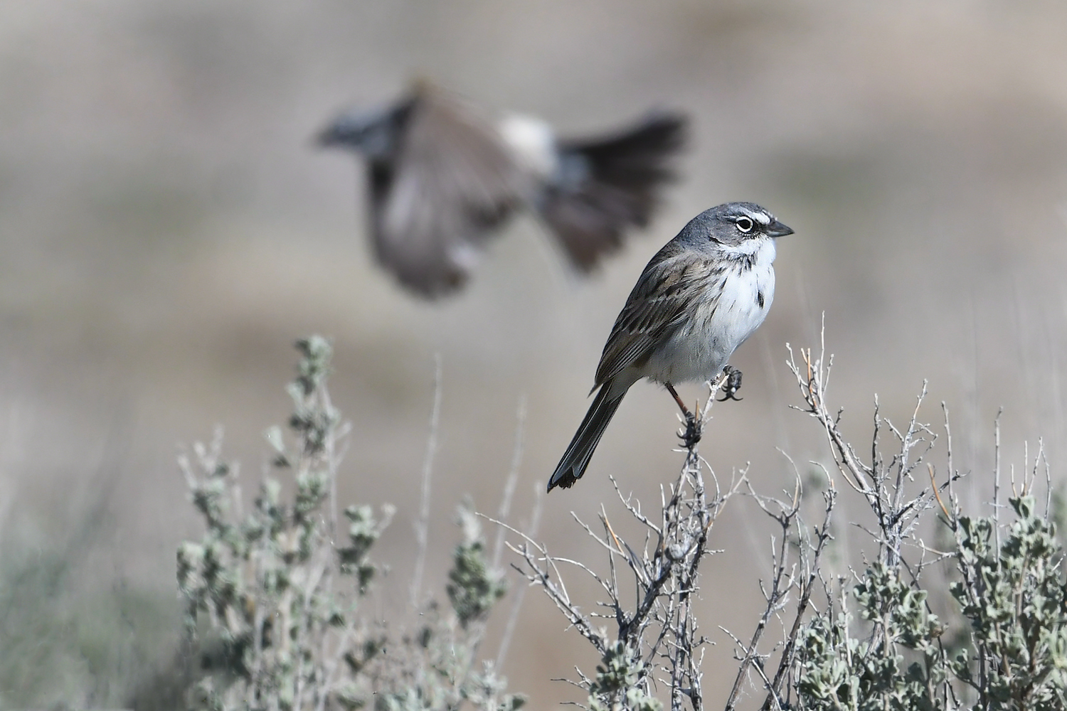
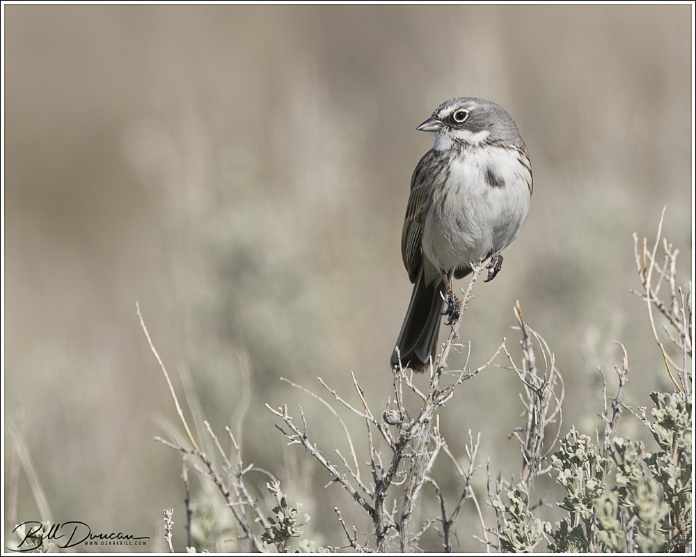
Based on another tip from Steve, we visited a foothills location to find the newly arrived Sagebrush Sparrow, a lifer species for all four of us. We had a great time with several cooperative males who were still setting up their individual territories.
Sagebrush Sparrow Photo by Dan Kirk
Sagebrush Sparrow Photo by Casey Galvin
Sagebrush Sparrow Photo by Bill Duncan
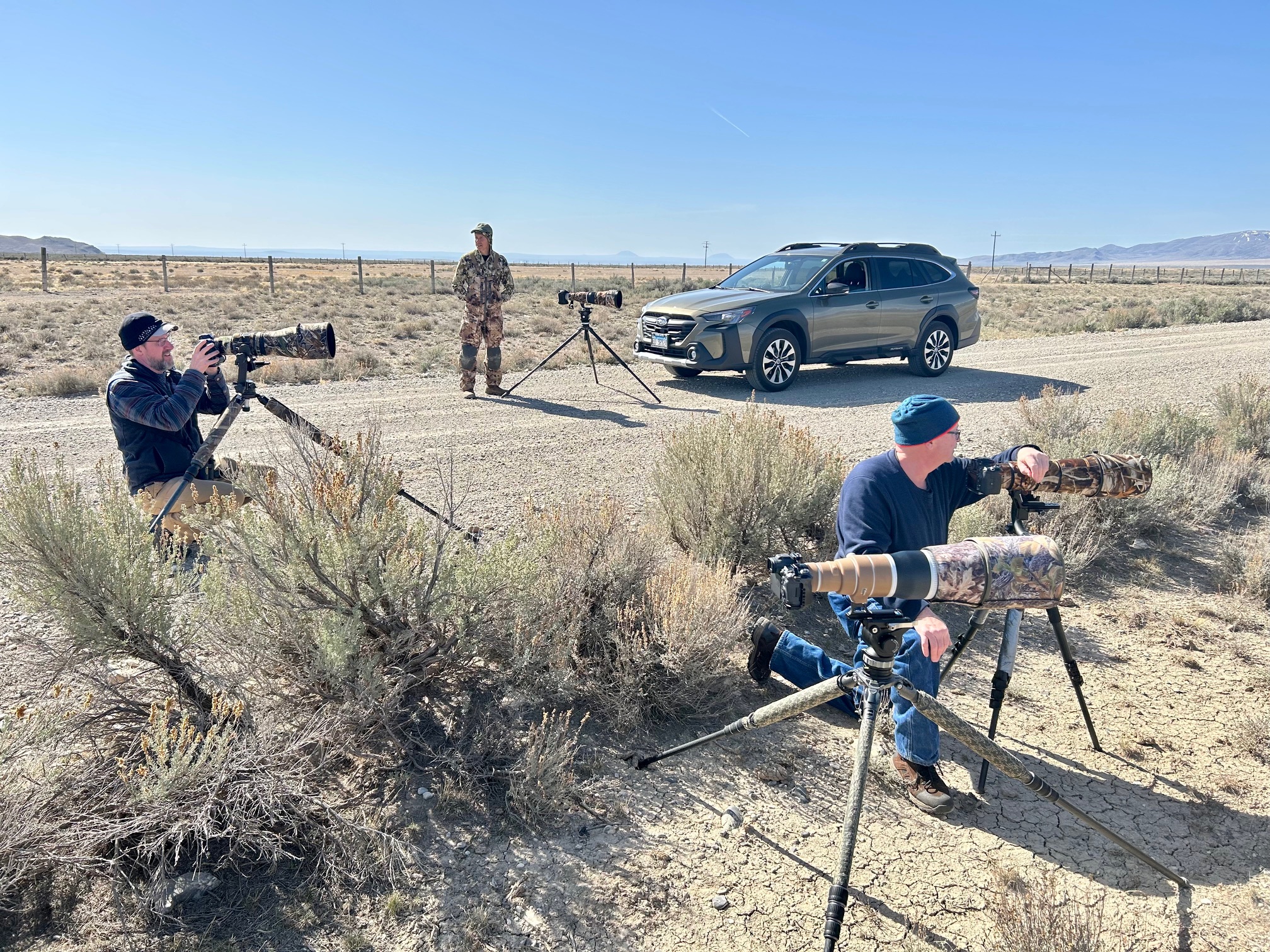
Three of our crew setting up to photograph Sagebrush Sparrow. Left to right, David Seidensticker, Dan Kirk, Casey Galvin. Photo by Bill Duncan
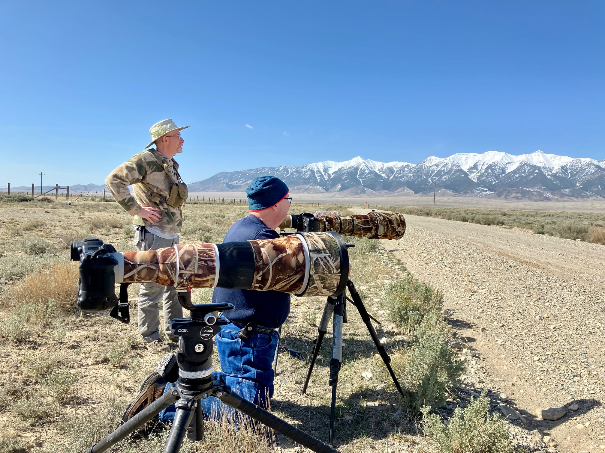
Bill Duncan and Casey Galvin waiting for Sagebrush Sparrow Photo by David Seidensticker
For another side quest, we ventured south for a quick visit to Grand Teton National Park. We had little luck with birds or wildlife, but David created this wonderful IR panorama of the mountain range.
Grand Teton infrared panorama Photo by David Seidensticker
Raven begging from parking lot at Grand Teton NP Photo by Casey Galvin
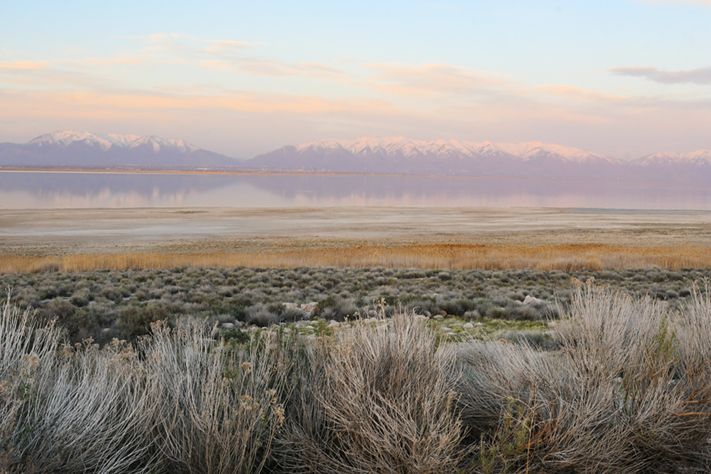
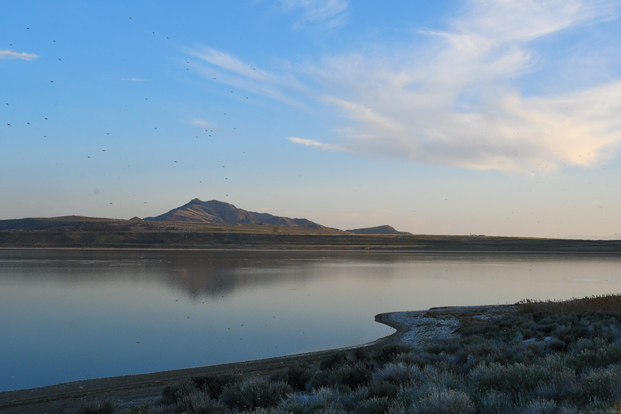
We had planned on staying a fourth day on the lek but none of us could imagine getting better or newer opportunities and the weather forecast was calling for clouds the next morning. Realizing we were relatively close (by western standards) and it wouldn’t really add much to our return trip back home, we decided to visit the Great Salt Lake and spent about six hours at Antelope Island State Park. This spot was unexpectantly beautiful and such an important area for western shorebirds and other water loving species. The waters were low and not conducive for great photography but it was thrilling to see thousands of American Avocets. We did have some nice opportunities for other birds and landscape photography as well.
Antelope Island State Park Photo by Casey Galvin
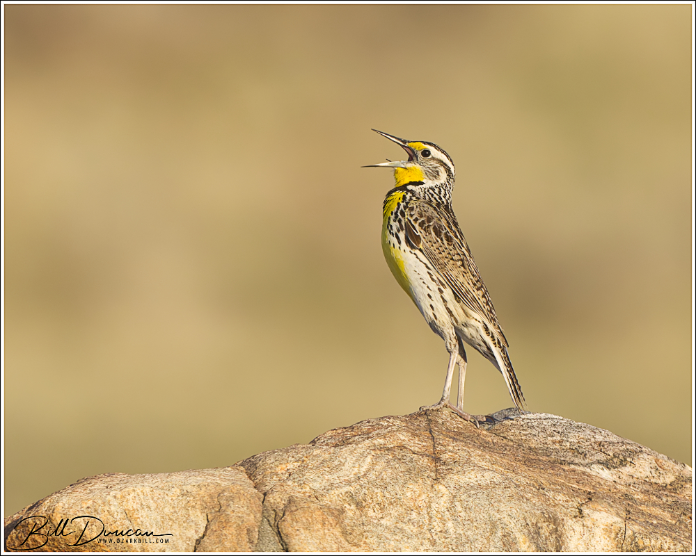
Western Meadowlark
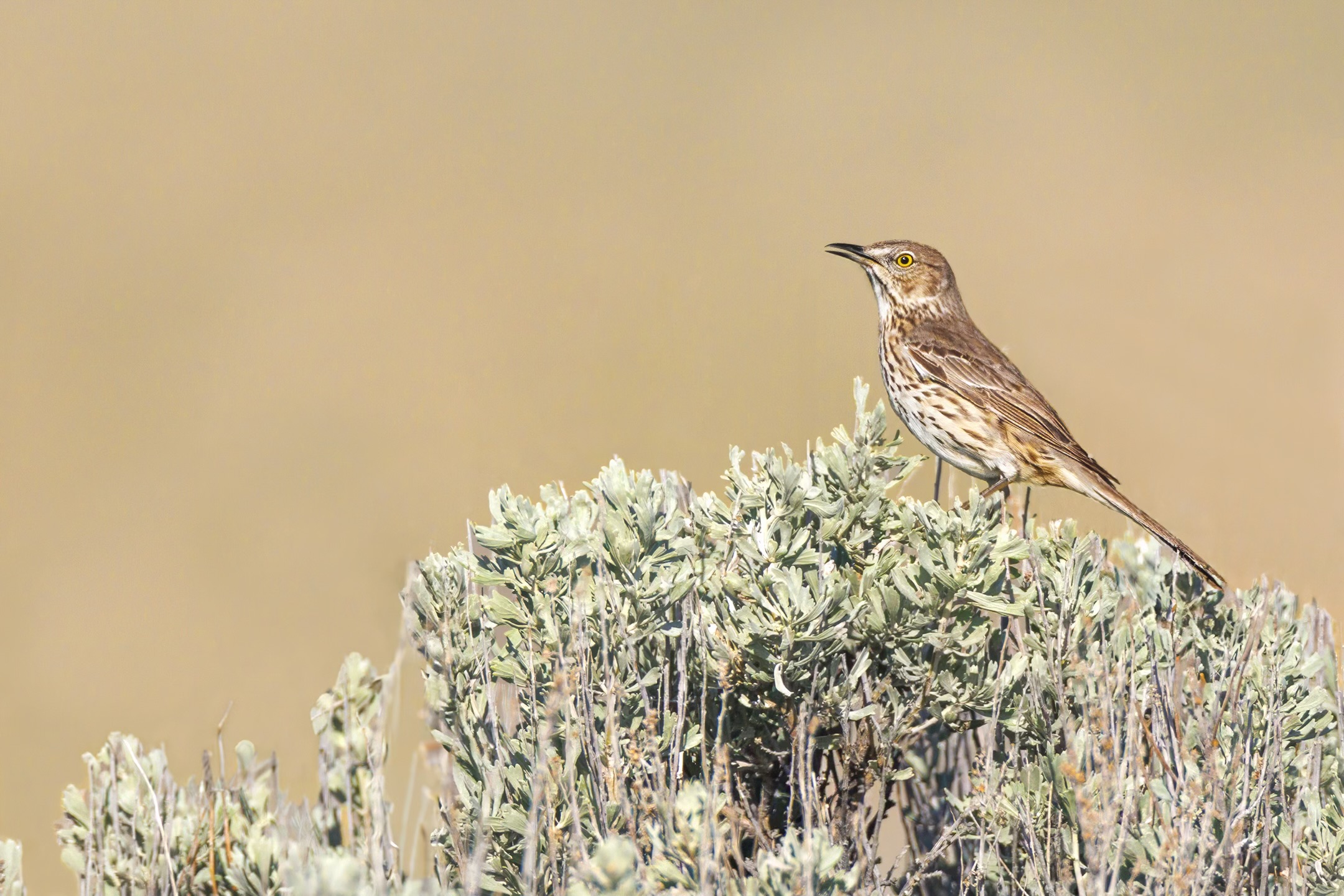
Sage Thrasher Photo by Dan Kirk
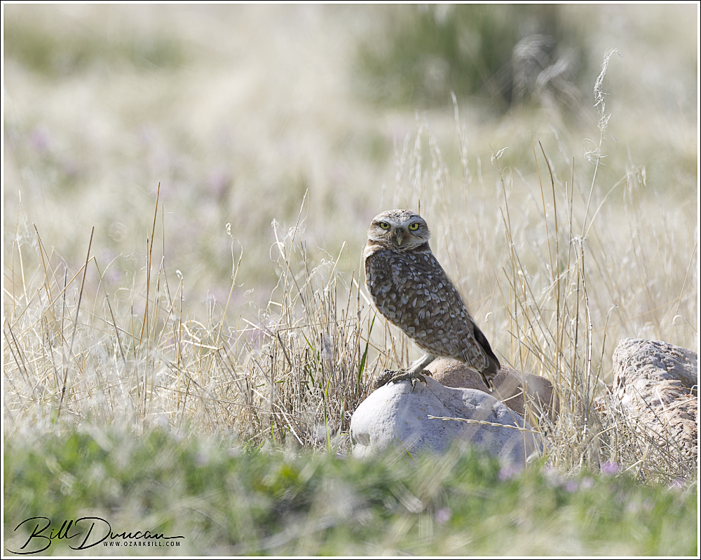
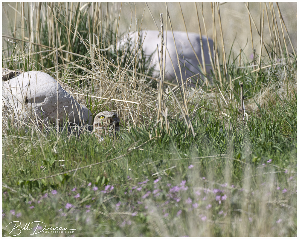
Burrowing Owl
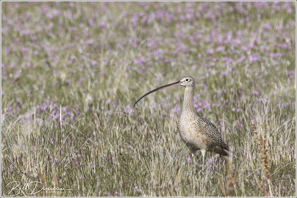
Long-billed Curlew Photo by Dan Kirk
Long-billed Curlew
Willet Photo by Dan Kirk
Antelope Island SP Photo by Casey Galvin
This wraps up our trip report for our time spent in the west. There are so many more photos by my friends and me that I could have easily included here, but I have to draw the line somewhere. This was a terrific trip that I won’t forget. Thanks again to Steve Jones and to David for handling so much of our trip logistics. And thank you, dear viewer. I appreciate any questions or comments you care to give below.
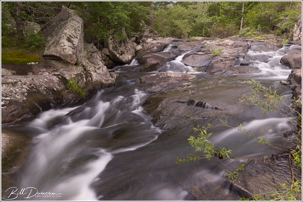
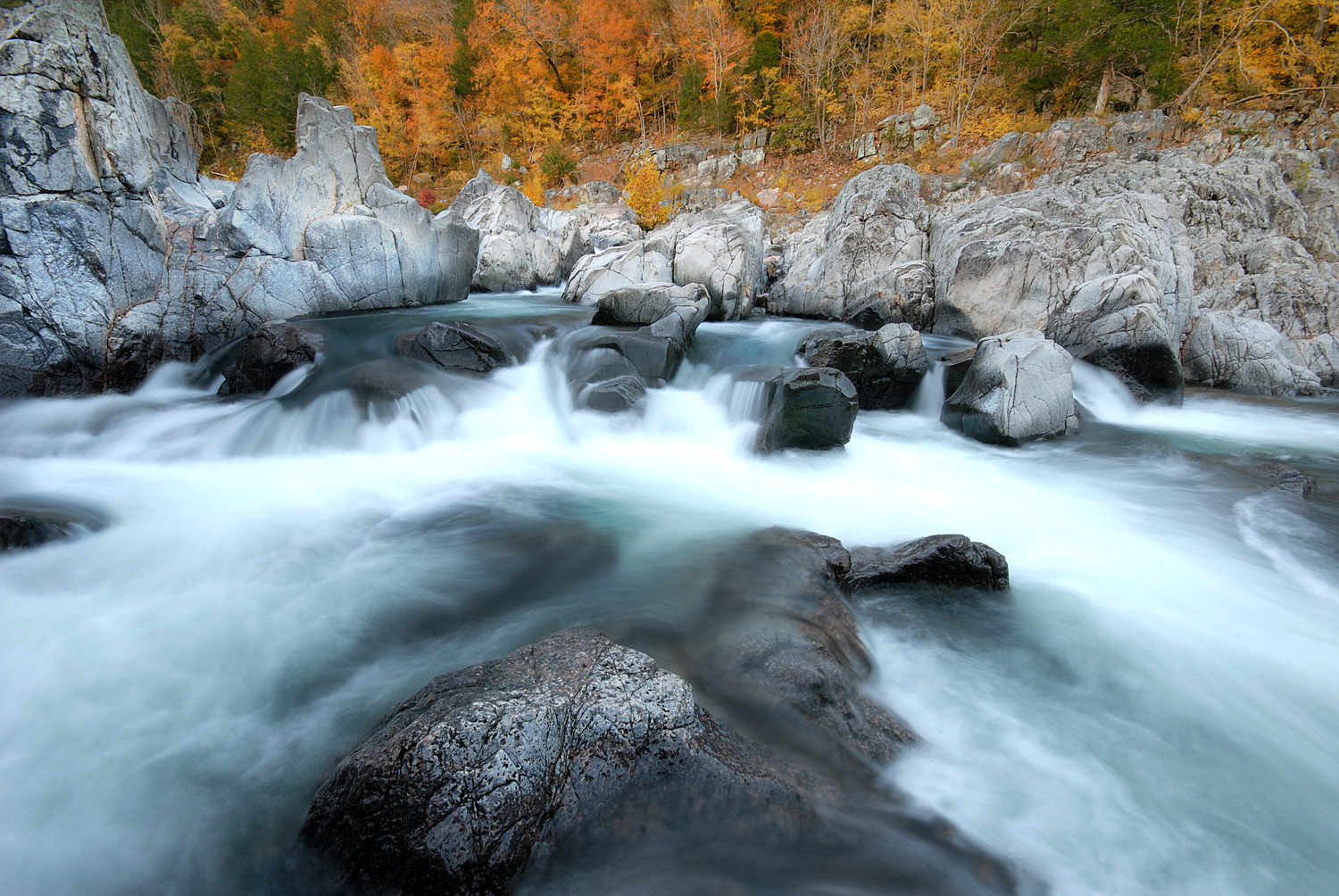
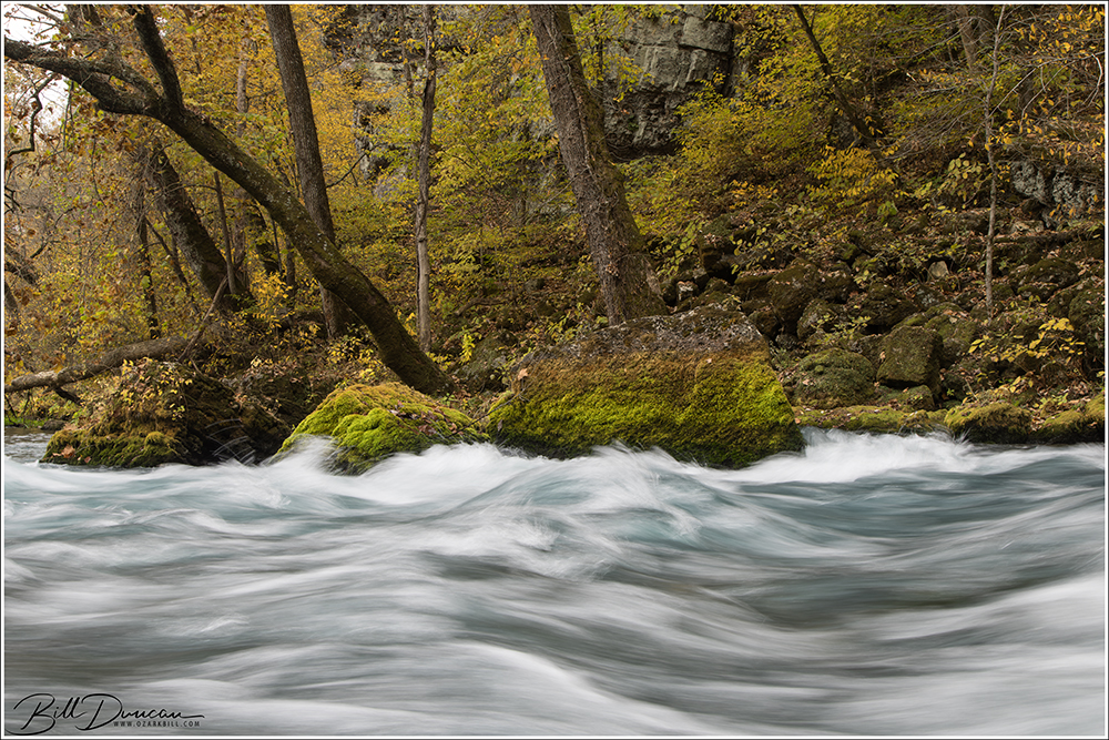
After record breaking rainfalls in southeastern Missouri, Casey and I headed down to visit some favorite waters in the St. Francois Mountains a couple days later. We expected a little more flow but this area drains so quickly, if you aren’t there immediately after the rains stop you won’t get to see the shut-ins and waterfalls at their peek. We were also unfortunate to have a mostly cloud-free day. Not the skies you want for shooting waters like these. But, we made the most of it – focusing our efforts near sunrise and sunset.
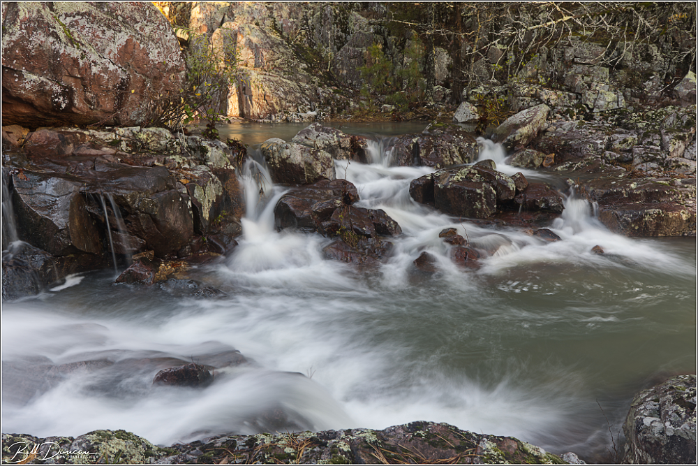
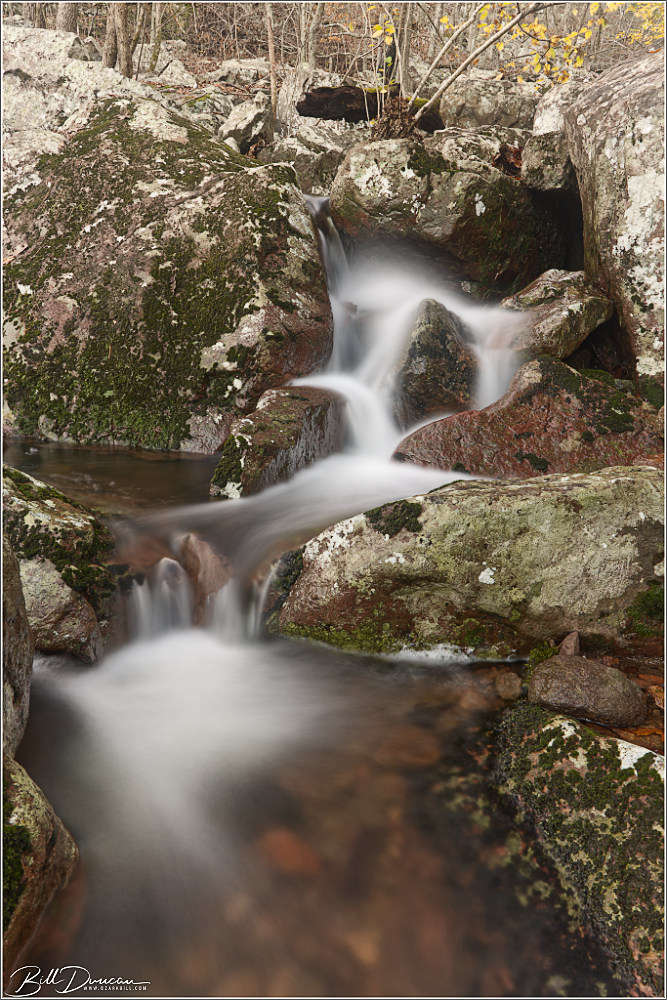
First up is a few from Leatherwood Creek Shut-ins.
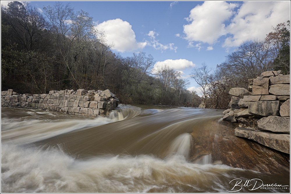
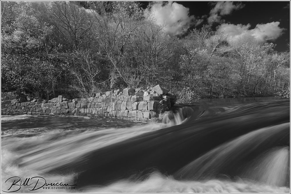
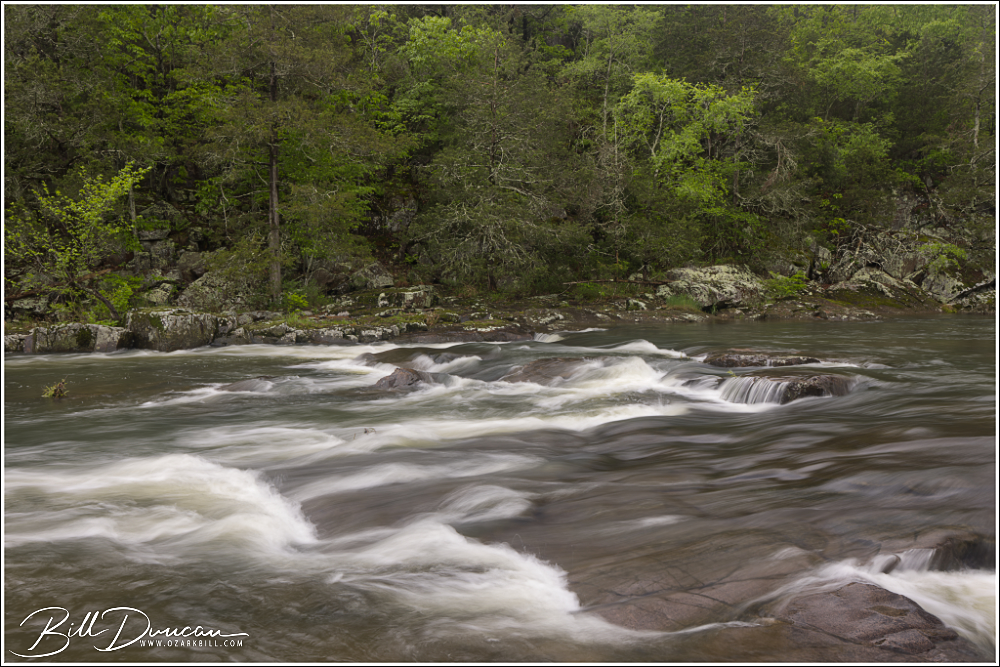
We then headed over to the St. Francois River to see how high the water was flowing at the Einstein Dam. This dam, built in 1879, was used to provide power to a mill and other facilities surrounding a nearby quartz mine. I have seen the water rolling higher over the dam, but we still had some impressive flow.
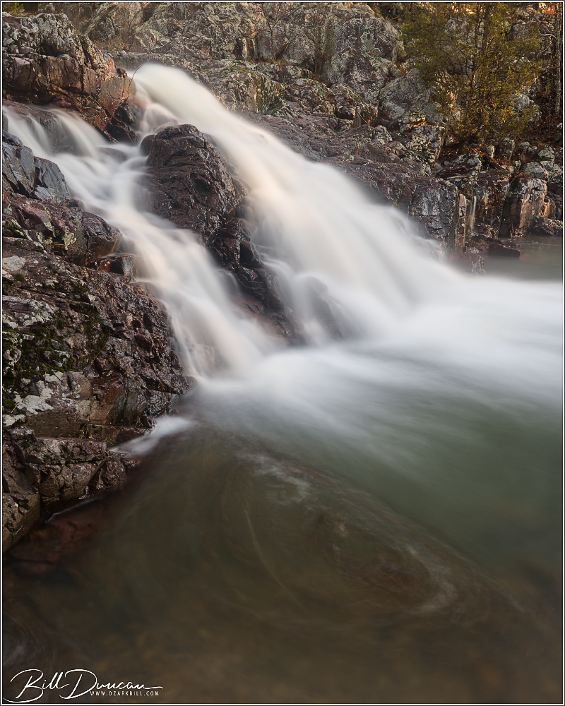
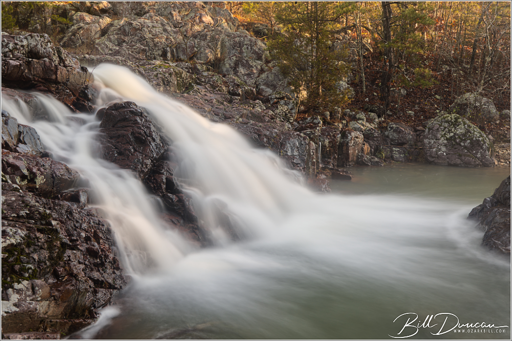
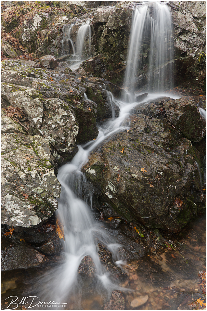
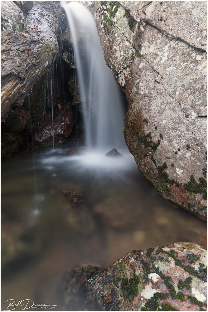
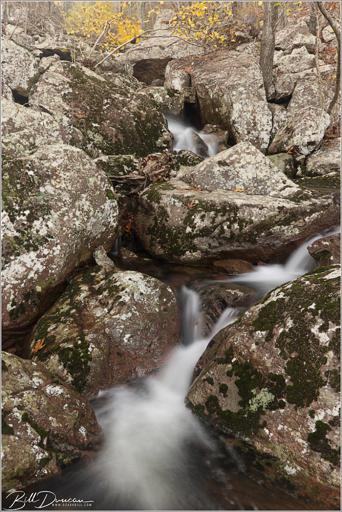
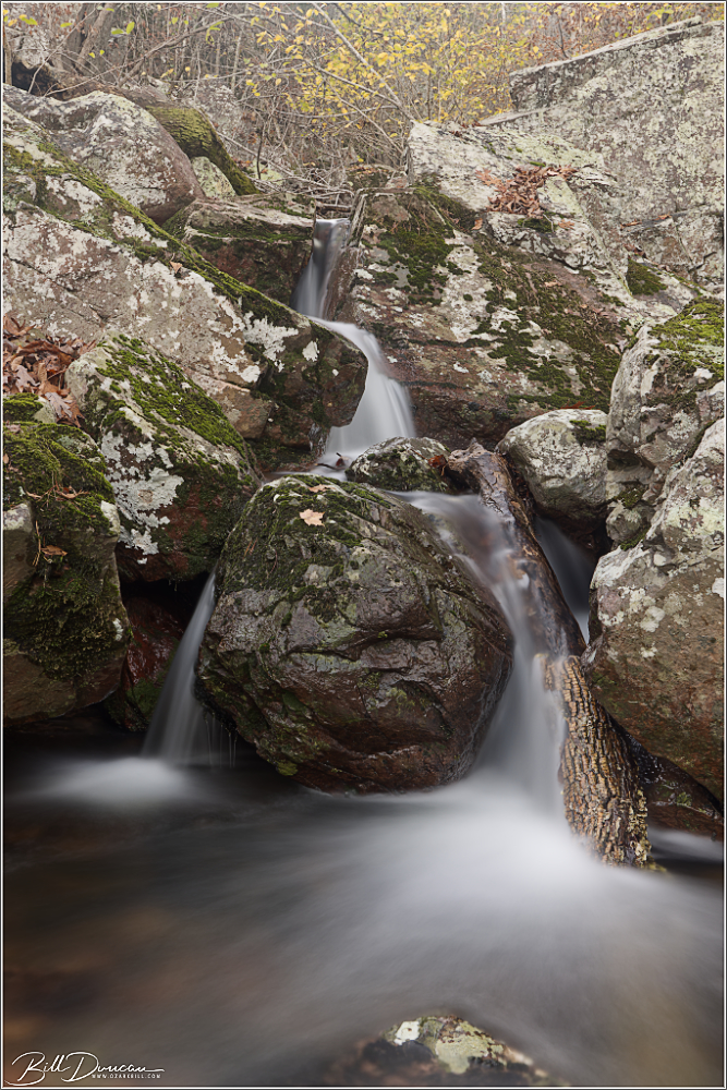
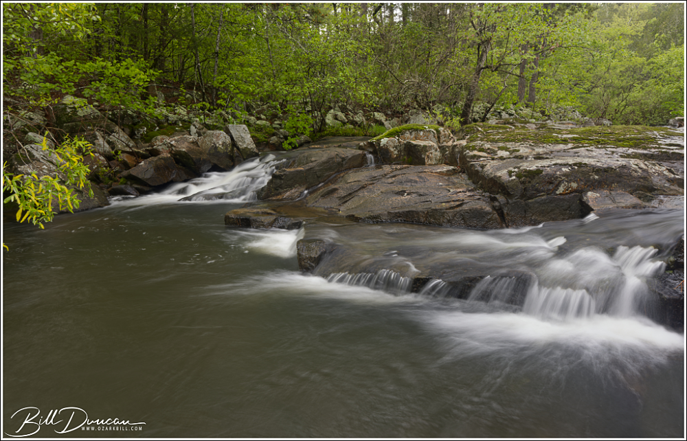
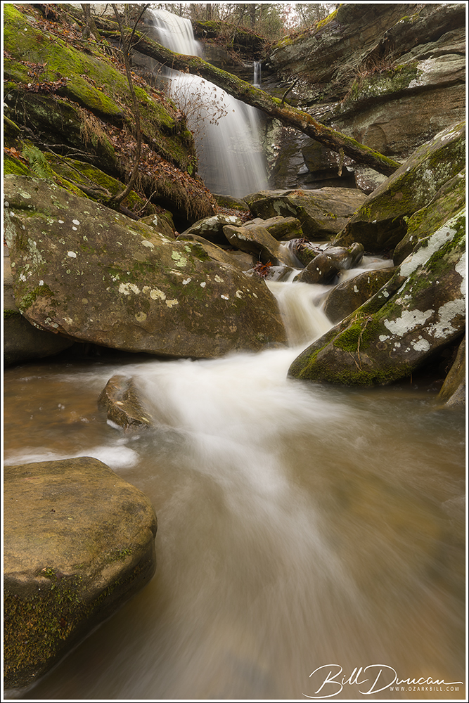
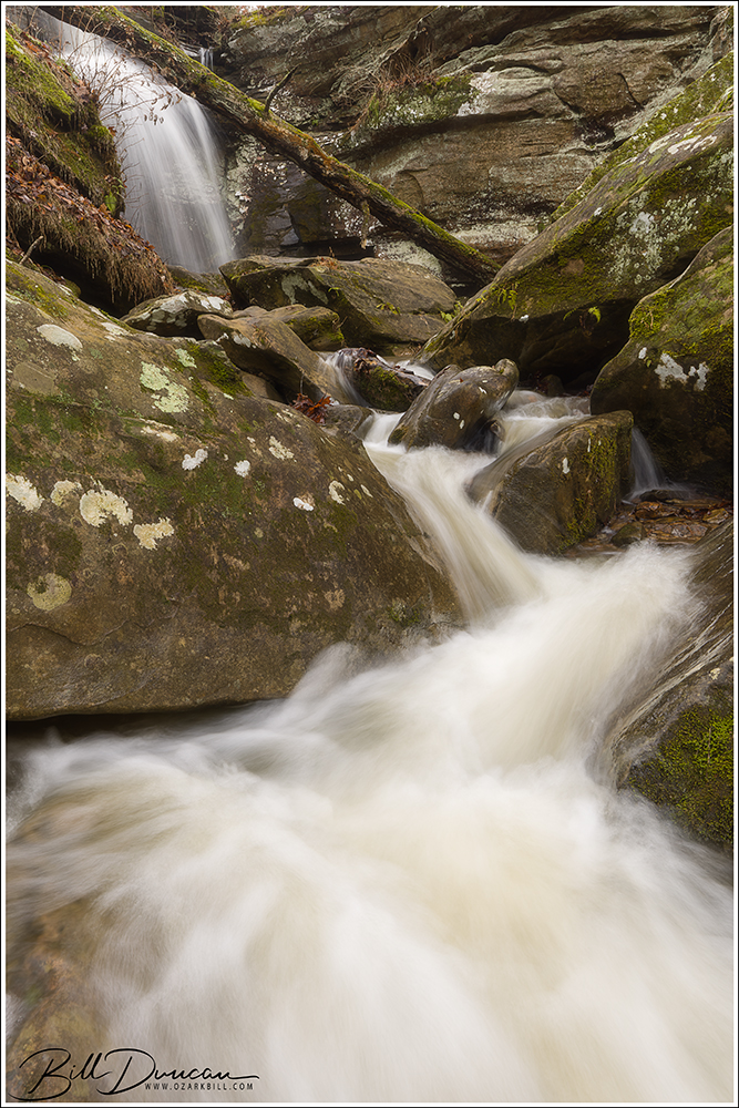
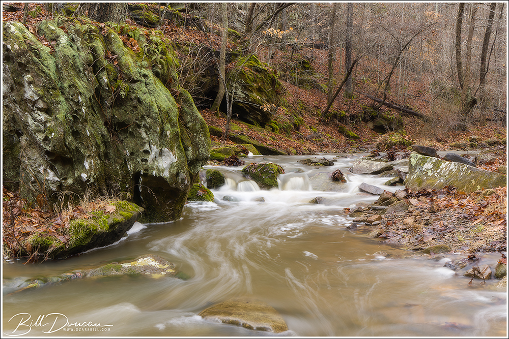
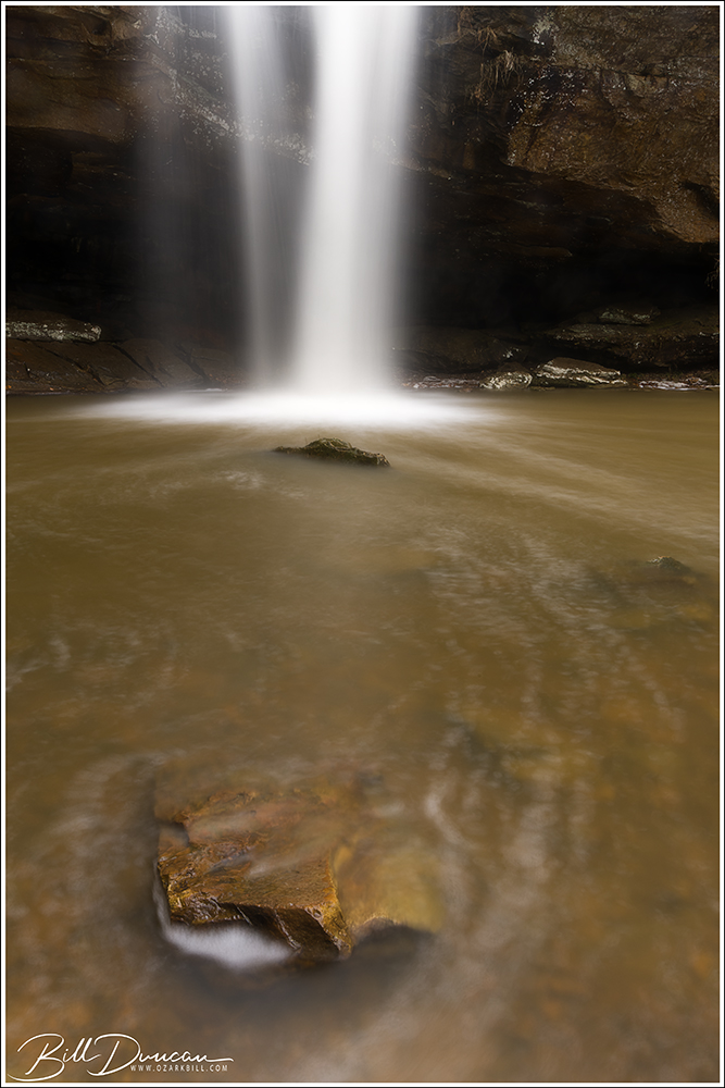
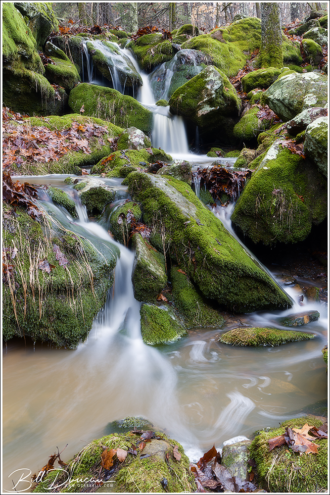
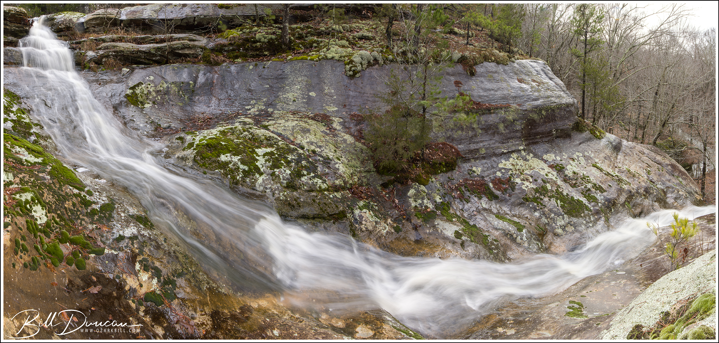
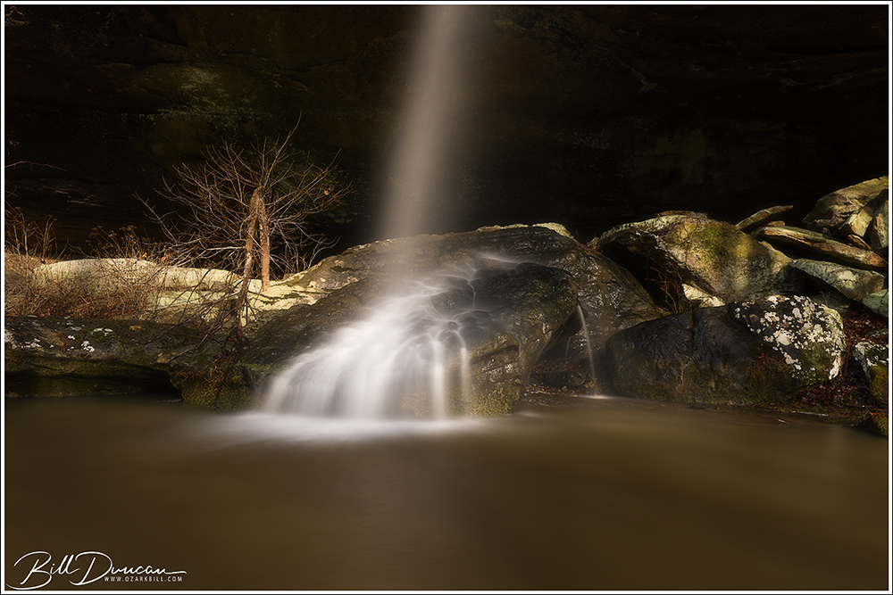
Our final stop of the day was the cascades of Black Mountain. With light running out, we climbed a little and made the following images.
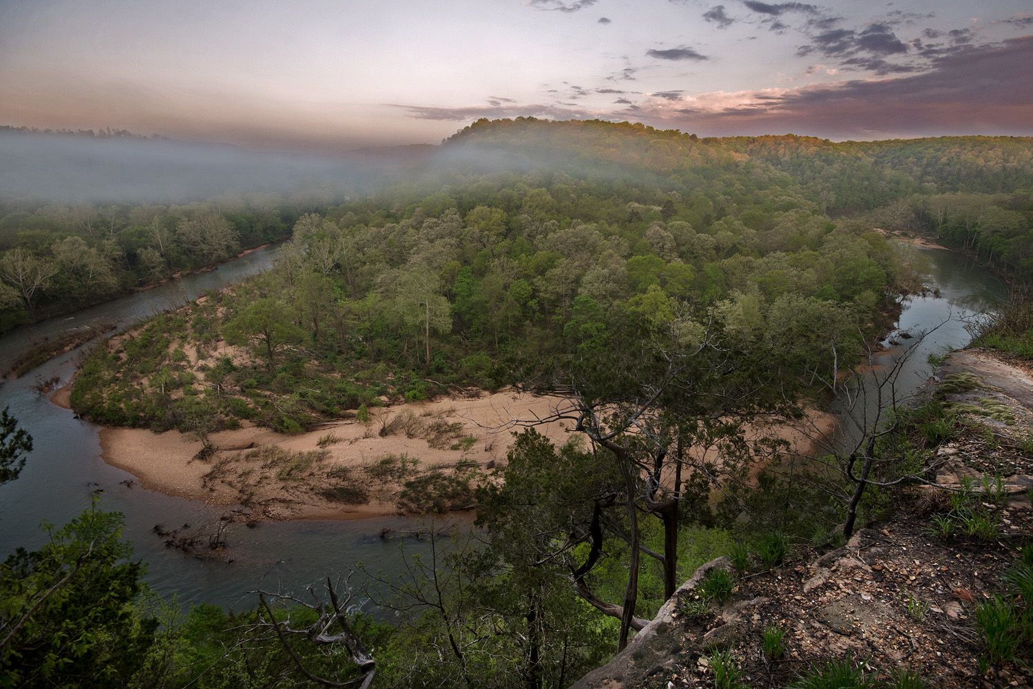
Anyone with a bit of knowledge about the St. Francois River of southeastern Missouri has probably heard of or has even visited the well-known stretch of the Tiemann Shut-ins that create the great series of class 1-3 rapids that experienced kayakers long to ride. The stretch of this river between Millstream Gardens and Silver Mines Recreational Area is one of the most scenic and biodiverse areas of the Show-Me State.
This spring I was turned on to three new-to-me shut-ins in the St. Francois watershed that I should have visited long ago. At first, it was surprising to me that these three geological features are not more well known. However, once I found out a little of the difficulty of getting to these locations, I am now not surprised at all.
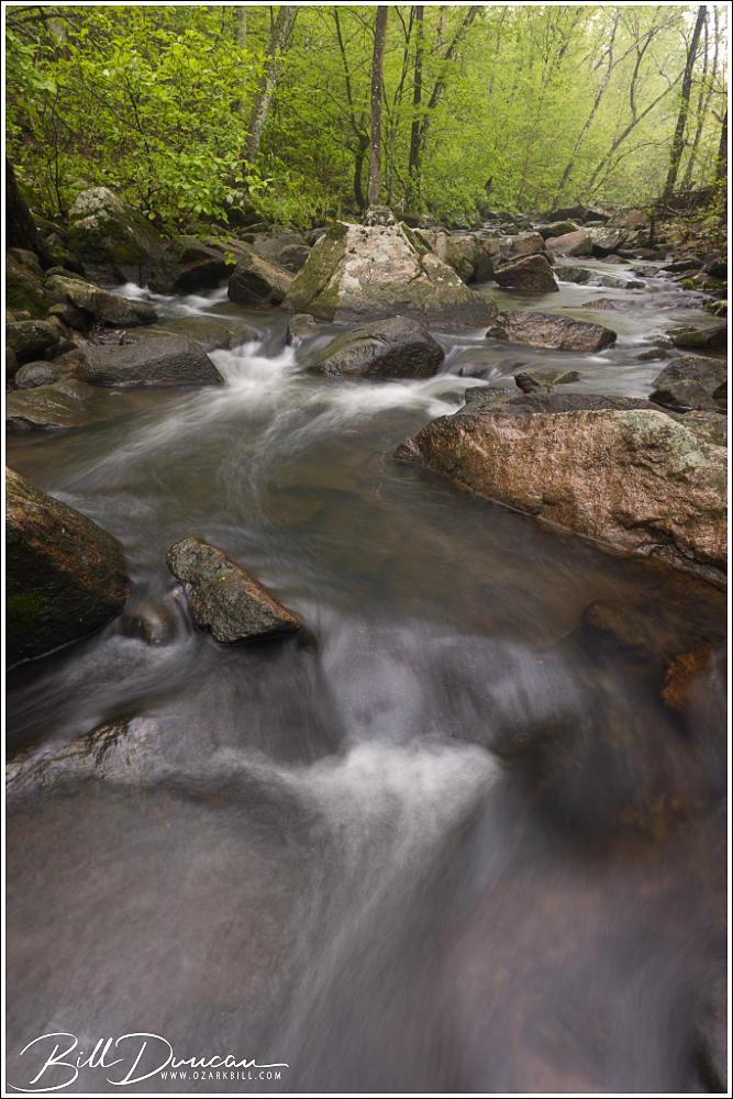
Looking up Turkey Creek
The St. Francois Watershed The geological history of the St. Francois River watershed is a tale written in stone, shaped over millions of years by dynamic processes. At its core lies the ancient Ozark Plateau, characterized by its resilient dolomite and limestone bedrock, remnants of a bygone era when shallow seas covered the region. Erosion and uplift sculpted the landscape, carving out rugged hills, steep bluffs, and winding valleys that define the watershed’s topography today.
Upper Stouts Creek Shut-ins
Within the embrace of the St. Francois River watershed thrives a rich tapestry of ecological diversity, harboring a multitude of habitats that support an abundance of plant and animal life. The forested slopes of the Ozarks provide refuge for a myriad of tree species, from towering oaks and hickories to delicate dogwoods and redbuds. Beneath the canopy, a lush understory of ferns, wildflowers, and mosses carpet the forest floor, while clear, spring-fed streams meander through the landscape, sustaining populations of freshwater mussels, fish, and amphibians.
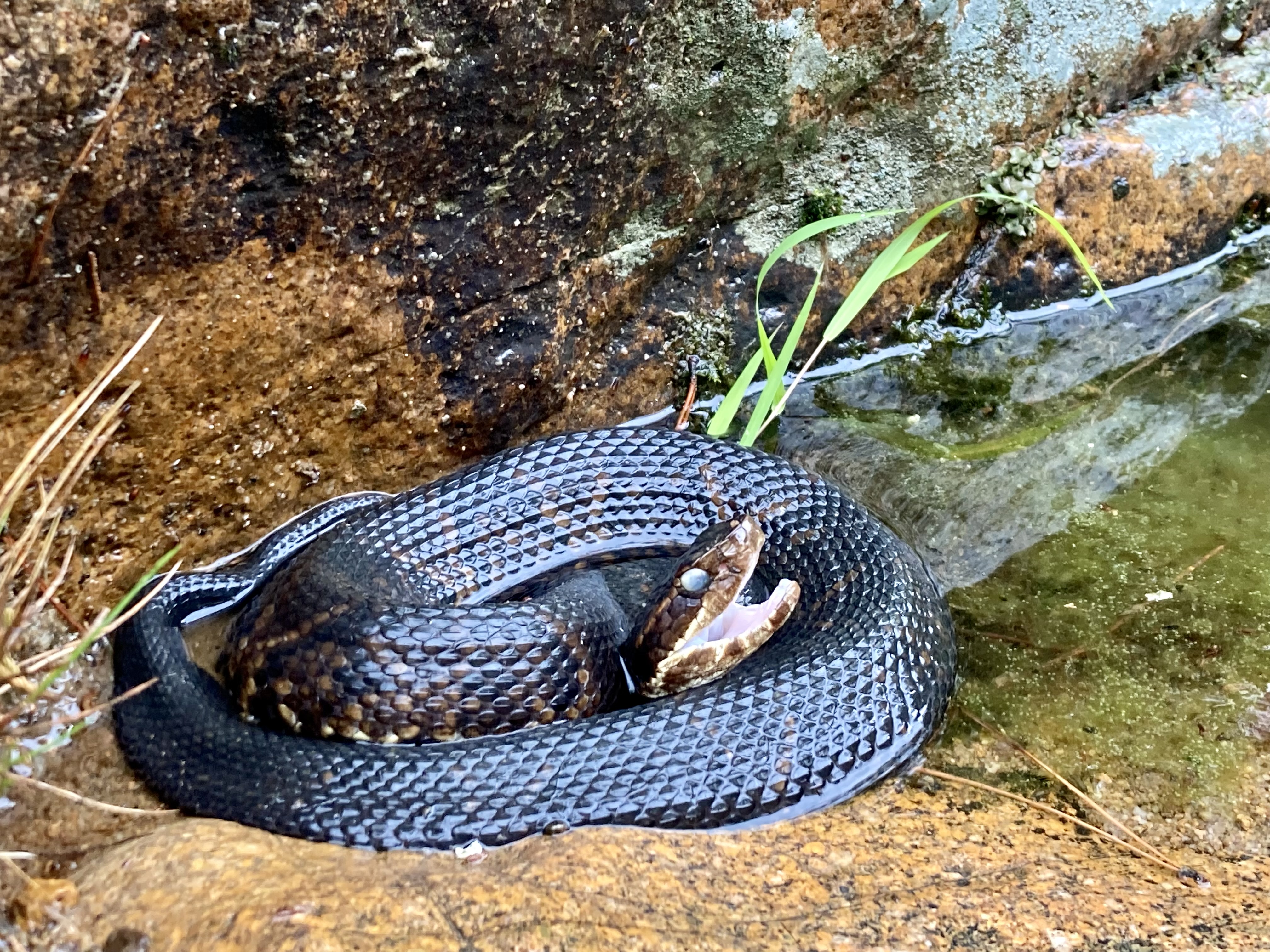
The traveler to the shut-ins of the St. Francois River watershed should always be on the lookout for cottonmouths.
The river itself serves as a lifeline for countless species, offering vital habitat and nourishment along its meandering course. From the elusive Ozark hellbender to the Bald Eagle, the St. Francois River watershed supports a diverse array of wildlife, including many species of conservation concern. Endemic flora and fauna, such as the Ozark chinquapin and the Hine’s emerald dragonfly, find sanctuary within the watershed, highlighting its importance as a stronghold for biodiversity.
About Missouri’s Shut-ins Shut-ins are a testament to the enduring forces of nature. Formed over many thousands of years, these unique rock formations are the result of a complex interplay between water erosion and geological upheaval. The shut-ins, characterized by narrow channels and cascading waterfalls, are formed when swiftly flowing streams encounter resistant igneous bedrock, creating natural barriers that redirect the flow and sculpting the surrounding landscape into breathtaking formations.
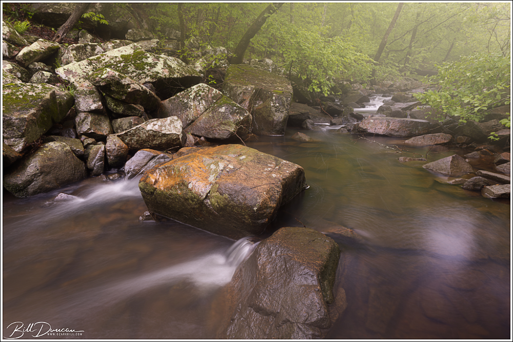
Humidity in these creek beds is usually very high, creating fog and haze. Turkey Creek Shut-ins.
Beyond their stunning beauty, shut-ins are also home to a diverse array of flora and fauna. The cool, clear waters of the shut-ins provide a habitat for various aquatic species, including aquatic invertebrates, freshwater mussels and fish. Along the rocky banks, towering hardwood forests thrive, offering refuge to an abundance of wildlife, from songbirds to white-tailed deer. The unique microclimate created by the shut-ins supports a rich tapestry of plant life, including rare species adapted to the harsh conditions of the rocky terrain.
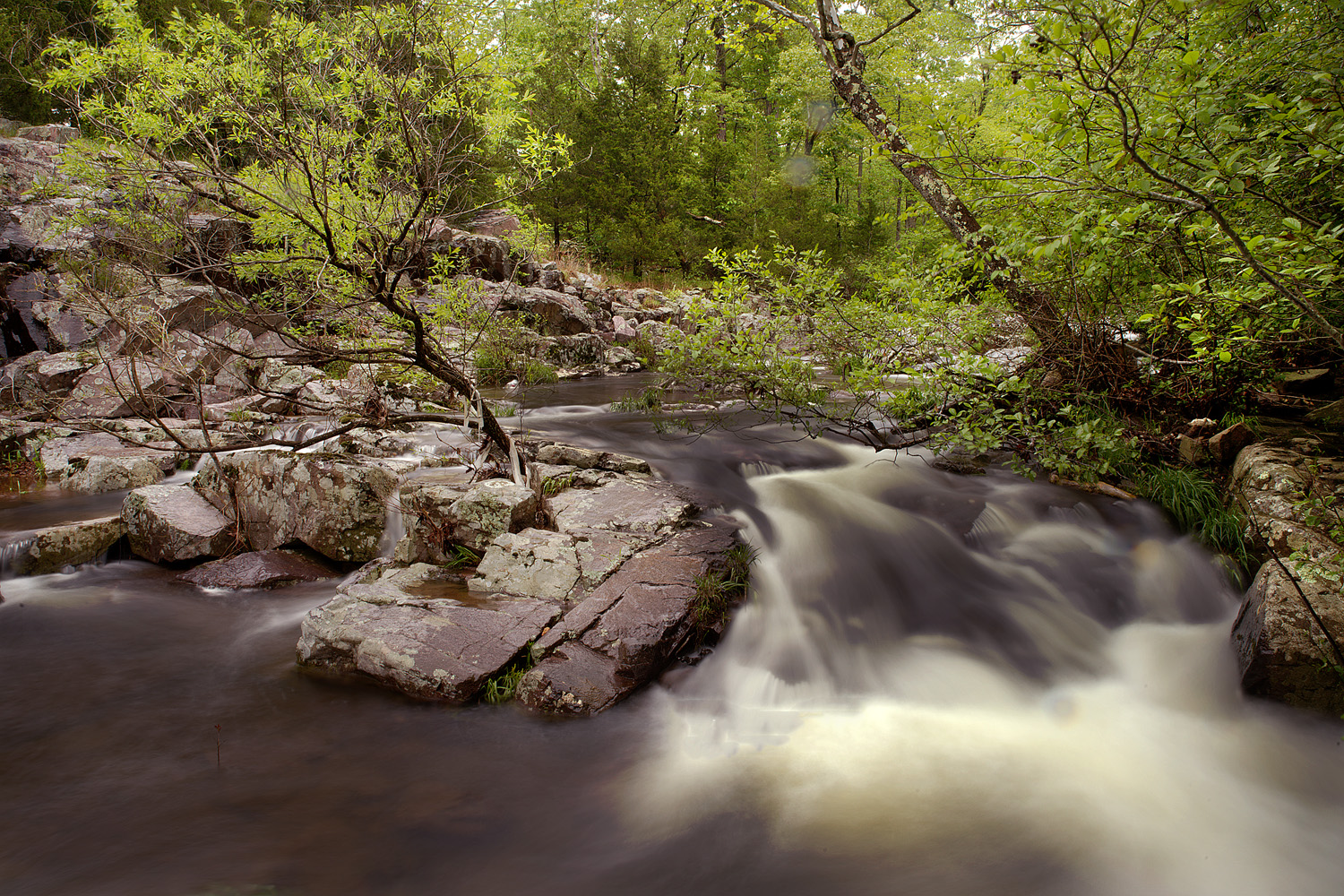
Upper Stouts Creek Shut-ins One of the main feeding branches of the St. Francois River, Stouts Creek contains a number of picturesque shut-ins. Casey and I had noted this particular one driving by for years but had never made the stop. We had to trespass a little to get our shots, but the folks who own this property are, theoretically at least, supposed to be inclined to forgive those who trespass. We spent just a few minutes here and were in and out without incident.
Upper Stouts Creek Shut-ins
Turkey Creek Shut-ins Flowing from the north, Turkey Creek empties its contents into the east side of the St. Francois River, just upriver from the historic Silvermines Dam. Getting to the Turkey Creek Shut-ins requires either a treacherous hike along the creek from the confluence, or a slightly less arduous bushwhack up and over a highland to the sight of the more picturesque parts of the shut-ins. Taking the easier way means missing portions of the shut-ins but will also result in fewer potential run-ins with cottonmouth snakes and ankle-snapping rocks.
Turkey Creek Shut-ins
Swimming holes abound in shut-ins like these at Turkey Creek.
Turkey Creek Shut-ins
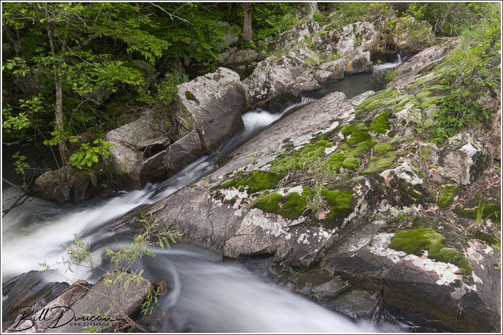
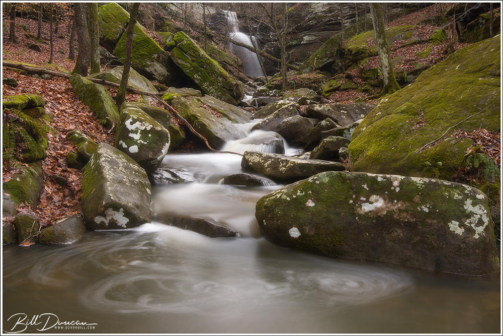
Mud Creek Shut-ins Mud Creek Shut-ins are definitely one of the most memorable shut-ins that I have had the pleasure to visit – not only because of their classic St. Francois Mountain beauty, but due to my story in reaching them. As is the case with Turkey Creek Shut-ins, these shut-ins can be reached by paddling the St. Francois River. However, I doubt my kayak skills would service safe passage across the class-3 rapids of this stretch of the river, especially while carrying expensive camera gear.
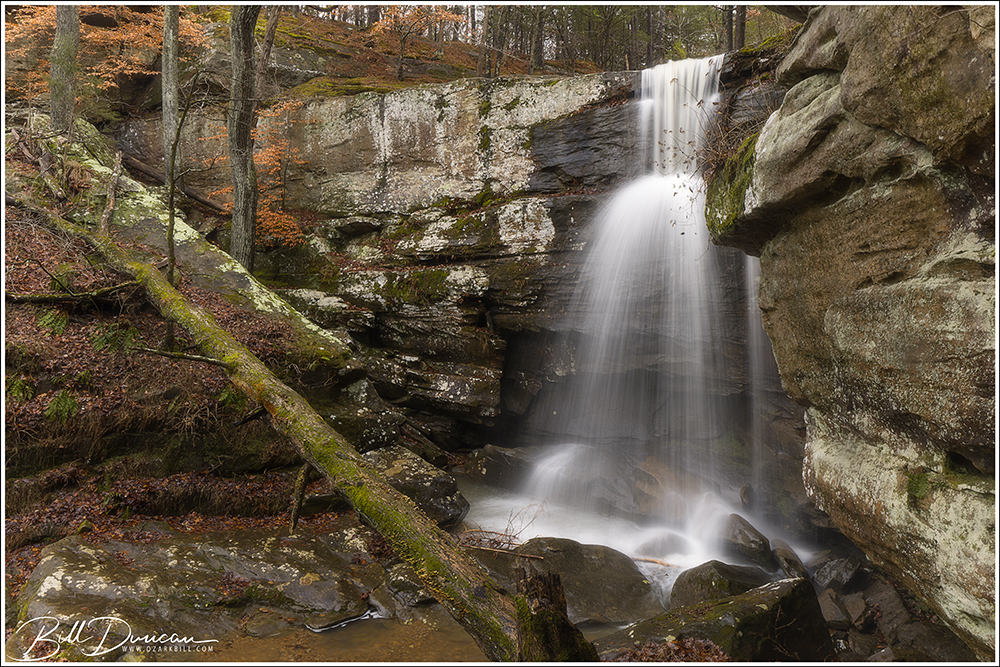
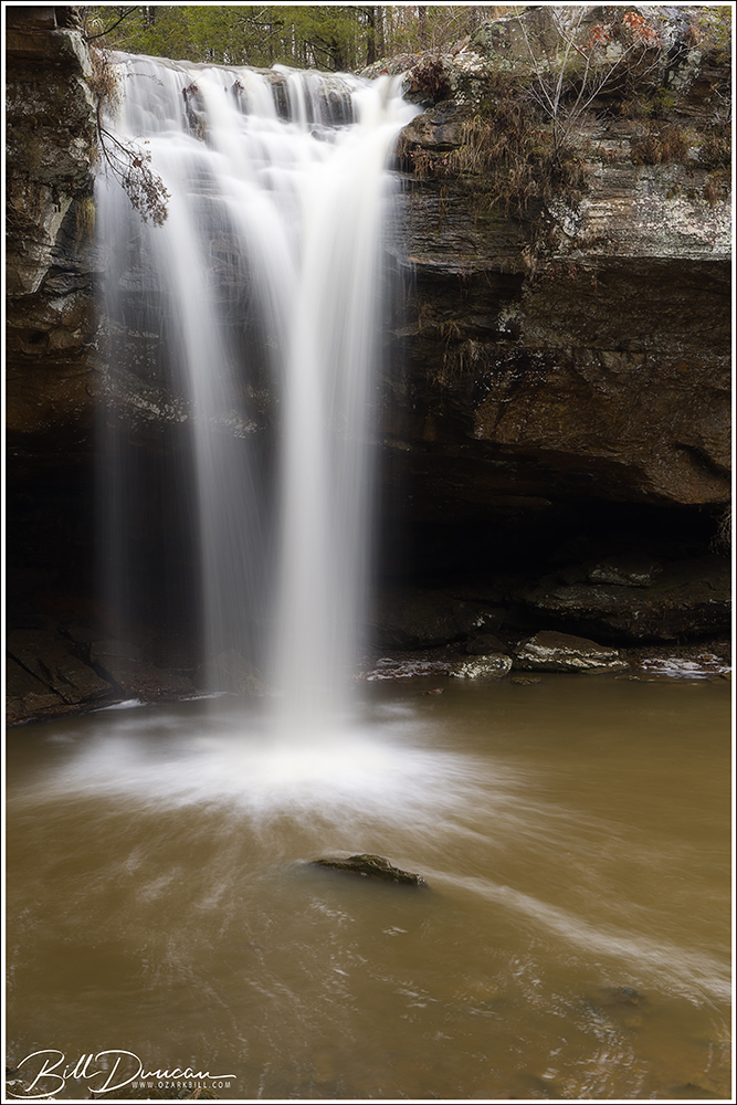
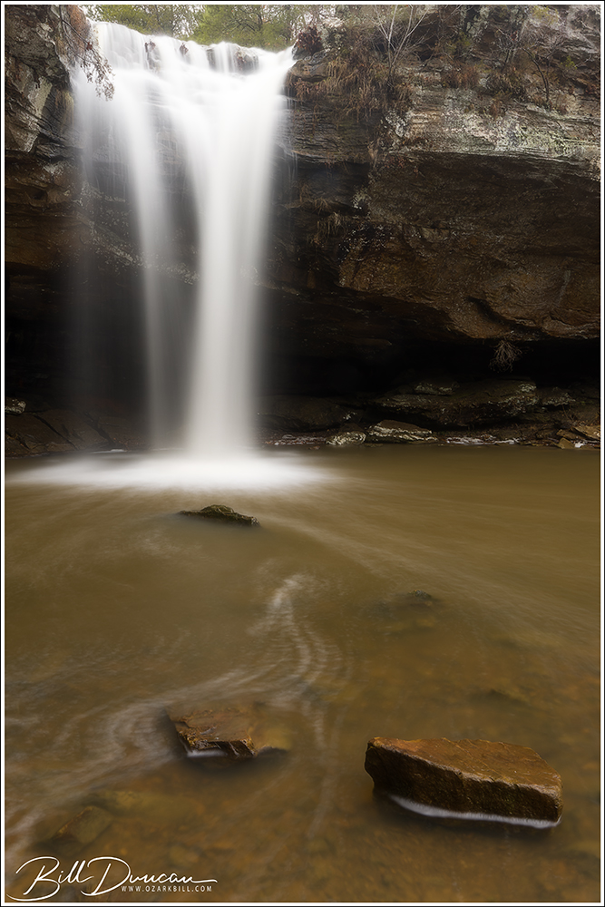
Moving upstream along Mud Creek from its confluence with the St. Francois, one first gets to view this very nice waterfall.
The next best option? Footing it across. I began this trek from the parking lot of the Silvermines Recreational Area. In times of high water, the low footbridge across the St. Francois River can be underwater, so I recommend parking on the north side of the river and paying the ridiculous $5.00 to park your car for a few hours.
The water finds multiple pathways against the rock as the creek races down the ravine.
From the parking area, I took the “trail” that runs upstream along the north side of the river until I got to the namesake mines. From here, it was steep climbing until I eventually ran into an old two-track that allowed for some switch-backing until I eventually rose from the river’s ravine into a more upland forest. Although the topology here was more manageable, fallen trees were everywhere, presumably from strong storms of recent years. The bushwhacking got frustrating, especially with the need to eat a spider or two every five to ten steps! Using my GPS, I kept the river to my right side and generally headed to the northeast to where Mud Creek meets the St. Francois. I should have headed much further to the north, but I kept finding myself heading back into the boulder-strewn ravine of the river. Eventually, I learned my lesson and rose to the highest elevation possible and made a direct line to where the GPS told me the confluence would be. Finally arriving, I realized I was then facing the hurdle of heading back down the ravine to the confluence. I could hear rushing water from the east and the north, shut-ins along the river and creek, respectively. I chose my point to descend into the ravine, not knowing if this would take me to sheer cliffs that would force me back up to try again. I eventually stumbled into the relatively small river bank that was thick with twenty foot tall alder and witch-hazel thickets.
Mud Creek Shut-ins
Clearing these thickets, with water halfway up my wellies (I got my first pair of Gumleaf boots recently, so I can no longer call these muck boots), I was finally able to see the confluence. Navigating around huge boulders, I began clambering up Mud Creek and almost immediately came upon the nicest waterfall of these shut-ins. About this time, the sky began to darken. Most of my trek to this point was in mostly sunny skies, making me wonder if the overcast skies forecasted for this afternoon where ever going to happen. Now I was hearing thunder and watching dark skies closing in quickly from the west.
Porphyry and swirls
I realized I probably had limited rain-free time with the shut-ins so I got to work, moving myself and my gear from one point of interest to the next upstream. This type of landscape photography is not for the faint of heart! Due to the sharp sides of the ravine, I was forced to cross the creek several times, negotiating deep pools, fast-moving water and slippery rocks. On several occasions, I used my tripod as an extra set of legs, helping me stabilize myself while crossing the creek.
Mudd Creek Shut-ins
Getting about a half mile upstream from the confluence, the shut-ins widened, opening up to large sections of exposed granite. It was around here that I decided the storm was not going to pass me by, but come right down on me. The thunder was getting closer and more frequent. I put my camera bodies and lenses into individual Ziplock bags and put the rain cover over my bag just when the sky opened up with torrential rains. It was then that I realized I was on the wrong side of the creek to get back to where I needed to be. I also sensed the waters in Mud Creek were starting to rise. The opposite side of the creek this far upstream looked like near-vertical cliffs, but I knew I probably did not have time to head back downstream to a point where I made the crossing earlier. I found the closet point to make a relatively safe crossing and found myself with just a few feet between the steep rise of the ravine and the creek that seemed to be increasing inch by inch. I found some handholds and started climbing. Spiders be damned!
St. Francois Mountain Beauty!
I climbed as carefully as possible, making progress while the rain came down in sheets and lighting danced across the sky directly above me. In five to ten minutes I made it up the approximately 400 feet of increased elevation and reached the top of the ravine. Not liking the idea of clambering down the opposite side of the ravine to get back to the mines, I decided a better route back would be to stay in the uplands and head north to Highway D to get back to my car. That was another two-mile bushwhack, back through the fallen trees, my wellies filling up with rain water, and limited visibility. I eventually made it to the road, finding my way safely back to my car. Not wanting to ruin my seat with my soaking wet cloths and not having a dry change of cloths, I striped to my boxer-briefs, put a towel down on my seat and drove the two-hours home. Thankfully I did nothing to raise the attention of any authorities on the way. 😉
I’d Like to thank Casey Galvin, Kathy Bildner and midwesthiker.com for the information that helped me reach these fantastic locations!
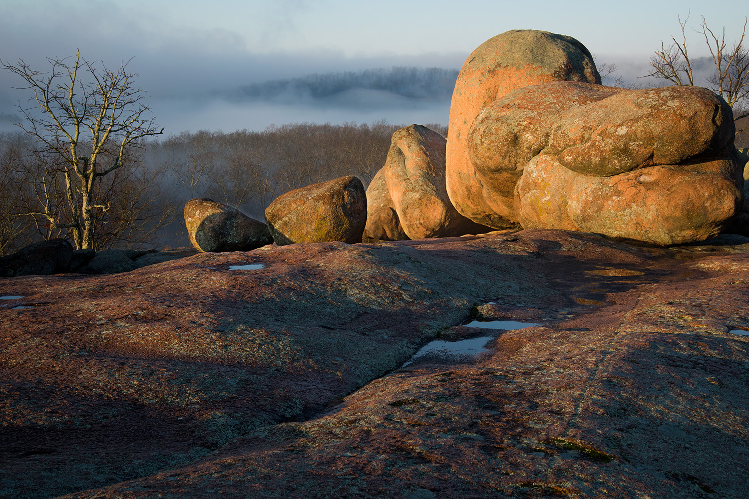
The WGNSS Nature Photography Group, led by the man with the great ideas, Casey Galvin, headed to Elephant Rocks State Park in Iron County, MO, for the group’s February field trip. Our primary target for the evening was to utilize the full moon to light our scene after sundown – images often referred to as “moonscapes.” This was my first real attempt at taking moonscapes; usually I am focused on low to no-moon nights in order to focus on stars and deep sky objects.
Reflections on Quarry Lake ISO-50, f/11, 3.2 sec. exposure, 140 mm focal length
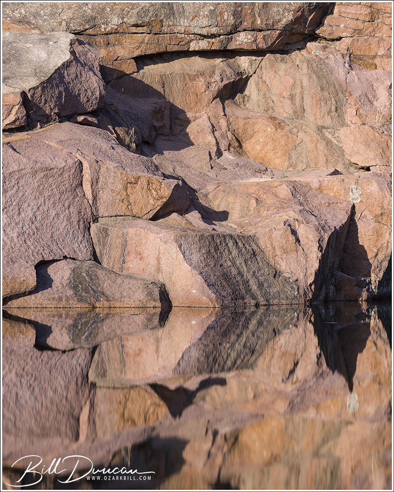
We arrived in time to have a walk around prior to sunset and the park’s official closing time. In order to be in the park after 5:00 pm, special permission must be made ahead of time. During our stroll, we made our way to the backside of the quarry lake – somewhere I had not been in many years. This turned out to be a serendipitous experience. There we encountered some very nice golden light and excellent reflections coming from the lake’s surface. Unfortunately, the winds were just strong enough to create some obnoxious ripples on the water, ruining the mirror effect I was going for. No worries, however; I added a CPL and a pretty strong neutral density filter (in order to increase shutter speed) to my mid-telephoto lens and the ripples magically disappeared.
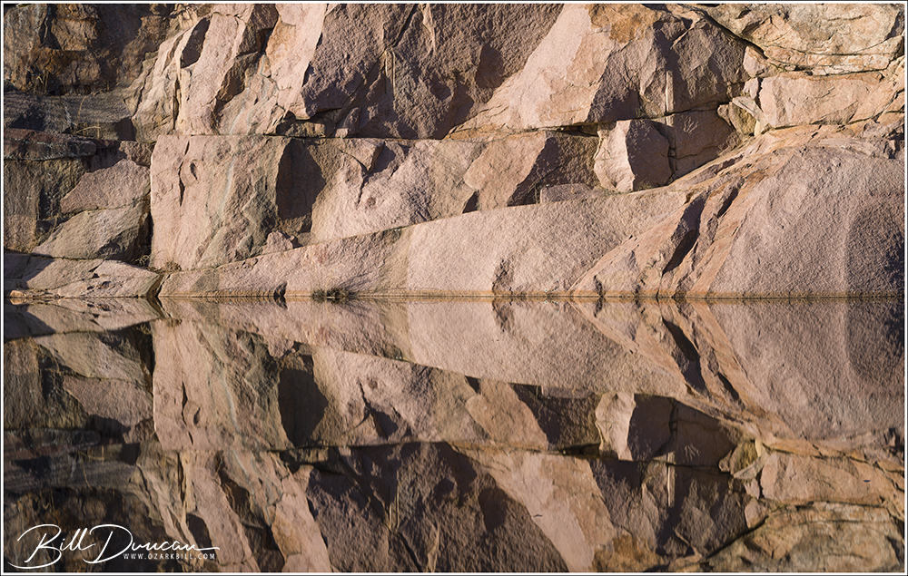
Several abstract-like faces appeared in tight-compositions with the rock wall mirrored off the lake’s surface ISO-100, f/9, 2.5 sec. exposure, 84 mm focal length
I find capturing enough saturation in lighter colors a challenge with digital cameras. I am finally learning how to recover this in post-processing. The pretty light helped showcase the pink granites that the St. Francois Mountains are known for. ISO-50, f/11, 5 sec. exposure, 118 mm focal length
This one was too good to pass up the opportunity to make the face more obvious by orienting it vertically. ISO-100, f/9, 4 sec. exposure, 73 mm focal length
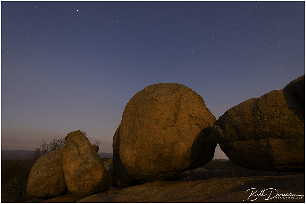
Shortly before sunset, we headed to the other side of the park to hang out with the rocks that give the park its famous identity. The remaining images were all taken after the sun had set and were exposed using only the light of the February full “snow moon.”
Moon rising over Elephant Rocks ISO-640, f/5.6, 10 sec. exposure, 20 mm focal length
Somewhat surprisingly, care had to be taken when shooting with the full moon at our backs as the shadows were very noticeable! ISO-3200, f/4, 6 sec. exposure, 20 mm focal length
Newer cameras shooting at longer exposures can pick up more stars than can be seen by the naked eye. I was happy to see the Pleiades and the Andromeda Galaxy in several of my moonscape images. ISO-320, f/4, 6 sec. exposure, 19 mm focal length
Can you spot the Pleiades star cluster in this moonscape? ISO-640, f/4.5, 8 sec. exposure, 15 mm focal length
This was certainly a special trip spent with friends. Temperatures and sky conditions were near perfect for photographing moonscapes. I was a bit surprised we did not have more WGNSS members take advantage of this special access. I won’t complain about that too much as I think having too many photographers would have made things more challenging with fighting shadows and finding access to good compositions.
Today I’m happy to provide a platform for renowned nature photographer and friend, Casey Galvin, to share his words and fantastic landscape photography from lesser known areas between the coasts. This article is exactly my philosophy when it comes to landscape photography – what little I do of that these days. I am much more interested in finding hidden gems without a plane trip or a multiday car ride. This is actually much tougher to do than placing your tripod in the holes dugout by the throngs of photographers chasing the iconic landscape subjects. Casey doesn’t usually present his works in an online format, so prepare yourself for a real treat! What follows are the writings and photographs of Casey.
When one thinks of great landscapes, Missouri and the two other Midwest states, Iowa and Illinois, do not come to mind. With the great American West along with coastal states available to most landscape photographers it is easy to fly over or drive through these three states without a thought of stopping. What makes this area special, most landscape photographers have never taken the time to be here in the Midwest. You make images no one else has, unlike in the western USA. However, because of this anyone who does stop and take the time to explore will find something that most people do not think of photographing. These three states have unique and special geological sites and plenty of water resources (rivers, creek, lakes, world class springs and seepage areas) and open landscapes.
Elephant Rocks State Park Iron County, Missouri
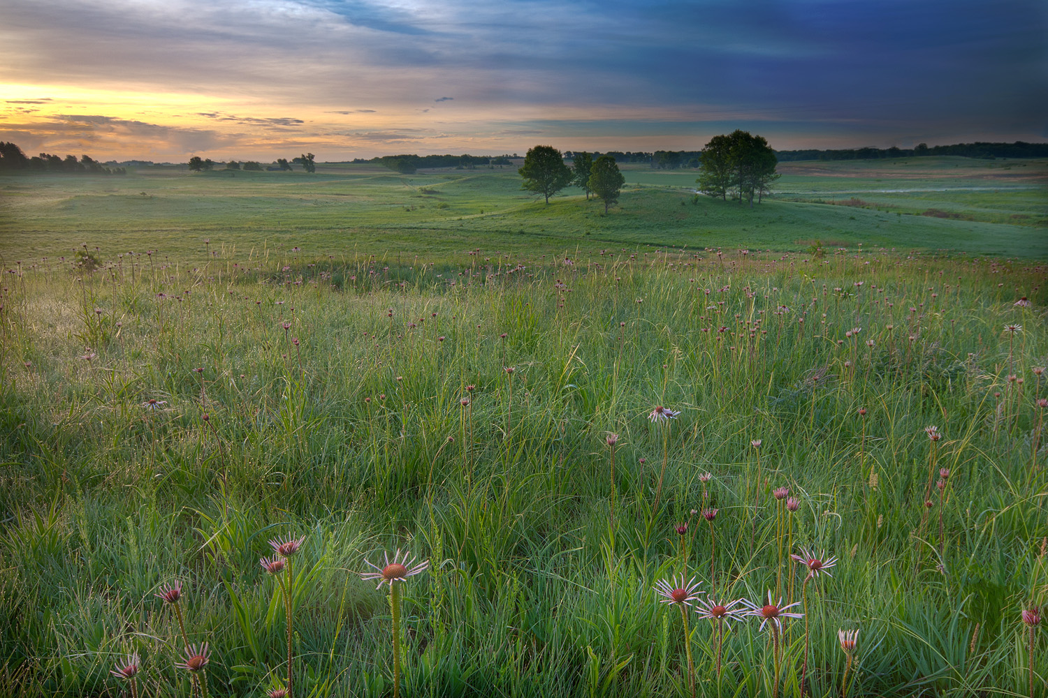
This being the heart of Tallgrass Prairie, there are still remnants left of this rarest of North American biomes. These systems were lost because it is some of the most productive farmland in the world, sand and gravel mining took others and conversion to urban development took the rest. Most people do not understand these grasslands probably because they have never experienced a true prairie. Unfortunately, there are not many large areas that are left untouched, but one can still find several remnants that are 1000 acres or even larger. This is where the buffalo roamed in large herds and in some locations, one can still find these animals ranging freely. The other nice feature for a photographer when visiting these sites is that you will most likely be the only one at that location. I have been on many a prairie for hours and have never seen anyone else.
Nachusa Grasslands Franklin Grove, Illinois
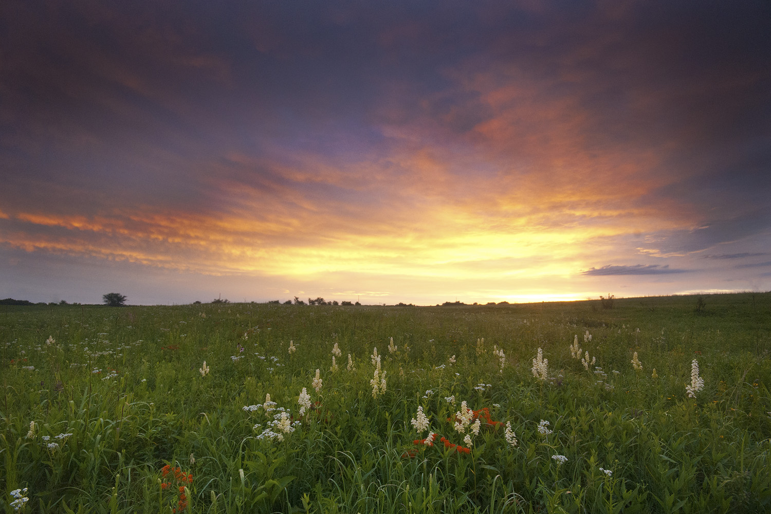
Like the West, where they get super blooms with the heavy winter rains, as long as the rains are steady, Tallgrass Prairies get super blooms at least once a month in the growing season. These systems are made for hot, dry weather. May brings profusions of paintbrush (Orabanche coccina), in June coneflowers rule (Echinacea pallida or if you are lucky in prairies near the Ozarks, E. paradoxa), in July blazing star (Liatris pycnostachia) takes over. Autumn is dominated by yellow composites, gentians and late Liatris species.
Helton Prairie Natural Area Harrison County, Missouri
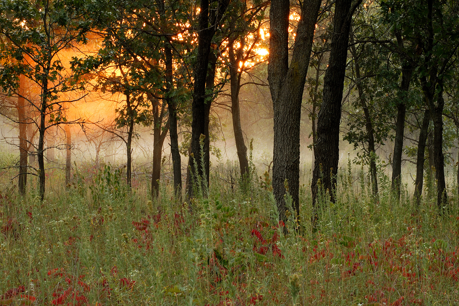
Savanna, another biome type, is usually tied to the prairie. This is the transitional biome between prairie and forest, and here you will find a mix of species from both. I have found that you can get good to great photographs on these lands, but because it does take work, you can develop photographic skills you can use elsewhere in the world. These can be difficult landscapes because of the open space
Kankakee Sands Kankakee County, Illinois
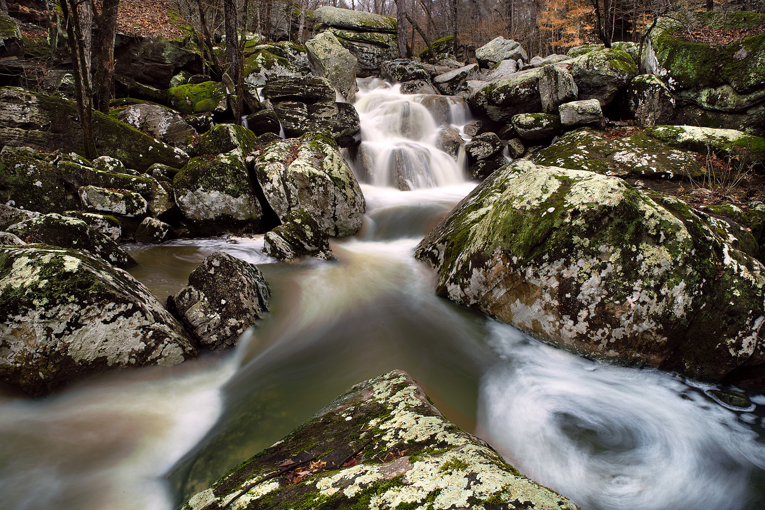
There are also unique geological features found in this region. The Saint Francois Mountains in SE Missouri are extinct volcanoes and ancient lava flows. Most have been exposed for over one billion years. With its acid soils it make for great plant diversity. When a river or creek flows through one of the lava flows you have what Missouri calls a shut-in (water is restricted or shut-in to a narrower passage due to the slow-to-erode nature of the underlying granite). These are extremely attractive to photograph in all seasons. Unfortunately, some of the more attractive ones are well visited. So unless you’re early or late in the day you may find yourself in large crowds. These are not tall mountains, being eroded for eons, but this is still mountainous country.
Johnson’s Shut-Ins State Park Reynold’s County, Missouri
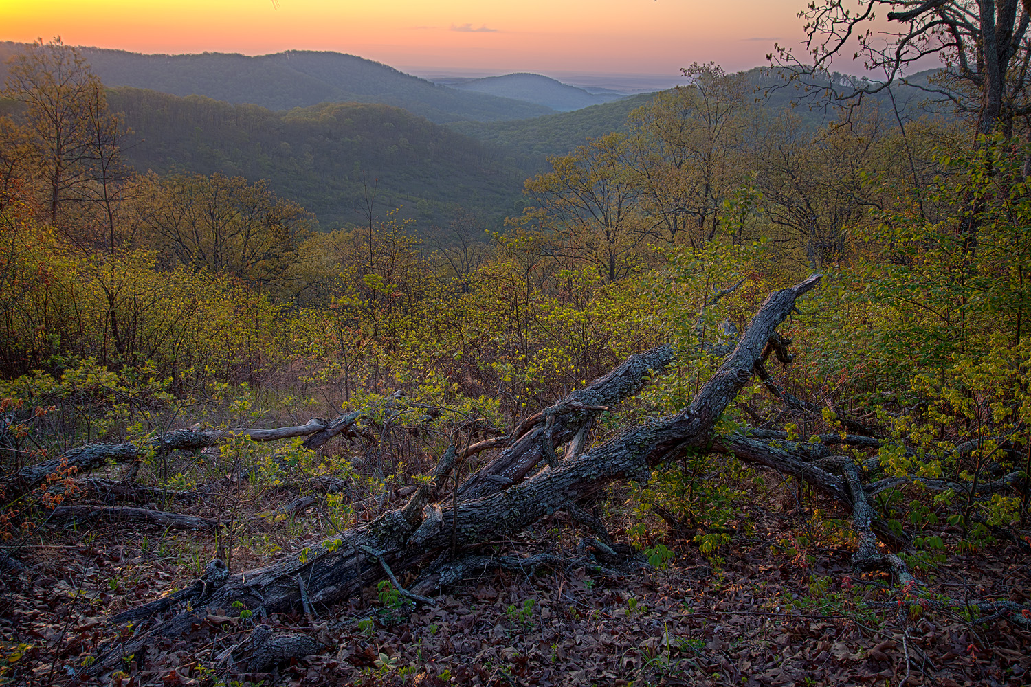
In southern Missouri there is also a unique set of monadnocks, an example being Caney Mountain Conservation Area – a remote area was once one of the last bastions for deer and turkey in the eastern USA.
Caney Mountain Conservation Area Ozark County, Missouri
In southern Illinois the Shawnee National Forest with its limestone and sandstone escarpments (Greater and Lesser Shawnee Hills and Ozarks) can make for nice areas to explore photographically. Garden of the Gods is very scenic. Wet weather waterfalls are abundant (yes, Illinois is not flat here). La Rue Pine Hills ecological area not only has tall limestone bluffs. Below them is one of the most floristically rich areas in the Midwest with over 1200+ plant species. According to Robert Mohlenbrock, an authority on the flora of Illinois, the Shawnee NF is more diverse than the Great Smokey Mountains National Park. The area south of the Shawnee Hills also has some of the best southern swamps remaining in North America.
Ghost Dance Falls Shawnee National Forest, Illinois
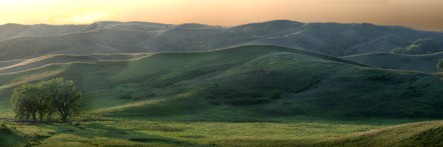
Along the west coast of Iowa and NW Missouri is another unique landform. The Loess Hills made up of windblown dust (loess soil) from the last glaciation. These type of hills are found only in three locations in the world and this being the only one in North America. The plants and animals found here are similar to those found nearly 100 miles west in Kansas and Nebraska. This is another type of tallgrass prairie with disjunct populations of mixed grass prairie species.
Broken Kettle Grasslands Preserve Plymouth County, Iowa
Forest covers the southern one-third of Missouri and the Shawnee NF in Illinois. Spring and autumn bring many landscape opportunities especially along the rivers and other water features. Wildflowers abound here through the growing seasons in the forest and in the spring and on rocky glades (opening between the woodlands) throughout the growing season. These are some of the more diverse forests in the country, with several species restricted to the Ozark Plateau. This is also a world class birding area.
Chalk Bluff, Ozark Scenic Riverways Shannon County, Missouri
Water features are abundant as stated prior. This is one feature that many areas in the country lack. Even in deep droughts, the larger springs still have plenty of output keeping many rivers flowing well deep into the autumn. Every 10 to 20 years there comes a drought where the biggest of rivers have levels that fall enough to be able to walk to some of the islands that are within them, allowing us to get images that might be harder to access without a boat.
Carver Creek Shut-ins Iron County, Missouri
I have spent many years studying and exploring these areas, through all four seasons. It is well worth the time to visit and explore.
Casey and I hit the roads and trails back in January looking for new waterfalls in the Shawnee Forest area of southern Illinois. January isn’t the prettiest time for waterfalls but finding them is often easier in the winter.
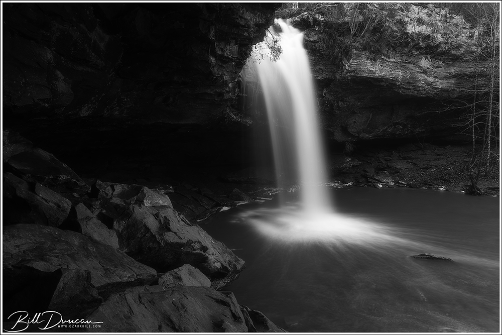
Burden Falls Wilderness Area
Up first is Burden Falls. Like most of the falls and features in the Shawnee, Burden only flows following significant rainfall. The amount of water flowing over the falls was not the highest it could be, but there was enough flow to be interesting. Here are a few more from this fantastic area.
Next up is Bork Falls.
Happy Hollow Falls
Last up is Jackson Hole Falls. This incredible two-stage set begins with a long slide that I captures in the panorama below. It then ends in an approximate 40′ drop.
The following images were taken during the WGNSS Nature Photography Group’s trip to Garden of the Gods (GOTG) and other locations this past April. This group is currently being led by Miguel Acosta. If you are interested in joining us for one of the group’s monthly outings, please see details at http://www.WGNSS.org!
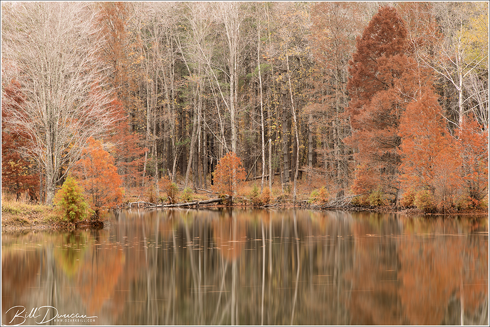
Late autumn colors on a mirror lake.
Many thanks to the photographers we met on the trail at Bell Smith Springs Wilderness who tipped us off to a spectacular mirror lake in the Shawnee. Miguel and I stopped at this location before heading back to St. Louis. The peak fall colors were obviously passed but this place screams potential and I hope to get there again next year. We had really nice conditions for this type of photography, with cloudy skies and winds which weren’t too bad. We could have found a few more compositions but the rains came and the winds got worse so we called it a day.
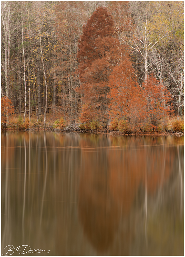
A different composition from the same scene as above.
The waters here were not as calm as to be desired for our purposes, but using polarizer and neutral density filters allowed us to get long shutter speeds that helped to lessen the effects of any wind-blown ripples on the water’s surface. All images in this post from this location were taken with shutter speeds between 20 and 30 seconds.
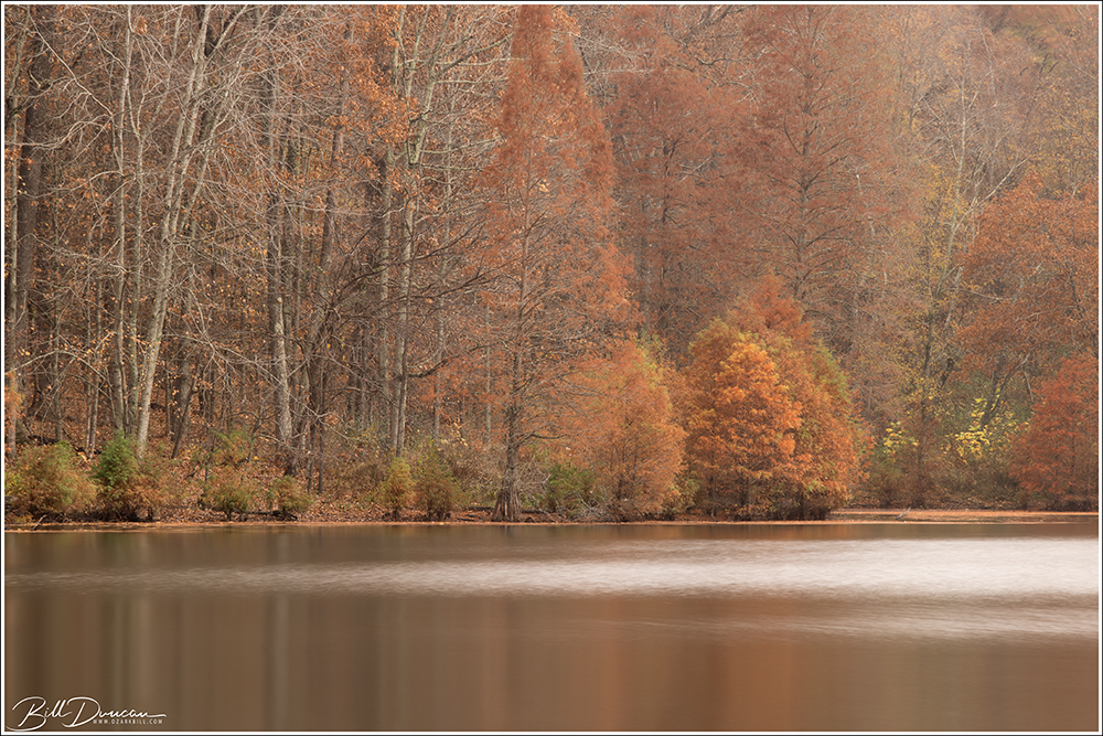
A wind-blown mirror lake
In the photo above the wind was starting to move pretty quickly across the wider portion of the lake. Using a shutter speed of 30 seconds allows the ripples created to appear with a more painterly appearance.
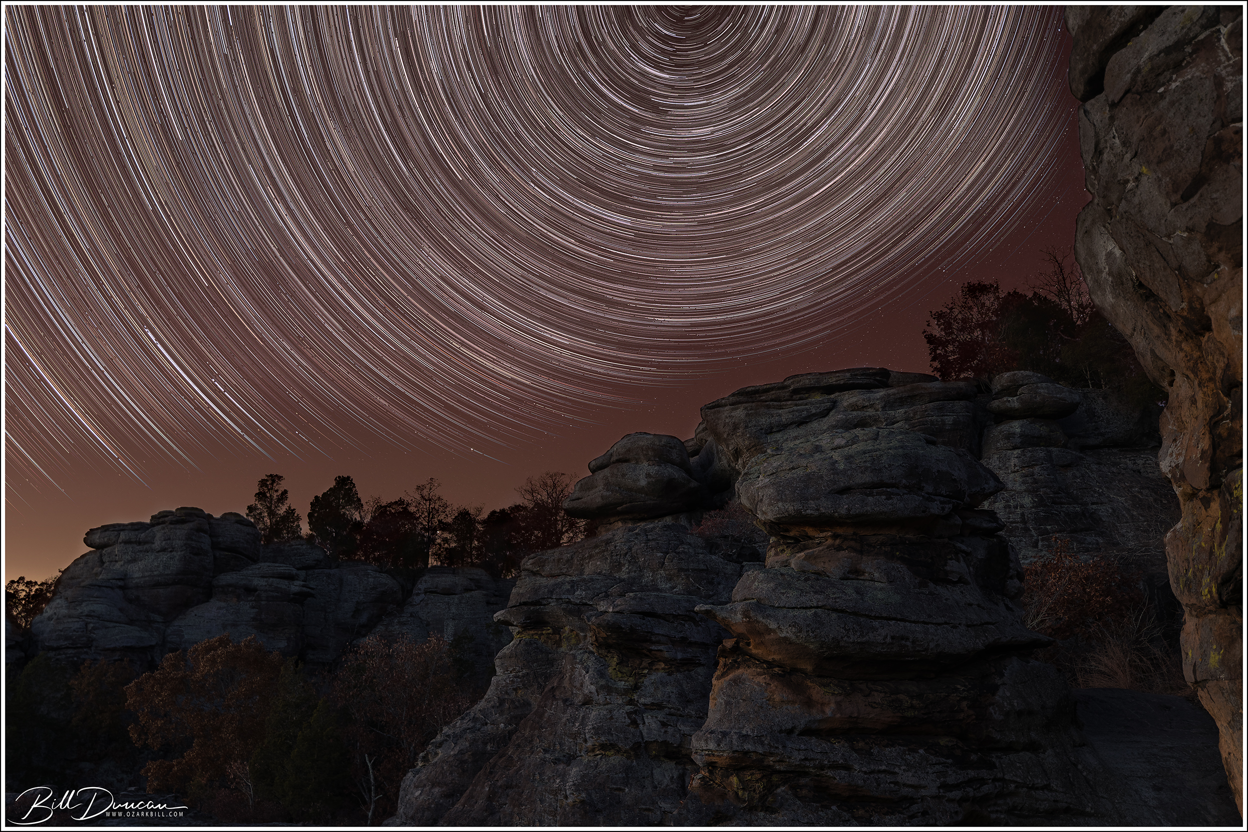
Monkey face with star trails
During this weekend trip, some of us enjoyed the camping experience while others chickened out and stayed at hotels or cabins. Similarly, some of us stayed late at GOTG to do a little astrophotography. Well, I should say that I stayed late. 😉 After my friends nabbed a couple of quick Milky Way images, they headed back to their air conditioned rooms and I was left by myself to work on the photo seen above. This photo was made by combining 213 30-second images in the computer to build the star trails with the iconic “monkey face” and other rock formations that GOTG is known for in the foreground.
This was a great weekend of friends, photography, hiking and camping.
I can’t help but to marvel at this grand post oak every time I visit Victoria Glades in Jefferson County, MO. I’m always hoping to be there in good light and skies to take a worthy photograph of it. On a morning of a WGNSS Nature Photo Group field trip, I arrived a little early with this in mind. Not an interesting sky, but I used the bright sun to my advantage to create a starburst.